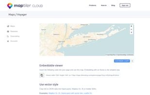
Best alternatives are  OpenFreeMapand
 Leaflet
26 alternativesOpenFreeMapandLeafletOpenFreeMapandLeaflet
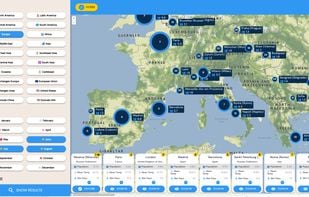
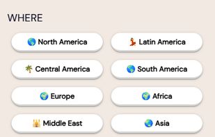
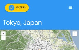
Explore 1860 digital nomad destinations on an interactive world map. Filter by temperature, rainfall, seasons, and world regions. Compare destinations by population size and climate data.
 TripAdvisorand
 Wikivoyage
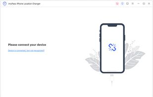
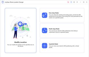
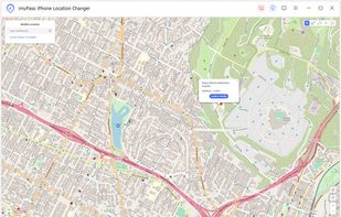
imyPass iPhone Location Changer is good location changer, which helps you set, change, and customize the location as you like on your iOS devices.

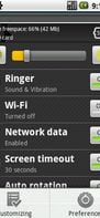
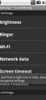
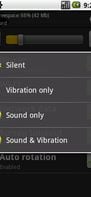
Quick Settings for Android gives you control over 12 frequently used settings like brightness, ringer type, volume control, WiFi, network data (on/off & 2G/3G setting shortcut), bluetooth, GPS, screen timeout, airplane mode, auto-sync, auto rotation and lock pattern.
 SBSettingsand
 Power Toggles
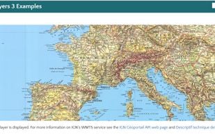
The reference implementation of the Open Geospatial Consortiums WFS and WMS services, GeoServer is a full featured open source software server written in Java that allows users to query, visualize, combine, edit and publish spatial data over the web.
OpenFreeMapand VersaTiles
Mgrs & Utm Map is a GPS and coordinate system application designed to assist military personnel and outdoor enthusiasts with navigation, supporting various satellite systems and offering diverse map layers.
 Garmin BaseCamp
Online maps for web, mobile apps and desktop software. You can change colors, add or remove particular map elements or enhance the map with own geodata.
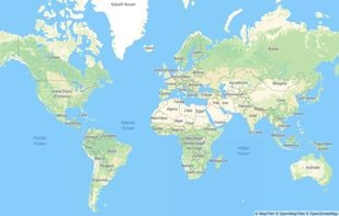

 OpenStreetMapandOpenFreeMap
 Preyand
 FindMyDevice (FMD)
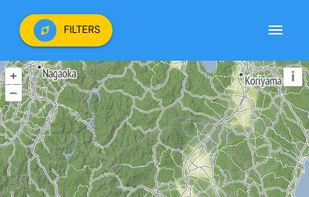
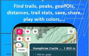
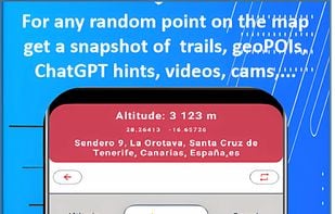
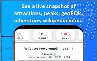
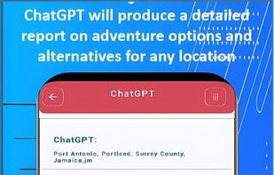
Trail Explorer is a website and a mobile app to explore any location on the map, discover nearby hiking trails and places of interest, explore outdoor sports opportunities, ChatGPT advice and insights, videos, webcams, the weather, news across 20 categories.
 openclimbing.organd
 Komoot
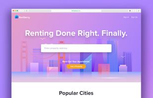
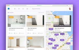
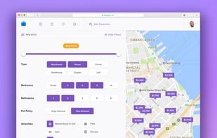
Rentberry was created to streamline a rental negotiation process between tenants and landlords. Due to Rentberry’s transparent custom offers’ submission, landlords and property managers can easily determine the real market price of their properties, while tenants can avoid...


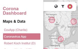
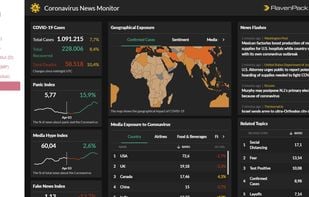
 Coronavirus COVID-19 Global Cases
The Headway Project was born out of a frustration with the need to send current and future location data to a corporation in order to figure out how we’re getting from A to B. Offline-only maps apps can be frustrating to use, and sometimes suffer from performance problems, poor...
 OpenStreetMapand
 Google Maps
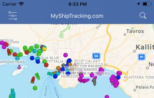
My Ship Tracking is a FREE REALTIME AIS vessel finder tracking service. With this vessel tracker you can monitor ship positions, vessel tracking, ship tracking, vessel position, vessels traffic, port activity in realtime map.
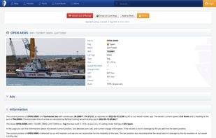

 VesselFinder
nodejs library to search for any place in any language. You can also use free open API from https://vakit.vercel.app

Care.com is the largest and fastest-growing online service that helps families find high-quality care providers.


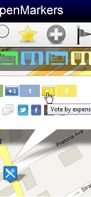
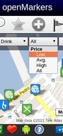
A new collaborative project to create open points of interest in all the world. You can add or vote your favorite places and you can discover the most voted places from other users, according to your budget!
 Apple Mapsand
 Yelp
Yelp
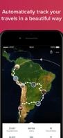
Automatically track your route and places you've visited while you are traveling. Just carry your phone in your pocket and the app creates your own beautiful travel journal.


 Roadtrippersand
 TravelMint
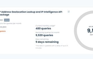
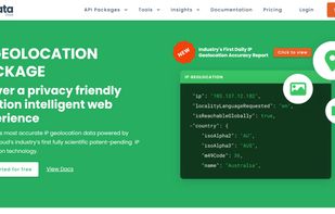
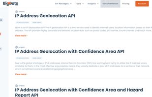
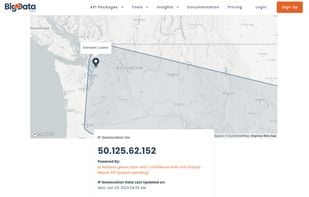
BigDataCloud provides next-generation PATENTED IP Geolocation APIs which provide the most accurate and rich locality information, network parameters, and security insights at sub-millisecond speeds.

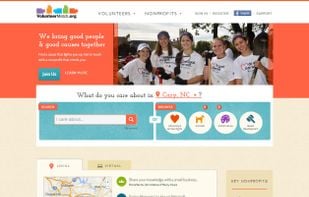
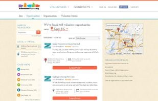
VolunteerMatch strengthens communities by making it easier for good people and good causes to connect. The organization offers a variety of online services to support a community of nonprofit, volunteer and business leaders committed to civic engagement.
 Idealist
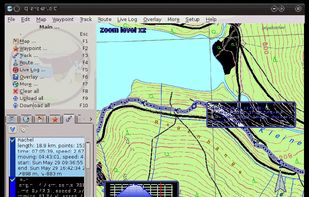
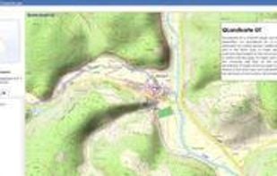
QLandkarte GT is a powerful Open Source GIS application to display your GPS data on a variety of maps. It's target is the less the scientific user but the private outdoor aficionado
 wandererand
 RouteConverter
Travel through Europe with FlixBus! Easily book your trip with our free bus app! Download the free FlixBus App now and you can easily book your mega cheap bus tickets directly on your Smartphone.


 Eurolinesand
 ComparaBUS
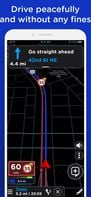
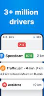
Flitsmeister is an app that helps you avoid fines, roadworks, traffic jams and accidents while driving. It warns you of speed cameras, speed enforcement zones, roadworks, delays and dangerous situations on the road.

 OpenStreetMapandGoogle Maps
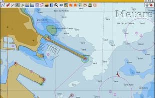
OpenCPN is a free software (GPLv2) project to create a concise chart plotter and navigation software, for use underway or as a planning tool.
 zyGrib
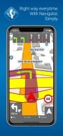
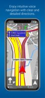
Free GPS navigation app with offline OpenStreetMaps, voice guidance, speed limit and camera alerts, and route planning for over 200 countries.
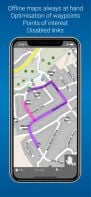
 CoMapsand
 Organic Maps
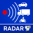
The only app that combines real-time alerts with the best offline radar detection alert system. With Radarbot, you will have the best radar alerts, real time traffic alerts and specific speed limit alerts for different vehicles (cars, motorbikes, trucks and commercial vehicles)...