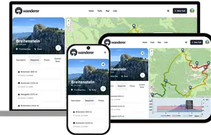
wanderer is a self-hosted trail database. You can upload your recorded tracks or create new ones and add various metadata to build an easily searchable catalogue.
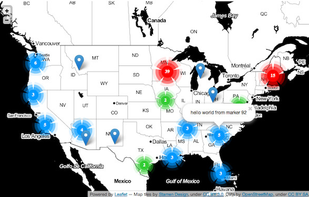
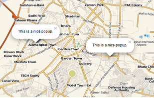
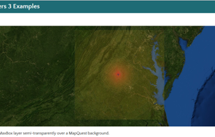
Leaflet is a modern open-source JavaScript library for mobile-friendly interactive maps. It is developed by Vladimir Agafonkin with a team of dedicated contributors. Weighing just about 28 KB of JS code, it has all the features most developers ever need for online maps.
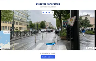
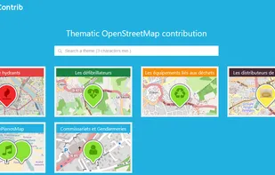
Panoramax is a digital resource for sharing and exploiting field photos. Anyone can take photographs of places visible from the public highway and contribute them to the Panoramax database. This data is then freely accessible and reusable by all.
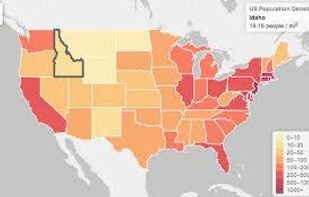
uMap let you create maps with OpenStreetMap layers in a minute and embed them in your site. Add custom annotations, lines, shapes, import and add custom layers (KML, CSV, GPS, ...) and other data.
A plus code address looks like a regular address, but with a short code where the street name and number would be. These addresses exist for any location, even for places where there are no roads.
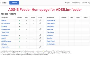
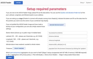
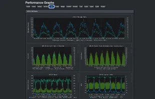
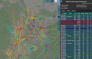
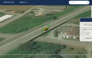
Simple to use ADSB Feeder Images. The easiest way to track nearby aircraft with your own hardware and share with others. Plot aircraft on your own map, and share to aggregators like adsb.lol, Fly Italy Adsb, TheAirTraffic, adsb.fi, ADS-B Exchange, ADSBHub, ADS-B One, airplanes.
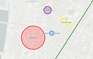
FacilMap is a privacy-friendly, open-source versatile online map that combines different services based on OpenStreetMap and makes it easy to find places, plan trips and add markers, lines and routes to custom maps with live collaboration.
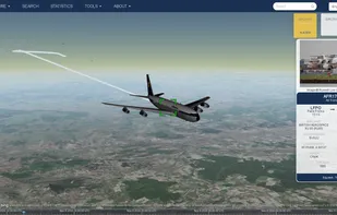
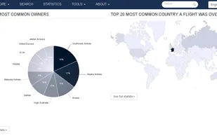
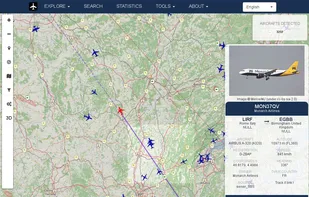
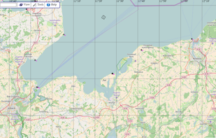
Open source project displaying aircrafts, vessels and gps trackers on a map. Browse through the data based on a particular aircraft, airline,airport, owner, vessel or tracker to search through the database or see extensive statistics.
The Headway Project was born out of a frustration with the need to send current and future location data to a corporation in order to figure out how we’re getting from A to B. Offline-only maps apps can be frustrating to use, and sometimes suffer from performance problems, poor...
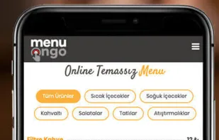
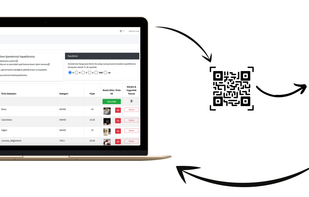
In particular, within the framework of the new social life conditions we are in with the Covid-19 pandemic process, people do not want to order with ordinary menus that are touched by everyone in social places.
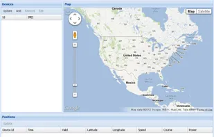
Traccar is open source server for various GPS tracking devices. At the moment server supports many types of trackers, mostly cheap devices made in Asia. An simple web application to manage devices.
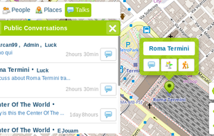
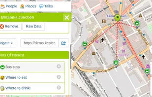
KeplerJs is a open source geosocial solution that lets users share favorite places and join discussions in real-time. It can be seen as a platform where users can interact with other open data platforms searching across OpenStreetMap, Geonames among other sources.

 Google Mapsand