
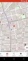
MapTiler is graphical application for online map publishing. Your map can create overlay of standard maps like Google Maps, Yahoo Maps, Microsoft VirtualEarth or OpenStreetMap and can be also visualized in 3D form by Google Earth.
MapTiler is graphical application for online map publishing. Your map can create overlay of standard maps like Google Maps, Yahoo Maps, Microsoft VirtualEarth or OpenStreetMap and can be also visualized in 3D form by Google Earth.


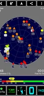
 Skyscannerand
 Flightradar24
Easily get a new location with just one tap. Save your photos and send them to your friends by Facebook, Twitter, or Instagram.
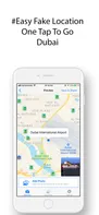
 Fake GPS Location Changer
Record anything in one place, reflect on your life, form habits, reduce stress, sleep better, feel calmer, and happier through guided journaling.


 TiddlyWikiand
 CherryTree
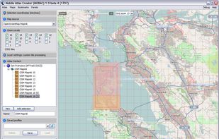
Mobile Atlas Creator (formerly known as TrekBuddy Atlas Creator) is an open source (GPL) program which creates offline atlases for GPS handhelds and cell phone applications like TrekBuddy, AndNav and other Android and WindowsCE based applications.

 Google Map Saver
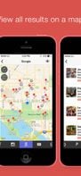
Location Browser for your iPhone
Localscope is a window to your world that lets you explore your surroundings like never before. Discover and find places, people and information around you using geo-tagged data from multiple local search engines, social networks, media sharing s.


 TripAdvisorand
 Yelp
Yelp
CityZen is an open source Android app that helps you navigate and explore your city easily. With CityZen you find points of interest (POIs) such as ATMs, gas stations, drugstores, mobile phone stores and other interesting services near you.


The Earth Awaits is a tool for long-term travelers, students taking a gap year, retirees, and anyone else with an irrepressible wanderlust. By providing just a few simple pieces of information, you can find a city that matches your lifestyle and budget.

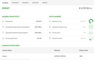
 Numbeoand
 Cost of Live
TrailRunner, a route planning software for long distance sports like biking, hiking, inline-skating, skiing. Calculator for jogging triathalon bikers running can calculate exercise and training routes matching your fitness and mileage.
 Golden Cheetah
GPS navigation with offline maps, voice guidance, real-time traffic, multi-vehicle routing, truck restrictions, and up to three route choices after a free trial.


 CoMapsand
 Organic Maps
FlipKey is a leading vacation rental marketplace that makes it easy, safe, and fun to find and book the perfect place to stay. FlipKey's verified guest reviews help you search more than 300,000 listings in 12,000 locations around the world.

CDC (Centers for Disease Control and Prevention) is America’s health protection agency, working 24/7 to protect America from health and safety threats, both foreign and domestic.
 WebMDand
 Mayo Clinic
Nomadable is a tool to find best cafes, coworking spaces, hotels where you can work remotely from. It is maintained by digital nomads around the world.


With a beautiful layout, easy to use interface, and expert live chat all for free, TheBesty app really is the perfect travel assistant. (It doesn’t complain if you forget to make your bed or leave the toilet seat up either).


 TripAdvisorand
 Booking.com
OpenTrailView (OTV) is a platform to upload 360 degree panoramas of off-road routes such as footpaths and cycle paths. The aim is to create a similar piece of software to Google Street View but for footpaths, using open licencing, and using underlying OSM data to link panoramas...

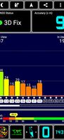
All your GPS information in one app. GPS Test shows basic GPS signal (SNR) and satellite information as well as your current location and time read from the GPS engine. It supports the following coordinate grids, OSGB,UTM,MGRS,USNG,CH1903 and Maidenhead.
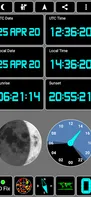
 GPS Status & Toolbox
SpatiaLite is a spatial extension to SQLite, providing vector geodatabase functionality. It is similar to PostGIS, Oracle Spatial, and SQL Server with spatial extensions, although SQLite/SpatiaLite aren't based on client-server architecture: they adopt a simpler personal...

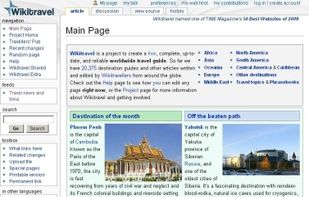
Open source travel guide featuring up-to-date information on attractions, hotels, restaurants, travel tips and more. Free and reliable advice written by Wikitravellers from around the globe.
 TripAdvisorand
 TravelToWith
Photerra is a social travel app, powered by an active community of explorers and locals sharing their best spots and hidden gems.


 TripAdvisorand
 Roadtrippers
 APlaceand
 Geocode Earth
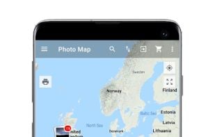
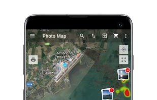
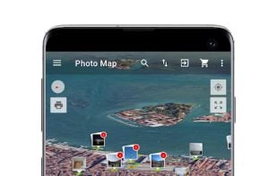
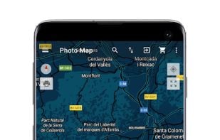
Photo Map for Android helps you to find great spots again. You can navigate from location to location in chronological order. You can share your Photos and Collages with friends.
 GeoPhotoand
 Photo Route
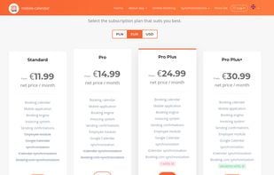
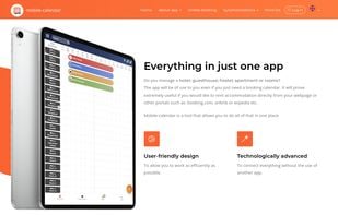
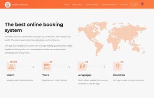
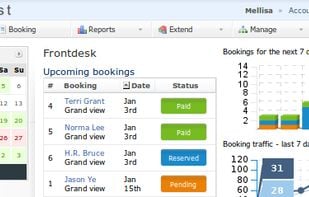
Reservation management system. If you rent accommodation, the mobile-calendar app was made for you!.

 Dudle
Dudle
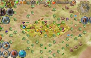
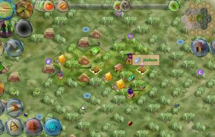
 DominAntand
 Merchant Kingdom
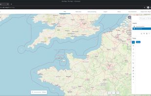
 Google Earthand
 OpenFreeMap
Checkfront is a powerful booking platform that allows businesses to manage their inventories online, centralize reservations, and process payments.


 Setmore Appointments