Apps with 'Based on OpenStreetMap' feature Page 5 of 6

All apps in Apps with 'Based on OpenStreetMap' feature category. Use the filters below to narrow down your search. 
Copy a direct link to this comment to your clipboard
  1. Sidekick icon
     2 likes

    Sidekick notifies you of road hazards ahead in real time, based on your location, direction of travel and events from multiple data sources. Hands-free. Eyes-free. Touchscreen not required.

    Cost / License

    • Free
    • Proprietary

    Platforms

    • iPhone
    • iPad
    Sidekick screenshot 1
    Sidekick screenshot 1
    Sidekick screenshot 2
    +5
    Sidekick screenshot 3
    7 alternatives
  2. Mapilio icon
     1 like

    Access street-level imagery and map data from all over the world. Fill in the gaps by requesting new coverage or capturing your own!

    Cost / License

    • Free
    • Proprietary

    Application type

    Platforms

    • Online
    • iPhone
    • iPad
    • Android
    • Android Tablet
    • Windows
    • Mac
    • Linux
    • Python
    Mapilio screenshot 1
    Mapilio screenshot 1
    Mapilio screenshot 2
    +2
    Mapilio screenshot 3
    5 alternatives
  3. MapMartini icon
     1 like

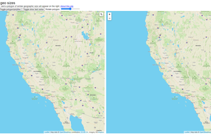
    Compare sizes of geographic areas by drawing a polygon on a map and overlaying it onto another part of the world. Also supports drawing paths and rotating the shape on the target map.

    Cost / License

    • Free
    • Proprietary

    Application type

    Platforms

    • Online
    MapMartini screenshot 1
    2 alternatives
  4. WhatIsWhere icon
     1 like

    OpenStreetMap based POI search tool (supports multiple criteria), POI download, search project reuse, etc. Can be used in market analysis and area research.

    Cost / License

    • Free
    • Proprietary

    Application type

    Platforms

    • Online
    16 alternatives
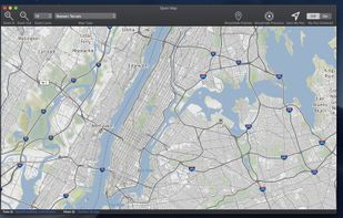
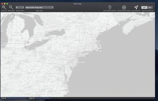
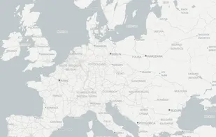
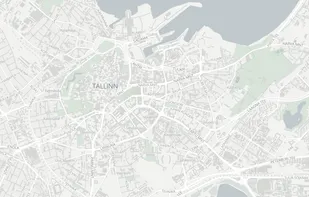
  5. The Vectorial Map application allows you to view Mapsforge offline vector maps on different platforms, including Windows, MacOS, Windows Phone, and Apple iOS. Mapsforge maps are directly rendered on your device, do not require an internet connection, and can be easily customized...

    Cost / License

    • Paid
    • Proprietary

    Platforms

    • Mac
    • Windows
    • iPhone
    • Windows Phone
    Vectorial Map screenshot 1
    1 alternatives
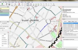
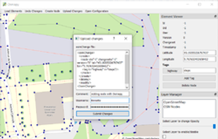
  6. Merkaartor is an OpenStreetMap editor for Unix, Windows and Mac OSX (prerelease, Intel only), distributed under the GNU General Public License.

    Cost / License

    • Free
    • Open Source

    Application type

    Platforms

    • Mac
    • Windows
    • Linux
    Merkaartor screenshot 1
    11 alternatives
  7. Wheelmap icon
     1 like

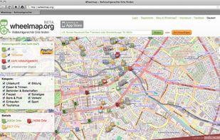
    Find wheelchair accessible places with Wheelmap. Users can find, enter and modify accessible and less accessible locations on a virtual map. With the search mask you can also find worldwide locations - for example to plan a journey.

    Cost / License

    • Free
    • Open Source (MIT)

    Platforms

    • Online
    • Android
    • iPhone
    • Android Tablet
    • iPad
    Wheelmap screenshot 1
    Wheelmap screenshot 1
    Wheelmap screenshot 2
    1 alternatives
  8. Mapwel icon
     Like

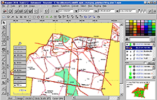
    Mapwel was designed to be used for custom GPS maps creation by both professionals and hobbyists.

    Cost / License

    • Paid
    • Proprietary

    Platforms

    • Windows
    Mapwel screenshot 1
    2 alternatives
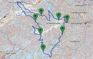
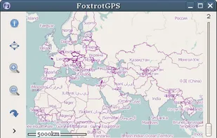
  9. FoxtrotGPS is a GTK+ based mapping and GPS application. It’s typically used to show a moving map showing your position in real time. It’s useful as a navigation tool, and as a track logging (e.g. for OpenStreetMap) and trip planning tool.
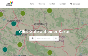
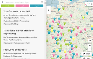
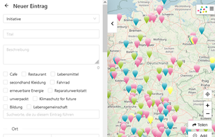
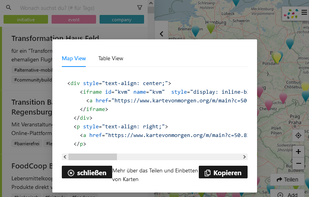
    Cost / License

    • Free
    • Open Source

    Platforms

    • Linux
    • GTK+
    FoxtrotGPS screenshot 1
    3 alternatives
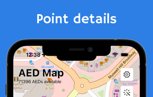
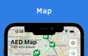
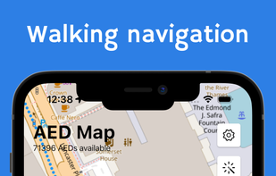
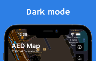
  10. OpenAEDMap is an open-data project which shows all Automated External Defibrillators (AED) around the world. The website is based on data from OpenStreetMap and is the result of OpenStreetMap Poland's association efforts.

    Cost / License

    • Free
    • Open Source (MIT)

    Application type

    Platforms

    • Online
    • Android
    • iPhone
    • iPad
    • Android Tablet
    OpenAEDMap screenshot 1
    OpenAEDMap screenshot 1
    OpenAEDMap screenshot 2
    +1
    OpenAEDMap screenshot 3
    1 alternatives
  11. parkNfree icon
     Like

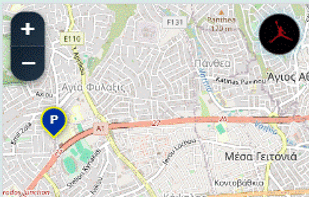
    parkNfree.com is a community-powered web app that helps drivers easily find and share free parking spots worldwide.

    Cost / License

    • Free
    • Proprietary

    Platforms

    • Online
    how the map web app looks like
  12. OSMCha icon
     Like

    OSMCha is composed by a group of softwares that together has the aim to make it easier to monitor and validate the changes in OpenStreetMap.

    Cost / License

    • Free
    • Open Source (ISC)

    Platforms

    • Online
    OSMCha screenshot 1
  13. Locus GIS icon
     Like

    Locus GIS - mobile application for collecting and updating of geodata.

    Cost / License

    • Freemium
    • Proprietary

    Platforms

    • Android
    Locus GIS screenshot 1
    Locus GIS screenshot 1
    Locus GIS screenshot 2
    +3
    Locus GIS screenshot 3
    1 alternatives
  14. Value-based routing over API for Cars & Trucks uses cost factors to calculate routes and not minimizing distances; it uses a proprietary artificial intelligence model to estimate ETAs. Considering toll and multiple mandatory driving breaks. Available for Europe.

    Cost / License

    • Paid
    • Proprietary

    Platforms

    • Software as a Service (SaaS)
    Value-based Routing screenshot 1
    9 alternatives
  15. EarthKit icon
     Like

    Automate the process of constructing overpass turbo queries, sifting through streetview/satellite images, initial geo-guessing, and more.

    Cost / License

    Platforms

    • Online
    Sifting view
    9 alternatives
  16. Osmapy icon
     Like

    Osmapy is an OpenStreetMap editor programmed in Python. Python is modern, has a huge user base and is battery-included. This allows everyone to contribute to this project. Osmapy uses the widespread, powerful and freshly-looking Qt-framework.

    Cost / License

    Platforms

    • Mac
    • Windows
    • Linux
    Osmapy screenshot 1
    12 alternatives
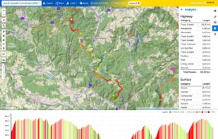
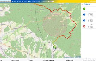
  17. bikerouter.de is a web-based route planner for all kinds of bicycles (trekking, road bike, gravel bike, mountainbike, and many more) with specialized and adjustable routing profiles.

    Cost / License

    • Free
    • Proprietary (MIT)

    Application type

    Platforms

    • Online
    bikerouter.de screenshot 1
    bikerouter.de screenshot 1
    1 alternatives
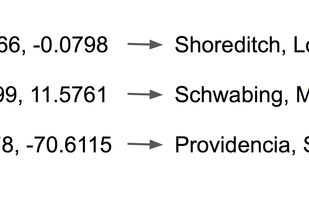
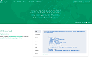
  18. An easy, open, worldwide, affordable API to convert coordinates to places or vice versa. Free and paid usage levels. Libraries for most programming languages.

    Cost / License

    • Freemium
    • Proprietary

    Platforms

    • Online
    OpenCage Geocoder screenshot 1
    OpenCage Geocoder screenshot 1
    11 alternatives
  19. Find articles from wikipedia/wikivoyage near given geographic location to be displayed in an interactive map through a generated kmz file - GitHub - k3b/AndroidGeo2ArticlesMap: Find articles from wikipedia/wikivoyage near given geographic location to be displayed in an...

    Cost / License

    Platforms

    • Android
    • Android Tablet
    8 alternatives