Apps with 'Based on OpenStreetMap' feature Page 3 of 6

All apps in Apps with 'Based on OpenStreetMap' feature category. Use the filters below to narrow down your search. 
Copy a direct link to this comment to your clipboard
  1. Forecastie icon
     25 likes

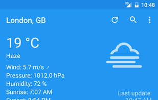
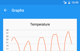
    Forecastie is a great app for staying updated with the surrounding weather conditions. Forecastie is designed to be as simple and intuitive as possible. This app uses OpenWeatherMap as a data channel and the weather updates are tiny so that you would not use up any significant...

    Cost / License

    • Free
    • Open Source

    Application type

    Alerts

    • Discontinued

    Platforms

    • Android
    • F-Droid
    Forecastie screenshot 1
    Forecastie screenshot 1
    Forecastie screenshot 2
    139 alternatives
  2. FireYak icon
     1 like

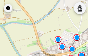
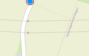
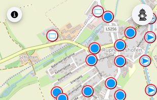
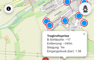
    FireYak helps fire departments quickly find the nearest usable water source (e.g. fire hydrants, suction points, water tanks, fire water ponds, fire stations) based on OpenStreetMap data.

    Cost / License

    Platforms

    • Online
    • Android
    • OpenStreetMap
    FireYak screenshot 1
    FireYak screenshot 1
    FireYak screenshot 2
    +2
    FireYak screenshot 3
  3. PlaceKit icon
     2 likes

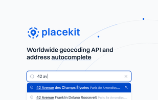
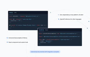
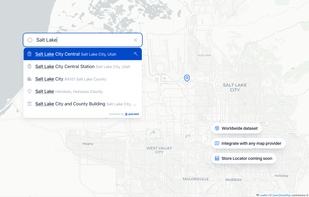
    Our mission at PlaceKit is to become the go-to geocoding solution for developers. Existing solutions feel opaque as they're split across many indiscernible APIs, confusing pricing, and locking developers into their ecosystem.

    Cost / License

    • Freemium
    • Proprietary (MIT)

    Application type

    Platforms

    • React
    • JavaScript
    • Software as a Service (SaaS)
    PlaceKit screenshot 1
    PlaceKit screenshot 1
    PlaceKit screenshot 2
    +2
    PlaceKit screenshot 3
    11 alternatives
  4. VeloPlanner icon
     1 like

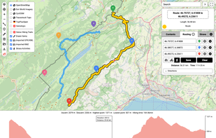
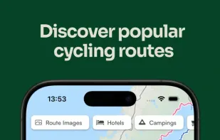
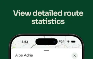
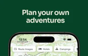
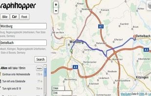
    Discover, plan & navigate the best cycling routes. VeloPlanner puts the world's official, signposted routes in one place. Download GPX files, access detailed route information & plan your next ride.
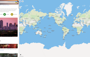
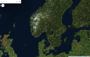
    Cost / License

    • Free
    • Proprietary

    Platforms

    • Online
    • iPhone
    • iPad
    • Android
    • Android Tablet
    VeloPlanner screenshot 1
    VeloPlanner screenshot 1
    VeloPlanner screenshot 2
    +2
    VeloPlanner screenshot 3
    10 alternatives
  5. Traili Map icon
     1 like

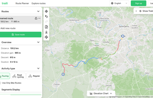
    Traili Map combines a catalog of verified bike trails, an advanced planner, and a cycling community all in one platform. Bike route planning made easy.

    Cost / License

    • Free
    • Proprietary

    Platforms

    • Online
    Default View when planning
    9 alternatives
  6. F4map icon
     1 like

    Customized 2D and 3D maps, including interactive solutions for events and tourism, with features like real-time effects and collaboration.

    Cost / License

    • Free
    • Proprietary

    Application type

    Platforms

    • Online
    • Software as a Service (SaaS)
    F4map screenshot 1
    F4map screenshot 1
    F4map screenshot 2
    +13
    F4map screenshot 3
    13 alternatives
  7. Lokjo icon
     2 likes

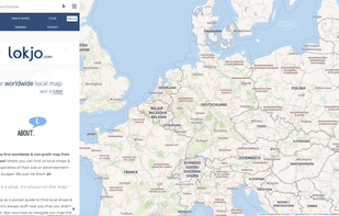
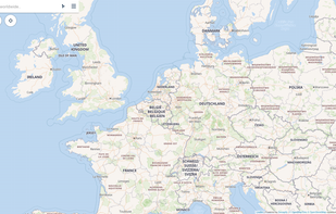
    Lokjo is the first worldwide & non-profit map from European soil where you can find all local shops & places, regardless of their size or advertisement budget. We just list them all.

    Cost / License

    • Free
    • Proprietary

    Application type

    Platforms

    • Online
    Lokjo screenshot 1
    Lokjo screenshot 1
    Lokjo screenshot 2
    24 alternatives
  8. Openstreetmap-based project for creating a map of the world's railway infrastructure

    Cost / License

    Platforms

    • Online
    1 alternatives
  9. MapSCII icon
     1 like

    MapSCII is a mapping tool that enables users to explore geographic locations in a text-based format. It was specifically designed for visually impaired individuals who may have difficulty accessing and navigating traditional graphical maps.

    Cost / License

    • Free
    • Open Source (MIT)

    Platforms

    • Linux
    • Mac
    • Windows
    • Snapcraft
    MapSCII screenshot 1
    45 alternatives
  10. Pellicola icon
     1 like

    Pellicola is an easy-to-use PHP web app for instant photo publishing and display on a map.

    Cost / License

    Platforms

    • Self-Hosted
    • Docker
    photo's and images thumbnail view
    Map view
    1 alternatives
  11. TransforMap icon
     12 likes

    TransforMap works towards an online platform for you to visualize the myriads of alternatives to the dominant economic thinking on a single mapping system.

    Cost / License

    • Free
    • Open Source

    Application type

    Platforms

    • Online
    Interface organic map showing a local supermarket alternative
    68 alternatives
  12. GMap.NET icon
     11 likes

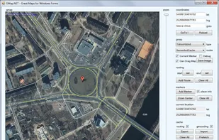
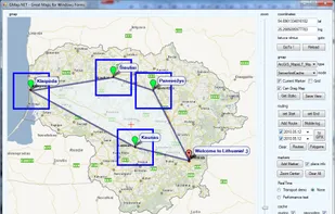
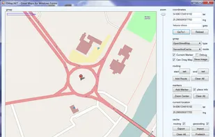
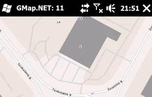
    GMap.NET is great and Powerful, Free, cross platform, open source .NET control. Enable use routing, geocoding, directions and maps from Google, Yahoo!, Bing, OpenStreetMap, ArcGIS, Pergo, SigPac, Yandex, Mapy.cz, Maps.lt, iKarte.

    Cost / License

    • Free
    • Open Source

    Alerts

    • Discontinued

    Platforms

    • Windows
    • Windows Mobile
    GMap.NET screenshot 1
    GMap.NET screenshot 1
    GMap.NET screenshot 2
    +5
    GMap.NET screenshot 3
    43 alternatives
  13. OpenMapTiles icon
     9 likes

    OpenMapTiles is a set of open-source tools for self-hosting of OpenStreetMap maps in more than 50 languages. It provides both raster as well as vector tiles, WMS and WMTS services for GIS programs, support for JavaScript viewers and mobile SDK.

    Cost / License

    • Freemium
    • Open Source

    Application type

    Platforms

    • Mac
    • Windows
    • Linux
    • Android
    • iPhone
    OpenMapTiles screenshot 1
    22 alternatives
  14. CyclOSM icon
     1 like

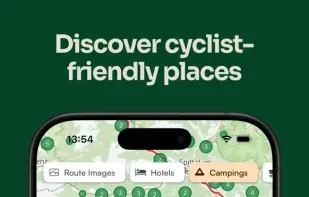
    CyclOSM is an OpenStreetMap cycle-oriented render. Contrary to OpenCycleMap, this render is free and open-source software and aims at being more complete to take into account a wider diversity of cycling habits.

    Cost / License

    • Free
    • Open Source

    Application type

    Platforms

    • Online
    5 alternatives
  15. Modest Maps icon
     13 likes

    Modest Maps is a small, extensible, and free library for designers and developers who want to use interactive maps in their own projects. It provides a core set of features in a tight, clean package with plenty of hooks for additional functionality.

    Cost / License

    • Free
    • Open Source

    Platforms

    • Mac
    • Windows
    • Linux
    Modest Maps screenshot 1
    52 alternatives
  16. MapTiler Cloud icon
     13 likes

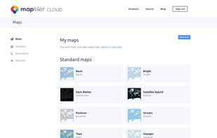
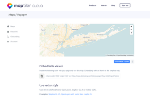
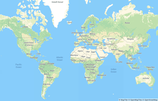
    Online maps for web, mobile apps and desktop software. You can change colors, add or remove particular map elements or enhance the map with own geodata.

    Cost / License

    • Freemium
    • Proprietary

    Application type

    Platforms

    • Online
    After you crate a free account
    The services provided
    One of the base maps
    +4
    Satellite layer
    31 alternatives