Apps with 'Based on OpenStreetMap' feature Page 4 of 6

All apps in Apps with 'Based on OpenStreetMap' feature category. Use the filters below to narrow down your search. 
Copy a direct link to this comment to your clipboard
  1. openMarkers icon
     17 likes

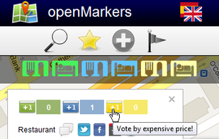
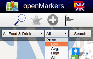
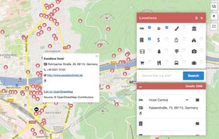
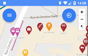
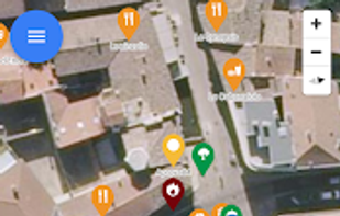
    A new collaborative project to create open points of interest in all the world. You can add or vote your favorite places and you can discover the most voted places from other users, according to your budget!

    Cost / License

    • Free
    • Open Source

    Alerts

    • Discontinued

    Platforms

    • Online
    Votes
    Search
    22 alternatives
  2. maps.earth icon
     2 likes

    The Headway Project was born out of a frustration with the need to send current and future location data to a corporation in order to figure out how we’re getting from A to B. Offline-only maps apps can be frustrating to use, and sometimes suffer from performance problems, poor...

    Cost / License

    Application type

    Platforms

    • Online
    • Self-Hosted
    maps.earth screenshot 1
    57 alternatives
  3. QLandkarte GT icon
     9 likes

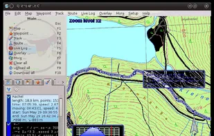
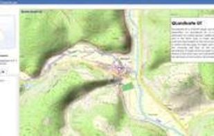
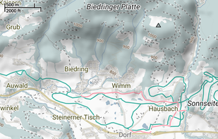
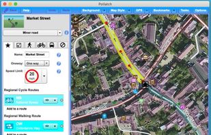
    QLandkarte GT is a powerful Open Source GIS application to display your GPS data on a variety of maps. It's target is the less the scientific user but the private outdoor aficionado
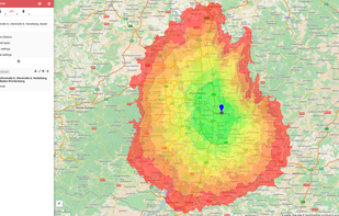
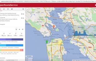
    Cost / License

    • Free
    • Open Source

    Alerts

    • Discontinued

    Platforms

    • Mac
    • Windows
    • Linux
    QLandkarte GT screenshot 1
    QLandkarte GT screenshot 1
    17 alternatives
  4. Free GPS navigation app with offline OpenStreetMaps, voice guidance, speed limit and camera alerts, and route planning for over 200 countries.

    Cost / License

    • Freemium
    • Proprietary

    Application type

    Platforms

    • Windows
    • Android
    • iPhone
    • Android Tablet
    • HUAWEI AppGallery
    • iPad
    • Android Auto
    • Kindle Fire
    • Apple Car Play
    MapFactor Navigator screenshot 1
    MapFactor Navigator screenshot 1
    MapFactor Navigator screenshot 2
    +5
    MapFactor Navigator screenshot 3
    27 alternatives
  5. Trekarta icon
     2 likes

    Offline vector maps support hiking, cycling, skiing, off-roading; enables track recording and background navigation; map filtering, custom places, terrain contours.

    Cost / License

    Application type

    Platforms

    • Android
    • F-Droid
    Trekarta screenshot 1
    Trekarta screenshot 1
    Trekarta screenshot 2
    +9
    Trekarta screenshot 3
    41 alternatives
  6. Navmii icon
     8 likes

    Free navigation app with offline maps, live traffic, voice guidance, POI search, walking mode, and driver scoring, available in over 150 countries.

    Cost / License

    • Freemium
    • Proprietary

    Application type

    Platforms

    • Android
    • iPhone
    • Android Tablet
    • iPad
    Navmii screenshot 1
    Navmii screenshot 1
    Navmii screenshot 2
    +2
    Navmii screenshot 3
    32 alternatives
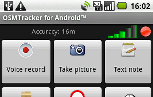
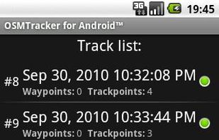
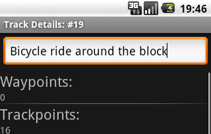
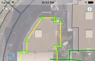
  7. OSMTracker stands for OpenStreetMap Tracker. It allows you to track your journey and mark significant way points. Way points can be marked with a tag using a button, with a quick voice record, a text note or by taking a picture.

    Cost / License

    Platforms

    • Android
    OSMTracker for Android screenshot 1
    OSMTracker for Android screenshot 1
    OSMTracker for Android screenshot 2
    +4
    OSMTracker for Android screenshot 3
    8 alternatives
  8. KeplerJs icon
     4 likes

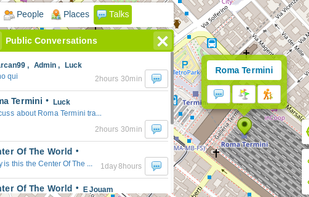
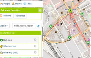
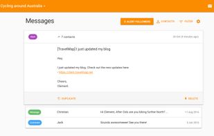
    KeplerJs is a open source geosocial solution that lets users share favorite places and join discussions in real-time. It can be seen as a platform where users can interact with other open data platforms searching across OpenStreetMap, Geonames among other sources.

    Cost / License

    • Free
    • Open Source

    Platforms

    • Online
    • Self-Hosted
    KeplerJs screenshot 1
    KeplerJs screenshot 1
    KeplerJs screenshot 2
    +2
    KeplerJs screenshot 3
    29 alternatives
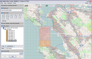
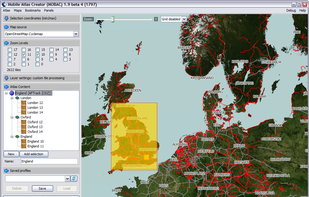
  9. Mobile Atlas Creator (formerly known as TrekBuddy Atlas Creator) is an open source (GPL) program which creates offline atlases for GPS handhelds and cell phone applications like TrekBuddy, AndNav and other Android and WindowsCE based applications.

    Cost / License

    • Free
    • Open Source

    Platforms

    • Mac
    • Windows
    • Linux
    San Francisco OpenStreetMap
    England OpenCycleMap
    1 alternatives
  10. OpenTrailView (OTV) is a platform to upload 360 degree panoramas of off-road routes such as footpaths and cycle paths. The aim is to create a similar piece of software to Google Street View but for footpaths, using open licencing, and using underlying OSM data to link panoramas...

    Cost / License

    • Free
    • Open Source

    Platforms

    • Online
    4 alternatives
  11. Spectator icon
     3 likes

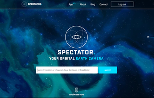
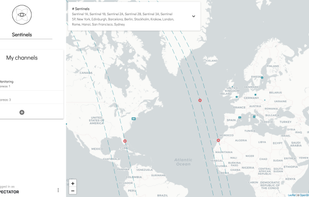
    Spectator simplifies access to satellite imagery from NASA, ESA and other providers. It gives you access to images archives, but also tracks satellites in real-time to give you information about next image acquisition.

    Cost / License

    • Free
    • Proprietary

    Platforms

    • Online
    Spectator screenshot 1
    Spectator screenshot 1
    14 alternatives
  12. Sharemap icon
     3 likes

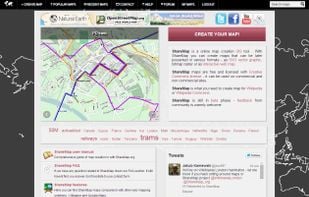
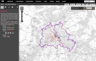
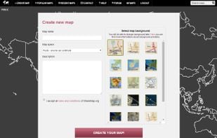
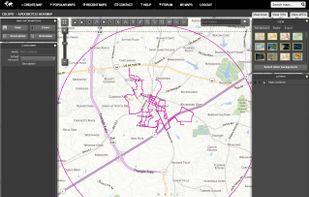
    Sharemap is an online map creation GIS tool. With ShareMap you can create maps that can be later presented in various formats - as SVG vector graphic, bitmap raster or as interactive web map. Maps are free and licensed with Creative Commons license - it can be used on commercial...
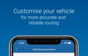
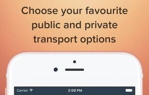
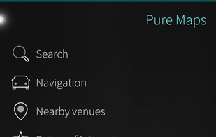
    Cost / License

    • Free
    • Proprietary

    Application type

    Platforms

    • Online
    Sharemap screenshot 1
    Sharemap screenshot 1
    Sharemap screenshot 2
    +1
    Sharemap screenshot 3
    22 alternatives
  13. Osm Go! icon
     2 likes

    Map your environment simply and fast, directly from the app. Keep your eyes wide open and contribute to OSM while on the run.

    Cost / License

    • Free
    • Open Source (MIT)

    Platforms

    • Online
    • Android
    • F-Droid
    Osm Go! screenshot 1
    Osm Go! screenshot 1
    Osm Go! screenshot 2
    +3
    Osm Go! screenshot 3
    6 alternatives
  14. Cruiser icon
     2 likes

    Cruiser is a map and navigation application using offline vector maps. Features:

    • Offline detailed vector maps (Mapsforge)
    • Map file chooser
    • Render theme file chooser
    • Render theme style selection
    • Variable text size of vector maps
    • Online maps (MapQuest, Mapnik, Cycle Map.

    Cost / License

    • Free
    • Proprietary

    Platforms

    • Android
    • Windows Phone
    Cruiser screenshot 1
    1 alternatives
  15. We-Travel icon
     3 likes

    Free navigation, 3D maps, voice guidance and tourist information always available on your java enabled mobile phone, without internet connection.

    Cost / License

    • Free
    • Proprietary

    Alerts

    • Discontinued

    Platforms

    • Windows Mobile
    • Java Mobile
    Offline Navigation
    OpenStreetMap Data
    POI Landmark
    +3
    We-Travel screenshot 3
    16 alternatives
  16. Potlatch icon
     1 like

    Potlatch is the classic OpenStreetMap editor, combining an efficient user interface with attractive presentation and a number of powerful features.

    Cost / License

    • Free
    • Open Source

    Application type

    Platforms

    • Mac
    • Windows
    Potlatch screenshot 1
    12 alternatives
  17. Probably the fastest maps ever on the App Store.

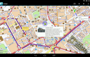
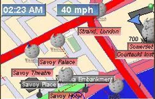
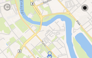
    Galileo Offline Maps provides you with a collection of online maps: CloudMade good looking maps, MapQuest, OpenStreetMap, OpenCycleMap, OpenStreetBrowser, HikeBikeMap.

    Caching is always on - Galileo saves map areas you have.

    Cost / License

    • Freemium
    • Proprietary

    Platforms

    • iPhone
    • iPad
    Galileo Offline Maps screenshot 1
    Galileo Offline Maps screenshot 1
    Galileo Offline Maps screenshot 2
    +1
    Galileo Offline Maps screenshot 3
    5 alternatives