Map Services Page 2 of 13

All apps in Map Services category. Use the filters below to narrow down your search. 

Popular filters:

Copy a direct link to this comment to your clipboard
  1. uMap icon
     34 likes

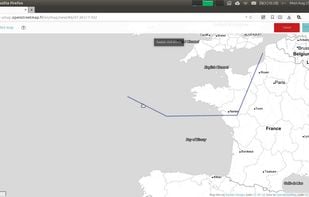
    uMap let you create maps with OpenStreetMap layers in a minute and embed them in your site. Add custom annotations, lines, shapes, import and add custom layers (KML, CSV, GPS, ...) and other data.

    • Map Service
    • FreeOpen Source
    • Self-Hosted
    • OpenStreetMap
    • Python
    • Django
    • Leaflet
    • Online
    uMap screenshot 1
    54 alternatives
  2. Vespucci icon
     9 likes

    Vespucci is the first OpenStreetMap editor for Android. That means: It is a light-weight, easy-to-use mapping tool on mobile Android devices.

    Vespucci screenshot 1
    17 alternatives
  3. Citymapper icon
     32 likes

    Real-time departures. Transit maps. Line status and real-time disruption alerts. Uber integration. Bike routing and live bike share info. Constant updates. Everything you need -- and may not even realize you need -- to manage your life in the city.

    • GPS Navigation Service
    • FreeProprietary
    • Online
    • Android
    • iPhone
    • Android Tablet
    • Apple Watch
    • Android Wear
    • Apple Messages
    Citymapper screenshot 1
    53 alternatives
  4. Kartaview icon
     18 likes

    KartaView is a free and open platform for street level imagery. Anyone can contribute images with a smartphone and the open source apps.

    • FreeProprietary
    • Online
    • Android
    • iPhone
    • OpenStreetMap
    • JavaScript
    • Leaflet
    Kartaview screenshot 1
    9 alternatives
  5. Street GL icon
     6 likes

    Streets GL is a real-time 3D map renderer built for visualizing OpenStreetMap data with a heavy focus on eye-candy features.

    Street GL screenshot 1
    50 alternatives
  6. VersaTiles icon
     3 likes

    Open-source stack for processing and distributing OpenStreetMap-based interactive map tiles, featuring customizable implementation free of commercial interests.

    • Map Service
    • FreeOpen Source
    • Mac
    • Linux
    • Self-Hosted
    • Homebrew
    • Docker
    VersaTiles screenshot 1
    53 alternatives
  7. Yandex Maps icon
     64 likes

    Yandex.Maps gives you access to maps of over 1800 cities and towns right in your pocket. Find addresses and companies. Plan your journeys in a car or on public transport taking current traffic conditions into account.

    • Map Service
    • FreeProprietary
    • Online
    • Android
    • iPhone
    • Android Tablet
    • Telegram
    • Windows Phone
    • iPad
    • Apple Watch
    • Kindle Fire
    Yandex Maps screenshot 1
    Yandex Maps screenshot 2
    Yandex Maps screenshot 3
    67 alternatives
  8. Marble icon
     53 likes

    Marble is a Virtual Globe and World Atlas that you can use to learn more about Earth: You can pan and zoom around and you can look up places and roads. A mouse click on a place label will provide the respective Wikipedia article.

    • Map Service
    • FreeOpen Source
    • Mac
    • Windows
    • Linux
    • PortableApps.com
    • Flathub
    • Snapcraft
    • Flatpak
    Marble screenshot 1
    40 alternatives
  9. NASA World Wind icon
     44 likes

    World Wind lets you zoom from satellite altitude into any place on Earth. Leveraging Landsat satellite imagery and Shuttle Radar Topography Mission data, World Wind lets you experience Earth terrain in visually rich 3D, just as if you were really there.

    Blue Marble: View of the eastern hemisphere
    15 alternatives
  10. Mapillary icon
     15 likes

    Collaborative street-level imagery platform using computer vision and machine learning for mapping, urban planning, transport, and geospatial dataset enhancement.

    • Map Service
    • FreeProprietary
    • Mac
    • Windows
    • Linux
    • Online
    • Android
    • iPhone
    Mapillary screenshot 1
    Mapillary screenshot 2
    Mapillary screenshot 3
    19 alternatives
  11. Moovit icon
     16 likes

    Join our community of 30 million riders helping improve transit routes in cities worldwide.

    • Map Service
    • FreemiumProprietary
    • Online
    • Android
    • iPhone
    • Android Tablet
    • iPad
    • Apple Watch
    Moovit screenshot 1
    34 alternatives
  12. Kagi Maps icon
     2 likes

    Kagi Maps is a powerful tool that simplifies the process of finding businesses, points of interest, and addresses. With Kagi Maps, you can easily search for locations, get driving or walking directions, and discover interesting stops along your route.

    Kagi Maps screenshot 1
    50 alternatives
  13. Roadtrippers icon
     40 likes

    Turn your road trip into an adventure. Roadtrippers is the world’s #1 road trip planning tool, with more than 25 million trips planned to date covering more than 16.9 billion miles. Whether you’re looking for an RV trip planner app or just planning your next summer road trip...

    • Travel Planner
    • FreemiumProprietary
    • Online
    • Android
    • iPhone
    • Android Tablet
    • iPad
    Roadtrippers screenshot 1
    121 alternatives
  14. Bing Maps icon
     34 likes

    Web mapping service offering street maps, aerial imagery, route planning, traffic updates, labeled points of interest, multiple views, and global coverage.

    Bing Maps
    74 alternatives
  15. Source SDK icon
     16 likes

    The Source SDK is a software development kit compiled by Valve Software that is used to create maps or mods for the Source engine, with the exception of Left 4 Dead, Left 4 Dead 2, and Alien Swarm. These games are packaged with their own SDKs, called the Left 4 Dead Authoring...

    The Source SDK launcher menu.
    12 alternatives
  16. AllTrails icon
     7 likes

    Explore the outdoors with AllTrails! Discover nature with hiking, biking, backpacking and running trails around the world. Log your hike, walk, run or mountain bike ride with our GPS activity tracker. Looking for a good spot for camping or backpacking?

    AllTrails screenshot 1
    AllTrails screenshot 2
    AllTrails screenshot 3
    48 alternatives
  17. FacilMap icon
     14 likes

    FacilMap is a privacy-friendly, open-source versatile online map that combines different services based on OpenStreetMap and makes it easy to find places, plan trips and add markers, lines and routes to custom maps with live collaboration.

    FacilMap screenshot 1
    8 alternatives