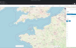
Map Services Page 6 of 13

All apps in Map Services category. Use the filters below to narrow down your search. 

Popular filters:

Copy a direct link to this comment to your clipboard
  1. OpenSeaMap icon
     1 like

    OpenSeaMap's goal is to add nautical and tourism information a sailor could be interested in to OSM (OpenStreetMap) and to present it in a pleasing way.

    OpenSeaMap download
    2 alternatives
  2. Make high-dpi maps for print applications within minutes, using the Printmaps editor. Put custom geo data such as routes or shapes onto your map, or geocode hundreds of addresses to populate your map with POIs.

    2 alternatives
  3. City-Data icon
     2 likes

    Stats about all US cities - real estate, relocation info, house prices, home value estimator, recent sales, maps, race, income, photos, education, crime, weather, houses, etc.

    • FreeProprietary
    • Online
    City-Data screenshot 1
    5 alternatives
  4. KeplerJs icon
     4 likes

    KeplerJs is a open source geosocial solution that lets users share favorite places and join discussions in real-time. It can be seen as a platform where users can interact with other open data platforms searching across OpenStreetMap, Geonames among other sources.

    KeplerJs screenshot 1
    29 alternatives
  5. MapTiler icon
     7 likes

    MapTiler is graphical application for online map publishing. Your map can create overlay of standard maps like Google Maps, Yahoo Maps, Microsoft VirtualEarth or OpenStreetMap and can be also visualized in 3D form by Google Earth.

    Overlay of Google Maps Google Earth embedded in browser
    6 alternatives
  6. TrailRunner icon
     8 likes

    TrailRunner, a route planning software for long distance sports like biking, hiking, inline-skating, skiing. Calculator for jogging triathalon bikers running can calculate exercise and training routes matching your fitness and mileage.

    11 alternatives
  7. SpatiaLite icon
     4 likes

    SpatiaLite is a spatial extension to SQLite, providing vector geodatabase functionality. It is similar to PostGIS, Oracle Spatial, and SQL Server with spatial extensions, although SQLite/SpatiaLite aren't based on client-server architecture: they adopt a simpler personal...

    3 alternatives
  8. Maverick icon
     4 likes

    Maverick is a GPS off-road navigation app for Android devices. It automatically caches all your maps for offline use so that you can access them even without an Internet connection. This app is great for hiking, boating, geocaching, and other outdoor activities.

    Maverick screenshot 1
    22 alternatives
  9. uDig icon
     5 likes

    uDig is a GIS software program produced by a community led by Canadian-based consulting company Refractions Research. It is based on the Eclipse platform and features full layered open source GIS. It is written in Java and released under GNU Lesser General Public License.

    Taaka, developed using uDig by Arbonaut for Finnish Forest and Park Services
    37 alternatives
  10. CartoDB icon
     5 likes

    A location intelligence and visualization engine that empowers you to effortlessly transform data into insights. With CartoDB, connect and map location data, quickly customize your visualizations, and develop powerful location based apps.

    30 alternatives
  11. Spectator icon
     3 likes

    Spectator simplifies access to satellite imagery from NASA, ESA and other providers. It gives you access to images archives, but also tracks satellites in real-time to give you information about next image acquisition.

    Spectator screenshot 1
    12 alternatives
  12. Sharemap icon
     3 likes

    Sharemap is an online map creation GIS tool. With ShareMap you can create maps that can be later presented in various formats - as SVG vector graphic, bitmap raster or as interactive web map. Maps are free and licensed with Creative Commons license - it can be used on commercial...

    Sharemap screenshot 1
    22 alternatives
  13. Gaia GPS icon
     3 likes

    Plan trips and record GPS tracks for free, with the best outdoor app. Browse hiking trail maps, hunting units, and scout offroad camping trips.

    Gaia GPS screenshot 1
    31 alternatives
  14. Globe icon
     1 like

    The Globe application allows you to have a 3D representation of the Earth always at your fingertips, like a real globe that you might find in stores. It's easy to use, just swipe your finger across the watch screen to spin the Earth in 3D.

    • PaidProprietary
    • Android Wear
    Globe app
    5 alternatives
  15. GMapCatcher icon
     3 likes

    GMapCatcher is an offline map viewer. It can display maps from many providers, using a custom GUI. GMapCatcher doesn't depend on the map's JavaScript. GMapCatcher is written in Python 2.7 & PyGTK, can run on Linux, Windows and Mac OSX.

    1 alternatives