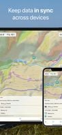
Map Services Page 9 of 13

All apps in Map Services category. Use the filters below to narrow down your search. 

Popular filters:

Copy a direct link to this comment to your clipboard
  1. Pineqone icon
     1 like

    Pineqone has destination guides for the entire world, a huge database of sights and attractions, and a Planner Tool which allows travelers to easily plan and budget their trips.

    Travel itinerary planner
    3 alternatives
  2. The TomTom Maps APIs allow you to easily build location-aware applications. A variety of cross platform REST APIs and SDKs are available to build and enhance your mobile and web apps with search, routing, mapping, traffic and navigation features.

    • Map Service
    • FreemiumProprietary
    • Mac
    • Windows
    • Linux
    • Android
    • iPhone
    16 alternatives
  3. Stadia Maps icon
     3 likes

    Stadia Maps provides great looking maps and geographic data services. We’re here to help you grow your business, not your bills.

    • Map Service
    • FreemiumOpen Source
    • Mac
    • Windows
    • Linux
    • Online
    • Android
    • iPhone
    • Chrome OS
    • Android Tablet
    • iPad
    Stadia Maps screenshot 1
    25 alternatives
  4. mamap.io icon
     1 like

    Easily create and embed a customizable, interactive map with markers, images and search functionality in just a few minutes. Enhance and customize your user experience without using ugly iframes.

    • Map Service
    • PaidProprietary
    • Online
    • Software as a Service (SaaS)
    Homepage
    11 alternatives
  5. Waypointer icon
     1 like

    Waypointer is a service for POI (GPS coordinates) search and management. It will be useful for tourists and owners of GPS devices. With help of Waypointer you can find POIs on map filtered by categories (i.e. spring or camping sites), and prepare your next journey. Also you can e.

    • FreeProprietary
    • Online
    Waypointer screenshot 1
    11 alternatives
  6. gMaps icon
     1 like

    gMaps - Google Maps for Windows Phone 7

    1. Map navigation with different layers support
    2. GPS tracking (with movement Direction, Speed and Navigation type information)
    3. Local and business search with multiple results, auto-complete and routes
    4. Routes search with route stati.
    14 alternatives
  7. Spatial Feature Server by MapET is an ESRI Geoservices REST Implementation and works with all ESRI Rest API's. The source of published data is the spatial extension of the major RDBMS, such Oracle, Microsoft SQLServer, MySQL, PostgreSQL.

    35 alternatives
  8. Spotzi icon
     1 like

    Spotzi is an easy-to-use online geomarketing platform you can try for FREE. Spotzi has a short learning curve, so you don't have to be a data scientist to work with Spotzi. Our main goal is to find your best-fit customers in just a few clicks.

    • Map Service
    • FreemiumProprietary
    • Mac
    • Windows
    • Linux
    • Online
    • Android
    • iPhone
    • Android Tablet
    • Windows Phone
    • iPad
    Select one of the geomarketing tools to visualize the areas with your best-fit customers.
    37 alternatives
  9. MapMartini icon
     1 like

    Compare sizes of geographic areas by drawing a polygon on a map and overlaying it onto another part of the world. Also supports drawing paths and rotating the shape on the target map.

    MapMartini screenshot 1
    2 alternatives
  10. Comparea icon
     1 like

    Comparea provides an accurate way to compare the area of two geographic locations. It uses a projection that helps minimize distortion so you can get a better idea of how big areas like Australia and Alaska really are in comparison to others like the United States and Brazil.

    Comparea screenshot 1
    2 alternatives
  11. The Cartograph app views Mapsforge offline vector maps, offline raster maps, and online/WMS maps. It supports tracking, route search, overlays, hillshading, reliefs, track drawing, and has many other features.

    Cartograph 2 Maps screenshot 1
    13 alternatives
  12. Orbis icon
     1 like

    Orbis is a geolocation social network where users can checkin to places around a map and conquer them for their grous. The app maps the hidden personality groups of a region by allowing them to tag their symbols in a crowdsourced map.

    • FreeProprietary
    • Android
    Orbis screenshot 1
    Orbis screenshot 2
    Orbis screenshot 3
    10 alternatives
  13. Hawaii Revealed app is the perfect companion to the book, or you can use it as a stand-alone app. Download and preview free information about Hawaiian culture, hotels, activities, restaurants and more for all four islands.

    The unlimited Ohau, Maui, kaui & the Big Island revealed in one
    Kauai Revealed
    The Custom Map from the book
    3 alternatives