Apps tagged with 'Terrain'

All apps in Apps tagged with 'Terrain' category. Use the filters below to narrow down your search. 
Copy a direct link to this comment to your clipboard
  1. Blender icon
     1860 likes

    Free open-source 3D software for modeling, texturing, rigging, animation, rendering, compositing, video editing, and simulation.

    Cost / License

    Application type

    Platforms

    • Mac
    • Windows
    • Linux
    • BSD
    • Snapcraft
    • Flathub
    • PortableApps.com
    • Haiku
    • Steam
    • Flatpak
    • NL flagNetherlands
    • European Union flagEU
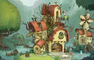
    Splash Artwork for Blender 4.3
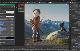
    Cycles Render Engine
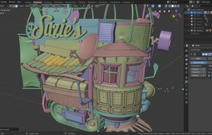
    Modeling, Sculpt, UV
    +9
    VFX
    154 alternatives
    4.8
    Excellent54 ratings
  2. Magic Earth icon
     61 likes

    Navigation app using OpenStreetMap data with offline maps for 233 countries, real-time traffic, transit info, multiple modes, privacy, and detailed routes.

    Cost / License

    • Freemium
    • Proprietary

    Application type

    Platforms

    • Android
    • iPhone
    • Android Tablet
    • HUAWEI AppGallery
    • iPad
    • Apple Watch
    • Android Auto
    • Apple Car Play
    • NL flagNetherlands
    • European Union flagEU
    Magic Earth screenshot 1
    Magic Earth screenshot 1
    Magic Earth screenshot 2
    +8
    Magic Earth screenshot 3
    50 alternatives
    4.4
    Very Good14 ratings
  3. Vue icon
     29 likes

    Create vast expanses of terrains, add trees, select the best point of view and render hyper-realistic images of your landscapes in moody atmospheres... in a few mouse clicks.

    Cost / License

    • Free
    • Proprietary

    Application type

    Alerts

    • Discontinued

    Platforms

    • Mac
    • Windows
    • US flagUnited States
    vue final
    vue screenshot
    vue render
    +6
    Vue screenshot 3
    61 alternatives
  4. NASA World Wind icon
     44 likes

    World Wind lets you zoom from satellite altitude into any place on Earth. Leveraging Landsat satellite imagery and Shuttle Radar Topography Mission data, World Wind lets you experience Earth terrain in visually rich 3D, just as if you were really there.

    Cost / License

    • Free
    • Open Source

    Application type

    Platforms

    • Mac
    • Windows
    • Linux
    • US flagUnited States
    Blue Marble: View of the eastern hemisphere
    SRTM + LandSat 7: Mt. Everest, Nepal
    GLOBE - 08-11-2004 Maximum temperature
    20 alternatives
  5. World Machine icon
     9 likes

    World Machine is a powerful terrain generation software used by game developers, visual effects artists, and independent creators to create realistic 3D landscapes and terrains.

    Cost / License

    • Freemium
    • Proprietary

    Application type

    Platforms

    • Windows
    • Mac
    • Linux
    • US flagUnited States
    World Machine screenshot 1
    World Machine screenshot 1
    World Machine screenshot 2
    29 alternatives
  6. Mgrs & Utm Map is a GPS and coordinate system application designed to assist military personnel and outdoor enthusiasts with navigation, supporting various satellite systems and offering diverse map layers.

    Cost / License

    • Freemium
    • Proprietary

    Application type

    Platforms

    • iPhone
    • iPad
    • Android
    • Android Tablet
    Mgrs & Utm Map screenshot 1
    Mgrs & Utm Map screenshot 2
    Mgrs & Utm Map screenshot 3
    5 alternatives
  7. Geomorph icon
     4 likes

    Geomorph is a height field generator and editor for the Linux operating system.

    A height field is a kind of topographic map. It is a 2D projection of a 3D landscape.

    Geomorph generates square images and shows a 3D preview of the resulting landscape. The resulting 2D image can.

    Cost / License

    • Free
    • Open Source

    Alerts

    • Discontinued

    Platforms

    • Linux
    24 alternatives
  8. UniWar icon
     15 likes

    UniWar is a turn-based strategy game where players battle it out on the field with units of differents races, building bases and using the terrain to overcome their opponents towards victory. Several modes are available along with many maps to play.

    Cost / License

    • Freemium
    • Proprietary

    Platforms

    • Android
    • iPhone
    • Symbian S60
    • Blackberry
    • iPad
    • US flagUnited States
    S60 v5 360x640
    S60 v5 360x640
    On iPhone 320x480
    20 alternatives
  9. CADMAPPER icon
     1 like

    CADMAPPER turns public data from sources such as OpenStreetMap, NASA and USGS into neatly organized, layered CAD files. Define any area with the online tool, then edit the drawing in AutoCAD, SketchUp, Rhino or Adobe Illustrator.

    Cost / License

    • Freemium
    • Proprietary

    Application type

    Platforms

    • Online
    • US flagUnited States
    CADMAPPER screenshot 1
    CADMAPPER screenshot 1
    2 alternatives
  10. Mantle Place icon
     1 like

    Draw any area on Earth and get it back as a site you keep: elevation, imagery, vectors, and lots more, ready for the tools you already use. Free up to 2 km² / 0.77 mi².

    Cost / License

    • Freemium
    • Proprietary

    Application type

    Platforms

    • Online
    • Software as a Service (SaaS)
    • US flagUnited States
    Draw any area on a 3D globe and watch the price update as you draw. Bundles up to 64 km² / 24.71 mi².
    Native import into Unreal Engine: terrain, imagery, buildings, and lots more land as editable assets.
    Areas up to 2 km² / 0.77 mi² are free at full quality.
    +1
    Satellite view: place an area anywhere on Earth and see its price before you buy.
    3 alternatives
  11. Picogen icon
     4 likes

    A free Terrain Synthesizer and RendererPicogen is an outdoor ray tracing system, a free Terrain Synthesizer and Renderer targeting large-scale terrain with realistic day/night-illumination and detailed plant populations.

    Cost / License

    • Free
    • Open Source

    Alerts

    • Discontinued

    Platforms

    • Windows
    • Linux
    Minimalistic GUI
    Navigation Window
    Wizard's Code Edit
    40 alternatives
  12. Nem's Mega 3D Terrain Generator is a relatively new terrain generator that takes a step in a completely different direction. Unlike traditional generators where the user must depend solely on the generators generation abilities, this generator gives its users complete 3D...

    Cost / License

    • Free
    • Proprietary

    Alerts

    • Discontinued

    Platforms

    • Windows
    • US flagUnited States
    Nem's Mega 3D Terrain Generator screenshot 1
    Nem's Mega 3D Terrain Generator screenshot 1
    Nem's Mega 3D Terrain Generator screenshot 2
    23 alternatives
  13. GeoControl icon
     3 likes

    GeoControl2, the professional terrain generator.

    The revolutionary concept of GeoControl2 opens up totally new dimensions of creating virtual landscapes.

    The unique combination of more artistic tools and semi-scientific algorithms makes it possible to create realistic, breathta.

    Cost / License

    • Paid
    • Proprietary

    Alerts

    • Discontinued
    • Warning

    Platforms

    • Windows
    • DE flagGermany
    • European Union flagEU
    GeoControl screenshot 1
    GeoControl screenshot 1
    GeoControl screenshot 2
    +7
    GeoControl screenshot 3
    19 alternatives
  14. PnP TerrainCreator is a highly integrated tool for large scale terrain creation. Featuring manual as well as automated/randomized terrain generation including heightmaps, texturing, vegetation, seas and rivers, static objects and environmental sounds enabeling you to build a...

    Cost / License

    • Freemium
    • Proprietary

    Alerts

    • Discontinued

    Platforms

    • Windows
    PnP TerrainCreator screenshot 1
    PnP TerrainCreator screenshot 1
    PnP TerrainCreator screenshot 2
    +5
    PnP TerrainCreator screenshot 3
    23 alternatives
  15. 3D terrain modeling software offering photorealistic landscapes, rapid animation rendering, CAD and GIS import, and scene editing for site visualization.

    Cost / License

    • Paid
    • Open Source

    Platforms

    • Windows
    • US flagUnited States
    Visual Nature Studio screenshot 1
    22 alternatives
  16. Graphite is Quad Software reference renderer for Grome editor.

    Definition: Middleware reference outdoor renderer, 100% integrated with Grome pipelines, directly from the makers of the editor.

    Advantages: Out-of-the-box solution for scenes created in Grome or other world modelin.

    Cost / License

    • Freemium
    • Proprietary

    Alerts

    • Discontinued

    Platforms

    • Windows
    • RO flagRomania
    • European Union flagEU
    Scene Viewer
    Grome Exporter
    Graphite Renderer screenshot 2
    23 alternatives
  17. Natural Creative Power that's Easy To Use

    Natural Graphics is the developer of Natural Scene Designer -- a powerful yet easy to use 3D program which lets you design, render, and animate natural outdoor scenes. Its intuitive interface makes it easy to use for beginners, while.

    Cost / License

    • Paid
    • Proprietary

    Platforms

    • Mac
    • Windows
    24 alternatives
  18. Grome icon
     1 like

    Grome is a game level authoring tool used by professional game developers and companies from 3D simulation industry.

    Cost / License

    • Paid
    • Proprietary

    Platforms

    • Windows
    • RO flagRomania
    • European Union flagEU
    Grome screenshot 1
    Grome screenshot 1
    Grome screenshot 2
    +4
    Grome screenshot 3
    24 alternatives
  19. AllyCAD icon
     1 like

    Industrial strength, user-friendly 2D/3D CAD package. Specialised Toolkits to enhance your productivity. Control Centre allows easy access to symbols, hatching, text, dimension and line styles. Enhanced bitmap capability can load 300 large images. Full compatibility with the late.

    Cost / License

    • Paid
    • Proprietary

    Application type

    Platforms

    • Windows
    58 alternatives
  20. World Creator icon
     2 likes

    World Creator is a landscape generator that is fully GPU powered and features a powerful array of artist driven creative tools.

    Cost / License

    • Paid
    • Proprietary

    Platforms

    • Mac
    • Windows
    • Unity
    • DE flagGermany
    • European Union flagEU
    World Creator screenshot 1
    World Creator screenshot 1
    World Creator screenshot 2
    +9
    World Creator screenshot 3
    6 alternatives
  21. Raiseland icon
     1 like

    Raiseland is a procedural terrain generator that can produce realistic & non-realistic terrains in minutes.

    Cost / License

    • Paid
    • Proprietary

    Alerts

    • Discontinued

    Platforms

    • Windows
    • Linux
    • Steam
    Raiseland screenshot 1
    Raiseland screenshot 1
    Raiseland screenshot 2
    22 alternatives
  22. QTViewer icon
     1 like

    Libmini is free software that displays geographic terrain data at real-time. This is an example application of integrating libmini in the Qt user interface. The application, the libMini QTViewer, primarily uses libmini viewer functions but provides additional camera control.

    Cost / License

    • Free
    • Open Source

    Platforms

    • Mac
    • Windows
    • Linux
    QTViewer screenshot 1
    QTViewer screenshot 1
    QTViewer screenshot 2
    +2
    QTViewer screenshot 3
    7 alternatives
  23. Proteus game icon
     1 like

    A game of audio-visual exploration and discovery. Terraform is a relaxing turn based puzzle game set in the future. Alter over 200 planets to allow settlements and forests to survive. Planets are made of hexagonal tiles that can be altered using many different tools and weather...

    Cost / License

    • Paid
    • Proprietary

    Platforms

    • Windows
    • Steam
    Proteus game screenshot 1
    Proteus game screenshot 1
    Proteus game screenshot 2
    +2
    Proteus game screenshot 3
  24. L3DT icon
     1 like

    Large 3D terrain generator.

    Cost / License

    • Freemium
    • Proprietary

    Platforms

    • Windows
    • AU flagAustralia
    Shows 3D editing screen for heightmap.
    Image from road making tutorial: http://www.bundysoft.com/wiki/doku.php?id=tutorials:l3dt:roads
    Example of heightfield layer, from official forums.
    24 alternatives