Apps with Offline Map Support

All apps in Apps with Offline Map Support category. Use the filters below to narrow down your search. 

Popular filters:

Copy a direct link to this comment to your clipboard
  1. CoMaps icon
     119 likes

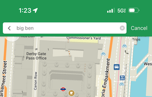
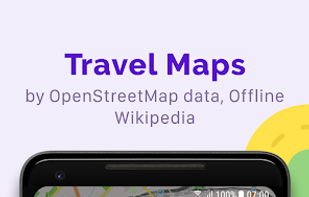
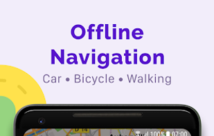
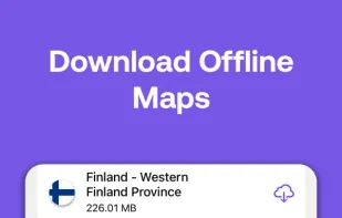
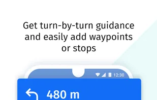
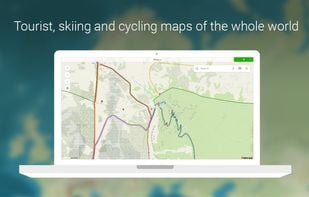
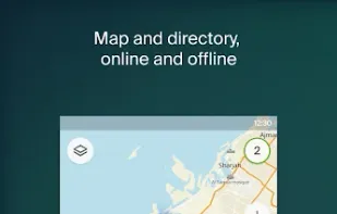
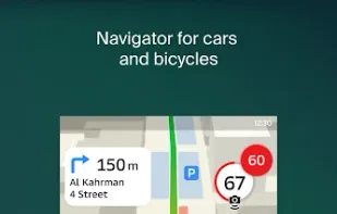
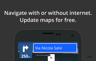
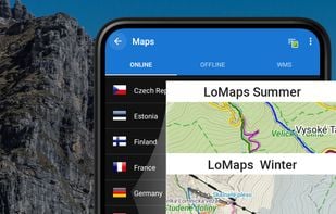
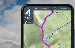
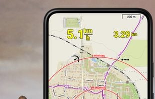
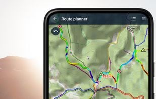
    CoMaps is a new community-driven map app project born out of the desire to create a truly open, transparent, and community-focused navigation app.

    CoMaps screenshot 1
    CoMaps screenshot 2
    CoMaps screenshot 3
    55 alternatives
    4.8
    Excellent13 reviews
  2. Organic Maps icon
     193 likes

    Privacy-focused GPS app with offline maps and community development, featuring real-time navigation, no location tracking, and open-source software.

    • GPS Navigation Service
    • FreeOpen Source
    • Linux
    • Android
    • iPhone
    • Android Tablet
    • HUAWEI AppGallery
    • iPad
    • OpenStreetMap
    • Flathub
    • F-Droid
    Organic Maps screenshot 1
    Organic Maps screenshot 2
    Organic Maps screenshot 3
    50 alternatives
    4.4
    Very Good40 reviews
  3. Google Maps icon
     1193 likes

    Navigate efficiently with real-time traffic updates, turn-by-turn GPS, panoramic street views, and comprehensive route planning for multiple platforms.

    • GPS Navigation Service
    • FreemiumProprietary
    • Online
    • Android
    • iPhone
    • Blackberry
    • Chrome OS
    • Android Tablet
    • iPad
    • Apple Watch
    • Android Auto
    • Android Wear
    • KaiOS
    • Apple Car Play
    Google Maps screenshot 1
    176 alternatives
    3.9
    Good22 reviews
  4. OsmAnd icon
     298 likes

    Navigation app with offline and online OSM maps, turn-by-turn voice guidance, cycling and driving modes, GPX tracking, POI search, and monthly updates.

    • GPS Navigation Service
    • FreemiumOpen Source
    • Android
    • iPhone
    • Android Tablet
    • iPad
    • Android Auto
    • F-Droid
    • Apple Car Play
    OsmAnd screenshot 1
    OsmAnd screenshot 2
    OsmAnd screenshot 3
    103 alternatives
    4.6
    Excellent17 reviews
  5. Magic Earth icon
     55 likes

    Navigation app using OpenStreetMap data with offline maps for 233 countries, real-time traffic, transit info, multiple modes, privacy, and detailed routes.

    • GPS Navigation Service
    • FreemiumProprietary
    • Android
    • iPhone
    • Android Tablet
    • HUAWEI AppGallery
    • iPad
    • Apple Watch
    • Android Auto
    • Apple Car Play
    Magic Earth screenshot 1
    45 alternatives
    4.4
    Very Good14 reviews
  6. MAPS.ME icon
     114 likes

    MAPS.ME offers the quickest offline maps of all the countries of the world. Travel with full confidence: wherever you are, MAPS.ME addresses all your offline mapping needs.

    MAPS.ME screenshot 1
    MAPS.ME screenshot 2
    MAPS.ME screenshot 3
    75 alternatives
  7. HERE WeGo icon
     135 likes

    Explore the world in glorious 3D with HERE Maps. Discover new places, collect your favourite places, plan the perfect journey, and sync it all with your mobile phones.

    • GPS Navigation Service
    • FreeProprietary
    • Online
    • Android
    • iPhone
    • Android Tablet
    • HUAWEI AppGallery
    • iPad
    • Samsung Galaxy Store
    HERE WeGo screenshot 1
    HERE WeGo screenshot 2
    HERE WeGo screenshot 3
    100 alternatives
  8. Mapy.com icon
     22 likes

    Global offline tourist maps feature hiking and bike trails, route planning, synced trip organization, panoramic images, public transit info, and local amenities.

    • GPS Navigation Service
    • FreeProprietary
    • Windows
    • Online
    • Android
    • iPhone
    • Android Tablet
    • iPad
    • Android Auto
    • Apple Watch
    • Apple Car Play
    • Android Wear
    Mapy.com screenshot 1
    44 alternatives
  9. Leaflet icon
     58 likes

    Leaflet is a modern open-source JavaScript library for mobile-friendly interactive maps. It is developed by Vladimir Agafonkin with a team of dedicated contributors. Weighing just about 28 KB of JS code, it has all the features most developers ever need for online maps.

    Leaflet with clustering
    54 alternatives
  10. 2GIS icon
     72 likes

    2GIS provides 3D-maps of 180+ cities, contacts of 1.5 million companies, car routing and public transport routes and and more! 2GIS is a complete and up-to-date directory of organizations with detailed cities’ maps.

    • Map Service
    • FreeProprietary
    • Online
    • Android
    • iPhone
    • Android Tablet
    • iPad
    • Android Wear
    2GIS screenshot 1
    2GIS screenshot 2
    2GIS screenshot 3
    63 alternatives
  11. Yandex Maps icon
     64 likes

    Yandex.Maps gives you access to maps of over 1800 cities and towns right in your pocket. Find addresses and companies. Plan your journeys in a car or on public transport taking current traffic conditions into account.

    • Map Service
    • FreeProprietary
    • Online
    • Android
    • iPhone
    • Android Tablet
    • Telegram
    • Windows Phone
    • iPad
    • Apple Watch
    • Kindle Fire
    Yandex Maps screenshot 1
    Yandex Maps screenshot 2
    Yandex Maps screenshot 3
    69 alternatives
  12. Marble icon
     53 likes

    Marble is a Virtual Globe and World Atlas that you can use to learn more about Earth: You can pan and zoom around and you can look up places and roads. A mouse click on a place label will provide the respective Wikipedia article.

    • Map Service
    • FreeOpen Source
    • Mac
    • Windows
    • Linux
    • PortableApps.com
    • Flathub
    • Snapcraft
    • Flatpak
    Marble screenshot 1
    42 alternatives
  13. ArcGIS icon
     18 likes

    ArcGIS offers unique capabilities and flexible licensing for applying location-based analytics to your business practices.

    • GIS Software
    • PaidProprietary
    • Windows
    • Online
    • Android
    • iPhone
    • Android Tablet
    • iPad
    ArcGIS screenshot 1
    52 alternatives
  14. Komoot icon
     11 likes

    Komoot is the key to the outdoors. Just plan your hiking, road cycling or MTB adventures in the planner, and be guided along every trail, track, road or path—even when you’re offline. Get your first region for free and say hello to your next adventure!

    Komoot screenshot 1
    57 alternatives
  15. OruxMaps icon
     24 likes

    OruxMaps is an online/offline map viewer and track logger for Android. You can use OruxMaps for your outdoor activities (running, trekking, mountain bike, paragliding, flying, nautic sports, etc.)

    Features:

    Online map viewer The tiles used online can be cached, and can be used.

    OruxMaps screenshot 1
    99 alternatives
  16. CalTopo icon
     Like

    Trusted by professional mountain guides, avalanche educators, and search and rescue teams, CalTopo has all the features you need to plan your next off-grid pursuit.

    • Map Service
    • FreemiumProprietary
    • Online
    • Android
    • iPhone
    • Android Tablet
    • iPad
    CalTopo screenshot 1
    18 alternatives
  17. GPXSee icon
     18 likes

    GPXSee is a Qt-based GPS log file viewer and analyzer that supports GPX, TCX, KML, FIT, IGC and NMEA files.

    • FreeOpen Source
    • Mac
    • Windows
    • Linux
    GPXSee on Windows
    GPXSee on Mac OS X
    GPXSee on Linux
    76 alternatives
  18. Locus Map icon
     15 likes

    Create, plan, edit, record, save or share your trips, keep the memories, track your performance, and much more. Locus Map is designed for hiking, mountain biking, cycling, running, geocaching, cross-country skiing, and other outdoor activities.

    Locus Map screenshot 1
    50 alternatives
  19. PaintMyMap icon
     1 like

    A free online tool to create and customize maps. You can paint countries with colors, patterns, or textures, place shapes and SVGs, edit map structures, and even load your own data.

    PaintMyMap screenshot 1
    6 alternatives