
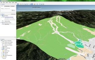
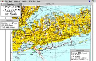
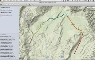
OkMap is an interactive software which allows you to work on your computer screen with web maps or digital maps that you have either bought or scanned.
- Map Service
- Freemium • Proprietary
- Windows
- iPhone
- iPad
OkMap is an interactive software which allows you to work on your computer screen with web maps or digital maps that you have either bought or scanned.

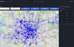
Self-hosted alternative to Google Location History (Google Maps Timeline).
 Google Mapsand
 Timelinize
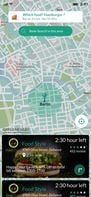
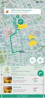
Location based restaurant food price, food rating & distance comparison and navigation by car, on foot, transit and bike in 41 countries. Just write hamburger, share/pin your location and list all hamburgers around; compare, select one and navigate.

 TripAdvisorand
 Yelp
Yelp
Aakashe is an instant drone imagery platform based in India. The subscription-based solution provides high-resolution aerial data to customers in infrastructure, urban planning, and real estate sectors.
 Google Earthand
 HERE WeGo
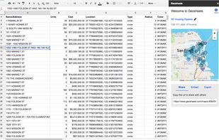
GeoSheets is a free add-on for Google Spreadsheets that makes it simple to do lightweight GIS tasks like geocoding, address normalization, distance calculations and creating customized and embeddable maps.
 QGISand
 Plus Codes
Crowdsourcing account-based interactive mobile map. All places are added by people without pre-moderation. Places quality is determined by voting (like on Reddit, low rated places are hidden). Ability to see places from chosen contributors.

 OpenStreetMapandGoogle Maps
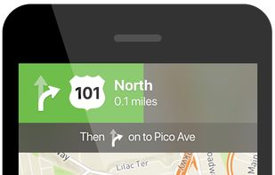
This is your fastest way around live traffic, speed cameras, and road hazards and right to wherever you are going. Boost your day-to-day navigation with your intelligent driving companion.
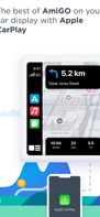
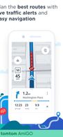
 Google Mapsand
 Magic Earth
Maperitive is a FREE desktop application for drawing maps based on OpenStreetMap and GPS data. You can define what gets on the map and how it is painted. You can also export these maps into bitmaps and SVG files and print them.
 OpenMapTiles
Picsplore is a brand new location based social network! We want to show you what’s new and exciting around you, it could be a band playing at a dive bar, a carnival, a house party, the possibilities are truly endless.


 Google Mapsand
 Pixelfed
GPSy is a sophisticated Mac GPS communications and GIS mapping program. GPSy connects your Mac to a broad range of Global Positioning System (GPS) navigational units and has advanced mapping, logging, and data transfer features.
 TrailRunnerand
 TrackOlap
UrtheCast is developing the world's first near realtime HD Earth video stream, via two cameras mounted aboard the International Space Station (ISS).
Google Earthand Marble
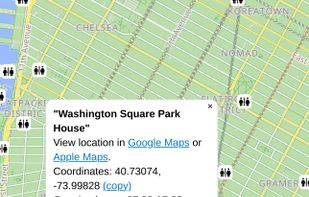
More than 280,000 public toilets in the World are available for you when just in need. Support world-level/continent-level/Australia database, "Download Database" can be used to switch between World version and Continent version anytime.
 TripToiletand
 Toilet Finder
xMap is an AI-powered location intelligence platform that enables users to ask geospatial questions in natural language, such as “Where should I open a new gym with low competition and high Gen Z population?”, and receive instant, visual answers.

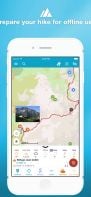
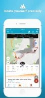
Offline mapping for hiking with customizable styles, overlays, and HD maps, GPS location tracking, marker management, and complete offline access for iOS and Android.

 CoMapsand
 Organic Maps
An online map to find a toilet near you containing the locations of more than 450,000 public toilets and bathrooms in many countries.
 TripToiletandToilet Finder
 Yard Sale Treasure Map
Fast quick optimized driving directions delivery route planning software website for multiple locations stops and single or multiple delivery vehicles. Find the best route with Speedy Route.
 MapQuestand
 Badger Maps
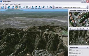
MapSphere is a manageable way to view and organize geographical data of different kind. This might be raster maps and satellite imagery from various sources, your own information received from GPS, tracks of your friends, whatever you want.
 OpenStreetMap
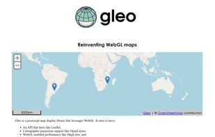
Gleo is a javascript map display library that leverages WebGL.
 Leafletand
 OpenLayers
The “We Can’t Wait” app offers Crohn’s & colitis patients and others a simple and fast way to locate publicly accessible restrooms and helps identify sympathetic establishments.


 TripToiletandToilet Finder
TallyGo provides a state-of-the-art mapping and navigation SDK that can be integrated into existing apps with virtually no development effort. Built for iOS, Android, and web.
 Google Mapsand
 OpenFreeMap
Cartogram is an indoor search engine that helps you find things indoors with over 10,000 indoor maps. Navigate indoors, search malls for products, get indoor directions, and share indoor location with others. Cartogram is an atlas for indoors.

 Google Mapsand
 GMaps WV
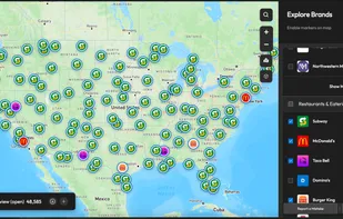
"City Spot" helps you to spot restaurants, theaters, banks, ATM's, stations, educational institutes, parks, hotels, bars etc.,.


 Apple MapsandYelp
Adze gives you the tools to edit GPX documents like a pro: create, modify and delete tracks, plan routes, mark waypoints, and more.
 GpsPruneandTrailRunner


