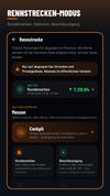
DriveBattle is the drive tracker for motorcycle and car crews. Every drive is recorded automatically - without opening the app. Compare yourself with your people, collect XP and levels, and share your best tours.


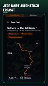
DriveBattle is the drive tracker for motorcycle and car crews. Every drive is recorded automatically - without opening the app. Compare yourself with your people, collect XP and levels, and share your best tours.


Probably the fastest maps ever on the App Store.
Galileo Offline Maps provides you with a collection of online maps: CloudMade good looking maps, MapQuest, OpenStreetMap, OpenCycleMap, OpenStreetBrowser, HikeBikeMap.
Caching is always on - Galileo saves map areas you have.


AutoMapa lets you avoid traffic jams and other disruptions on roads with LiveDrive! technology.


Discover millions of outdoor trails around the world. Choose between hiking, running, bike, MTB, kayak, ski or up to 70 different types of activities.

Hill Explorer helps you identify mountains, peaks, and nearby points of interest directly in the landscape using your phone’s camera and GPS.


Windy Gap helps you choose the right walk for the day you have. Set the distance and climb, then see the best fits, the hard parts, and what's known about each route.

Offline metro routing and day-by-day trip planning for travelers visiting China, with scheduled last-train times for every station.


PeakVisor will make you a superhero of outdoor navigation by putting state-of-the-art 3D maps and mountain identification magic wand in your hand.


Search, filter and map locations by travel time rather than distance with this API. When added to a location search engine it can search and display results by time and create travel time maps for users. In-depth data analysis also available.

Privacy-focused location APIs delivering map tiles, geocoding, and routing, with transparent usage-based pricing, open standards, and engineering-led support.


Offline navigation app with HD maps, voice-guided directions, categorized POI search, lane and speed limit alerts, and route recalculation for Android.


Offline Android app for finding shared-bike stations and walk–bike–walk routes, with local maps, address search, GBFS coverage and no tracking.


AmigoCollect is a field data collection mapping solution that allows teams to work in collaboration on real-time through mobile devices (iOS & Android). No GIS training & minimum investment.


Zyflow is a cycling map that shows where to stop, not only how to get there. It puts bike-friendly stays, cafés and restaurants on one map, with bike parking, secure storage and charging marked on each place, plus drinking water, repair stations and e-bike chargers.


Get up-to-date, detailed charts you can use offline plus a boatload of features on your mobile device, so they’re on hand wherever you go. The Boating app is a must-have for cruising, fishing, sailing, diving and all your activities on the water.


Navitel Navigator 11 is a precise offline GPS navigation, up-to-date online services, and detailed maps of 67 countries and territories of the world. 7 days free.


Offers turn-by-turn navigation, real-time traffic updates, offline mapping, multiple route options, point-of-interest search, and global coverage.


Ridge is a ski route planning app for iPhone. You pick the runs you want to ski and it links them up with the right lifts in an efficient order, showing the total distance and a time estimate for your skill level before you set off.


Helm is a marine navigation app for United States waters. It combines NOAA electronic navigational charts, USACE eHydro dredging surveys, state lake elevation data and live NOAA CO-OPS tide observations into a single depth figure calculated against the boat's draft, and it...


PistePal is a ski and snowboard map app that combines high-resolution trail maps with navigation, tracking and location sharing for more than 6,000 resorts worldwide, plus around 7,000 mapped backcountry areas.


OpenTrailPaper is firmware for the LilyGO T5S3 4.7" E-Paper PRO. It shows ride data and offline maps, follows GPX routes, records FIT files and connects to Bluetooth sensors. You buy and protect the board yourself.


Snonav is a navigation app for ski resorts that works like a car sat-nav on the mountain. Set a start point and a destination and it calculates the quickest route across runs and lifts, then guides you with in-ear audio instructions at every turn, so you don't have to stop...


A free, interactive trail map and GPS tool built exclusively for dirt bike and motocross riders to discover and navigate off-road rides.

Offline ski and snowboard navigation that speaks every turn across pistes and lifts, matches routes to your level and guides you from your watch.