Travel & Location Page 31 of 84

All apps in Travel & Location category. Use the filters below to narrow down your search. 

Popular filters:

Copy a direct link to this comment to your clipboard
  1. GlobeInfos icon
     1 like

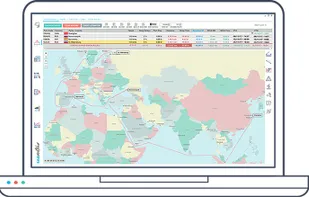
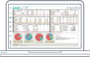
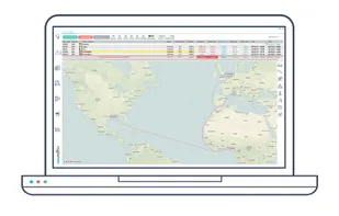
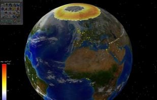
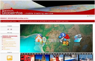
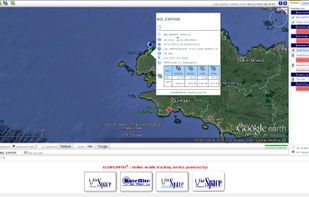
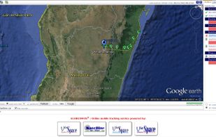
    GlobeInfos is a mobile tracking service : it offers geolocation of vessels, boats, cars, trucks through INMARSAT or IRIDIUM satellite networks and allow the possibility to visualize them online on your favorite web browser.

    Cost / License

    • Paid
    • Proprietary

    Platforms

    • Online
    Globeinfos Homepage
    Details informations
    The main tracking page
    3 alternatives
  2. SeeClickFix icon
     1 like

    SeeClickFix encouraging residents to become active citizens in taking care of and improving their city by reporting non-emergency issue in their neighborhood.

    Cost / License

    • Free Personal
    • Proprietary

    Platforms

    • Online
    • Android
    • iPhone
    Screenshot of the web application for the Brooklyn area.
    2 alternatives
  3. Schmap icon
     1 like

    Schmap destination guides - travel guides with photos, reviews and dynamic maps for cities, islands and regions worldwide.

    Cost / License

    • Free
    • Proprietary

    Application type

    Platforms

    • Mac
    • Windows
    • Online
    Schmap screenshot 1
    1 alternatives
  4.  1 like

    MapSVG is a WordPress map plugin that helps you create custom content (people, real estate, events, or anything else) and show it on a vector, image, or Google Maps - with filters and search.

    Cost / License

    • Paid
    • Proprietary

    Platforms

    • Online
    MapSVG screenshot 1
    6 alternatives
  5. Drop!in icon
     1 like

    Drop!in uses location-based information to help you have a more engaging and eventful life. For the aggregation of event data this application uses GPS.

    Cost / License

    • Free
    • Proprietary

    Platforms

    • iPhone
    Drop!in screenshot 1
    Drop!in screenshot 2
  6. MacGPS Pro icon
     1 like

    Navigation software to connect your Mac with most GPS receivers.

    Cost / License

    • Paid
    • Proprietary

    Platforms

    • Mac
    1 alternatives
  7. Seametrix icon
     1 like

    Sea routing software, simulating sea navigation and routing. Essential for voyage planning, calculating sea distances, and estimating sea voyage duration and costs.

    Cost / License

    • Freemium
    • Proprietary

    Platforms

    • Windows
    seametrix sea distances
    seametrix voyage estimation
    Seametrix screenshot 2
  8.  1 like

    RoboGEO geocodes digital photos with location data (latitude, longitude, altitude, photo direction, etc.) and then allows you to perform various operations on the photos or to export them to different applications.

    Cost / License

    • Freemium
    • Proprietary

    Alerts

    • Discontinued

    Platforms

    • Windows
    6 alternatives
  9. Sidekick icon
     2 likes

    Sidekick notifies you of road hazards ahead in real time, based on your location, direction of travel and events from multiple data sources. Hands-free. Eyes-free. Touchscreen not required.

    Cost / License

    • Free
    • Proprietary

    Platforms

    • iPhone
    • iPad
    Sidekick screenshot 1
    Sidekick screenshot 2
    Sidekick screenshot 3
    7 alternatives
  10. Cyclope GPS icon
     1 like

    The Cyclope bike application allows, in addition to the classic functions of a bike computer, to connect the cyclists in them. You can know the position of the other riders, have the time gap, create your bike route, participate in the world cycling championship, communicate by...

    Cost / License

    • Free
    • Proprietary

    Platforms

    • Android
    Main dashboard of Cyclope with the performance of the cyclist at the top and the 3D map at the bottom.
    Time gap between cyclists.
    Talky-walky and messaging to communicate between cyclists.
    +4
    Profile and performances of the cyclist.
    60 alternatives
  11. Tripify icon
     4 likes

    Travel guides, planning, notes, expenses. Plan your itinerary in details, the way you want. Define the time, duration, add notes to each place, register expenses related to it. Save time and money and get unique tips from the new travel guides!

    Cost / License

    • Free
    • Proprietary

    Platforms

    • Online
    • Android
    • iPhone
    • iPad
    Main Page
    Map of your planning
    Travel planning resume
    +10
    Day by day planning
    70 alternatives
  12. Rezdy icon
     25 likes

    Rezdy is a commission free online booking software specialized in tours, activities, rental, attractions and shuttle.

    Cost / License

    • Paid
    • Proprietary

    Platforms

    • Online
    Rezdy screenshot 1
    Rezdy screenshot 1
    Rezdy screenshot 2
    +8
    Rezdy screenshot 3
    72 alternatives
  13. AssetTiger icon
     1 like

    AssetTiger is a free community service and cloud-based asset management tool. This is more than just for asset management system. Options to include assets, scheduled servicing and maintenance, warrant, repair, check-in and check-out for assets.

    Cost / License

    • Free
    • Proprietary

    Platforms

    • Online
    • Android
    • iPhone
    • Android Tablet
    AssetTiger screenshot 1
    AssetTiger screenshot 1
    AssetTiger screenshot 2
    +5
    AssetTiger screenshot 3
    23 alternatives
  14. Capture your travel memories or visits to special places with Tagofy - Geotag Map Camera, adding date-time, Map, Geotag, Latitude, Longitude, Altitude, Weather, Magnetic field, Timestamp, and Compass information to your camera photos.

    Cost / License

    • Freemium
    • Proprietary

    Platforms

    • iPhone
    • iPad
    • Android
    • Android Tablet
    Tagofy - Geotag Map Camera screenshot 1
    Tagofy - Geotag Map Camera screenshot 2
    Tagofy - Geotag Map Camera screenshot 3
  15. HISTORY Here is an interactive, location-based guide to thousands of historic locations across the United States, brought to you by HISTORY.

    Cost / License

    • Free
    • Proprietary

    Platforms

    • Android
    • iPhone
    • Apple Watch
    HISTORY Here screenshot 1
    HISTORY Here screenshot 2
    HISTORY Here screenshot 3
    1 alternatives
  16. Waylo icon
     2 likes

    Save up to 75% Waylo is the only Online Travel Agent that predicts hotel price drops and sells you hotels today at tomorrows lower prices. Waylo also allows you to track individual hotels or groups of hotels to get the best rate when prices drop.

    Cost / License

    • Free
    • Proprietary

    Application type

    Platforms

    • Online
    • Android
    • iPhone
    • Windows Phone
    • Facebook Messenger
    Booking a hotel through Facebook Messenger. Couldn't be easier.
    Waylo makes sure you get the cheapest prices.
    17 alternatives
  17. The Hand Vu icon
     2 likes

    The Hand Vu uses a camera and uses gesture motions to navigate through the computer.

    Cost / License

    • Free
    • Proprietary

    Platforms

    • Mac
    • Windows
    2 alternatives
  18. indiemapper icon
     2 likes

    This is an online mapping site that "helps you make static, thematic maps from geographic data by bringing the best of traditional cartographic design to internet map-making." Sponsored by Axis Maps, LLC.

    Cost / License

    • Free Personal
    • Proprietary

    Application type

    Alerts

    • Discontinued

    Platforms

    • Online
    Landing Page
    Initial screen
    11 alternatives
  19. EarthBrowser is an innovative earth simulation that combines an easy to navigate 3 dimensional globe with real-time weather conditions and 7 day forecasts for thousands of locations worldwide. Live earthquakes, hurricanes, webcams, volcanoes and cloud animations are just some of...

    Cost / License

    • Paid
    • Proprietary

    Application type

    Platforms

    • Mac
    • Windows
    Earth Browser screenshot 1
    Earth Browser screenshot 1
    12 alternatives
  20. MapLarge icon
     1 like

    Beautiful, User Friendly online mapping software that scales to big data.

    The MapLarge API enables user-driven, low latency, interactive visual exploration and analysis of very large geospatial and non-geospatial data collections to recognize patterns and identify anomalies. Use.

    Cost / License

    • Freemium
    • Proprietary

    Application types

    Platforms

    • Windows
    • Linux
    • Online
    MapLarge API
    MapLarge screenshot 1
    MapLarge screenshot 2
    27 alternatives
  21. Street View – World Explorer transforms your iPhone into a window to the planet. Move from a map to real street-level imagery with a single tap, and experience places as if you’re standing right there. No complicated tools, no clutter—just pure exploration.

    Cost / License

    • Free
    • Proprietary

    Application type

    Platforms

    • iPhone
    • iPad
    Discover any place instantly with live street view and smooth 3D map experience. Explore cities, streets, and landmarks in real time with easy navigation controls.
    Drop pins on any location with a single tap and save places with name, date, and notes. Perfect for remembering favorite spots, travel plans, and important locations.
    Access all your saved places, favorites, and measurements in one organized history. Quickly manage, revisit, or edit your stored locations anytime.
    46 alternatives