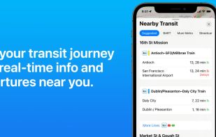
Navigate with ease using voice-guided directions, real-time traffic, transit updates, and explore cities in 3D with Look Around and Flyover.
Cost / License
- Free
- Proprietary
Application typeApplication types
Since
- Since 2015
United States
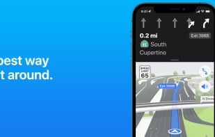


Navigate with ease using voice-guided directions, real-time traffic, transit updates, and explore cities in 3D with Look Around and Flyover.


Transportr is the public transport companion that respects your privacy and your freedom. Transportr is a non-profit app developed by people around the world to make using public transport as easy as possible wherever you are.


wanderer is a self-hosted trail database. You can upload your recorded tracks or create new ones and add various metadata to build an easily searchable catalogue.

Offers a Google Maps–style interface with clickable OpenStreetMap points, editing tools, vector maps with 3D tilting, public transport data, and mobile PWA support.

Global offline tourist maps feature hiking and bike trails, route planning, synced trip organization, panoramic images, public transit info, and local amenities.


With the Pl@ntNet app, identify one plant from a picture, and be part of a citizen science project on plant biodiversity.


Marketplace for short and long-term stays, offering unique accommodations, business solutions, and immersive experiences led by local experts.


The Earth and its neighbors as a 3D globe and atlas for the Mac – maps and open geodata on real terrain.


AI software lets users view dish images from menu photos, decide what to order by matching menu items with images, using Llama AI 3.2 vision.


Leaflet is a modern open-source JavaScript library for mobile-friendly interactive maps. It is developed by Vladimir Agafonkin with a team of dedicated contributors. Weighing just about 28 KB of JS code, it has all the features most developers ever need for online maps.


TripIt organizes your travel plans in one place. Simply forward confirmations to plans@tripit.com and we’ll do the rest. Access all your flights, hotels, car rentals, activities, maps and more on your WP7. Upgrade to TripIt Pro for peace of mind from check-in to baggage claim.


Panoramax is a digital resource for sharing and exploiting field photos. Anyone can take photographs of places visible from the public highway and contribute them to the Panoramax database. This data is then freely accessible and reusable by all.


Find affordable flights, hotels, and car rentals globally with no hidden fees. Compare travel options, set price alerts, and explore eco-friendly tickets.


MapComplete is an OpenStreetMap-viewer and editor, which shows you information about features of a specific theme and allows to update it.


App for turning your smartphone or tablet into a live flight tracker supporting search & more.


Live images of Earth, updated every 10 minutes with GOES and Himawari-8, and every 15 minutes with Meteosat. Zoom to Satelite Map view with Street names. Rain and Weather view.

MapLibre GL is a community-led fork derived from mapbox-gl-js before their switch to a non-OSS license.
Average weather for 30,000+ cities worldwide — temperature, rainfall, sunshine, humidity and the best time to visit, from 30 years of climate data.


Mobile editing tool for OpenStreetMap adds shops, amenities, and POI. Supports offline use, micro-mapping, and user-contributed map updates.


Remap builds cycling loops on-the-fly that fit your riding style. Then it turns every road you ride into territory you hold.


Access real-time transit predictions and A-to-B trip planning in over 100 cities. Locate nearby transport options like bike shares and ride services.


Real-time departures. Transit maps. Line status and real-time disruption alerts. Uber integration. Bike routing and live bike share info. Constant updates. Everything you need -- and may not even realize you need -- to manage your life in the city.