Geotag Alternatives
Geotag is described as 'Open source program that allows you match date/time information from photos with location information from a GPS unit or from a map' and is an app in the travel & location category. There are more than 25 alternatives to Geotag for a variety of platforms, including Windows, Mac, Web-based, Linux and Android apps. The best Geotag alternative is ExifTool, which is both free and Open Source. Other great apps like Geotag are ExifToolGUI, Geosetter, FrameTags and Metadata++.
Alternatives list
- 6 RoboGEO alternatives
RoboGEO geocodes digital photos with location data (latitude, longitude, altitude, photo direction, etc.) and then allows you to perform various operations on the photos or to export them to different applications.
Cost / License
- Freemium
- Proprietary
Alerts
- Discontinued
Platforms
- Windows
R

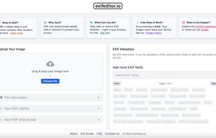
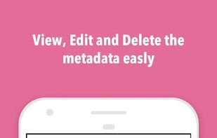
EXIFEditor.io is a fast, privacy-focused online EXIF editor and viewer. Instantly view, edit, or remove EXIF metadata from your images—right in your browser, with no uploads and no registration required.


Free GPS photo stamp tool that renders location data directly onto your photos — not just a coordinate readout in a sidebar.
Cost / License
- Freemium
- Open Source
Platforms
- Online
- Windows
- Mac


GPSPhotoLinker adds GPS position and location data to your photos. The latitude and longitude recorded by your GPS unit are linked and saved to your photos. GPSPhotoLinker automatically enters the city, state and country into the metadata.
Cost / License
- Freemium
- Proprietary
Platforms
- Mac


 47 ExifTool: Edit Metadata alternatives
This is a ported application of above tool into the Android environment, we're working on it to make our app is useful and friendly with nice UI/UX based, to help the user can be easily modified EXIF data with an easy way.


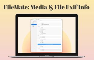
The ultimate file inspection and metadata editing utility for your Mac. Drag and drop any file to instantly reveal and edit its hidden data without re-encoding.

 9 Geotag Photos Pro alternatives
Add GPS capabilities to your camera for the fraction of the cost of a dedicated GPS logger.
Cost / License
- Free
- Proprietary
Platforms
- Mac
- Windows
- Linux
- Android
- iPhone
- iPad

 +7
+7


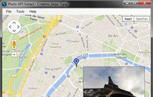
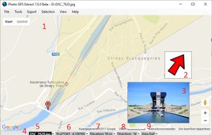
Photo GPS Extract is a free Windows-compatible software tool to quickly visualize the GPS location of a JPG photo: it will read the coordinates from the photo and show them on a Google Map.
Cost / License
- Free
- Proprietary
Platforms
- Windows
 +9
+9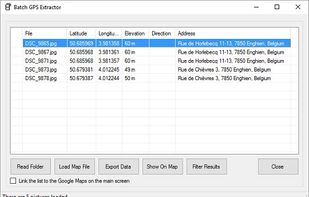


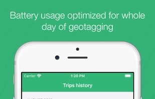
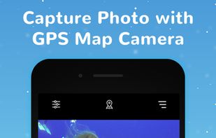
When was the last time you talked to someone to tell you where are you?Probably,that would be some long time back.With this navigation app GPS Map camera:Geotag Photos & add GPS Location,on a smartphone, you can survive even in the middle of nowhere.
Cost / License
- Freemium
- Proprietary
Platforms
- Android
- iPhone
- Android Tablet
- iPad


 +9
+9


Geomakers is the only photo geotagging software in the world that allows you to add unlimited tags. What do we offer? More features, better performance, the best price.
Cost / License
- Freemium
- Proprietary
Platforms
- Online
- Software as a Service (SaaS)


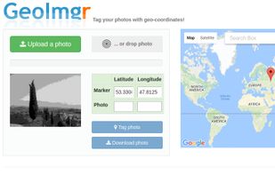
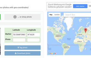
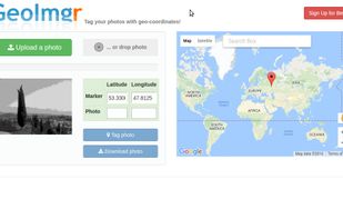
GeoImgr is a web-application to check the GPS geo-coordinates in the EXIF data of an JPG-image, show the location on the map and save new GPS geo-coordinates into the image.
Cost / License
- Free
- Proprietary
Platforms
- Online
 +2
+2