


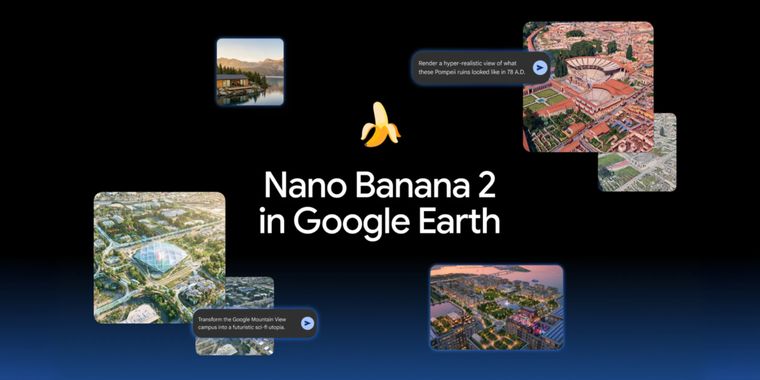

Google Earth integrates Nano Banana for historical and future location visualizations
Google has added its Nano Banana image generation tool to Google Earth, allowing users to create custom images based on real locations. One of its main uses is visualizing how places may have looked in the past. For example, educators can prompt it to reconstruct Pompeii in 78 AD, turning the modern ruins into a populated Roman street.
These historical scenes are AI generated interpretations rather than verified reconstructions. Since complete visual records of ancient locations do not exist, some architectural, cultural, or historical details may be inaccurate.
Google is also positioning Nano Banana for real estate, urban planning, and architecture, letting users visualize proposed developments before construction begins. The integration can also generate custom infographics for specific Google Earth locations, although Google has not clarified whether this is supported for every location.





- Map Service
- Free Personal
- Proprietary
Other apps mentioned in this article

Related news
External links
- Reimagine the world with Nano Banana in Google EarthNews From Google • Official source
- Google has added Nano Banana to Google Earth for some reasonMashable
- Google Earth added Nano Banana, and I immediately reimagined Philly with zombies and evil clownsZDNET
- Nano Banana Image Generation Comes To Google EarthEngadget
- The Nano Banana AI Image Generator Has Arrived in Google EarthPetaPixel
- Nano Banana 2 Is Coming to Google EarthLifehacker
Comments
Love that this got taken down within an hour
Can't wait to see the brilliant resolution imagery of google from Palestine, I mean, why would they skip that part of the map ? This would be helpful to end a crime enduring since decades having peak event in 2023 but the conflict goes on since the late 40's. Let's see what google earth will reveal - or hide.
"I wonder what main street is gonna' look like when they finish building this 14th vape & weed shop"
"Google pulled its newly introduced "Nano Banana 2" AI image-generation feature from Google Earth less than 24 hours after launch. The tool was halted because users quickly used it to generate convincing fake satellite images of conflicts, disasters, and altered landmarks, raising severe misinformation concerns." Not that Google doesn't distort anyways. In Florida after the hurricanes, Google mapping blatantly skipped the more damaged buildings (evident in timestamping).. not the road,.. but case-by-case buildings.
I really like when AI is used to help us visualize ideas instead of just generating text. Bringing history to life or previewing future projects directly inside Google Earth feels like a natural and genuinely useful application of generative AI.
Let archaeologists and architects do their work so we can have reliable historical reconstructions, and don't leave it to an AI that will hallucinate half the time.