
Apps tagged with 'Terrain Analysis'

All apps in Apps tagged with 'Terrain Analysis' category. Use the filters below to narrow down your search. 
Copy a direct link to this comment to your clipboard
  1. RustGIS icon
     2 likes

    Native on Windows, macOS, Linux, and in your web browser. Local files are processed on your machine; web data sources, AI providers and plugins can use the network. Map operations are commands you can script from the terminal, Python or the AI Assistant.

    Cost / License

    Application type

    Since

    • New

    Platforms

    • Windows
    • Mac
    • Linux
    • Online
    • US flagUnited States
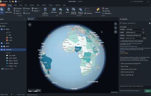
    RustGIS screenshot 1
    RustGIS screenshot 1
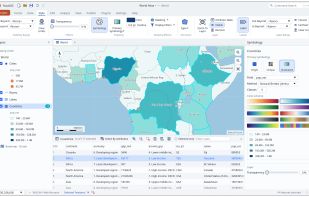
    RustGIS screenshot 2
    +14
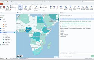
    RustGIS screenshot 3
    13 alternatives
  2. PixelGust icon
     1 like

    PixelGust is a web-based platform that provides comprehensive environmental data for any location on Earth. Click anywhere on a map or enter coordinates to instantly get:

    Cost / License

    • Freemium (Subscription)
    • Proprietary

    Application type

    Since

    • Since 2026

    Platforms

    • Online
    • GR flagGreece
    • European Union flagEU
    Landing page
    Point data
    Report for a user defined polygon
    5 alternatives
  3. LIDAR Analyst software is tightly integrated with the Esri® ArcGIS® platform to provide an end-to-end solution for visualizing and processing LiDAR data. Core to the product is the ability to rapidly generate accurate 3D scene content allowing tactical teams or...

    Cost / License

    • Pay once
    • Proprietary

    Since

    • Since 2019

    Platforms

    • Windows
    4 alternatives
  4. DEM/DSM, orthophotos and point clouds (LAS/LAZ) and explore them in a smooth, GPU-accelerated 3D environment — then measure, analyze and export, all in one tool.

    Cost / License

    • Free
    • Proprietary

    Application type

    Since

    • Since 2026

    Platforms

    • Windows
    • TR flagTürkiye
    Drone orthophoto draped over a multi-gigabyte terrain model in 3D, with the layer list and terrain scenarios on the left.
    Aspect analysis coloured by slope direction, computed at full resolution and shown as a live overlay on the 3D terrain.
    Hydrology: flow direction over the surveyed terrain inside a selected analysis area, saved as raster or vector.
    +4
    Road and corridor design: alignment drawn on the terrain with the generated road surface, exported to DXF, Excel or a PDF report.
    2 alternatives
  5. TerraExplorer is a powerful, easy to use tool to build, analyze, and navigate high resolution 3D world environments created by fusing aerial and satellite photography, terrain elevation data and other 2D and 3D information layers.onto a 3D map,.

    Cost / License

    • Freemium
    • Proprietary

    Since

    • Since 2015

    Platforms

    • Windows
    • Online
    • Android
    • iPhone
    • iPad
    • Android Tablet
    • Windows Phone
    • Windows Mobile
    • US flagUnited States
    TerraExplorer Overview
    3D Models
    Contour Map
    16 alternatives