Cost / License
- Free
- Proprietary
Platforms
- Android
- iPhone


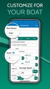
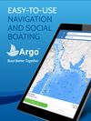
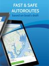
Ever have a stressful day navigating on the water? Wanted to know more about the conditions you are about to head into? Are you looking for exciting places to explore, the best place to refuel, or just trying to meet up with a friend?


Anonymous driver messaging and parking assistant communicate with any vehicle by license plate, instantly and privately.


Forgot where you parked your car again? This app will remember the parking location and show the direction from your current location to the parking spot.


parkOmator was designed exclusively for the Apple Watch. This original parking ticket solution saves you from the expensive fines and hours wasted in court. parkOmator was created for the watch so it has a clear and intuitive interface and is easy to use.


ETA instantly shows travel time (including support for driving, public transit*, cycling* and walking) to your favourite places. When driving, ETA also supplies traffic information that details any delays on your route.


Land Nav Assistant is a navigation app designed for military personnel that accepts MGRS or Latitude / Longitude coordinates, providing visual navigation to each point and enabling users to analyze their pace count and directional tendencies.


The Giant RideControl app opens up the world of connectivity for your Giant E-Bike. The app allows you to connect your phone with your E-Bike, giving you the ability to keep your E-Bike up to date, to customize your motor setting and use your E-Bike display for navigation.


RidgeText is the lightweight alternative to heavy outdoor navigation apps. Instead of draining your battery with complex map rendering, RidgeText works entirely over SMS.


9Cab is an on demand ride hailing app, with which riders can get a ride quickly at a single tap from their android or ios/iphone devices.


Military-grade navigational app, created by a U.S. Army Field Artillery officer, designed to provide service members with a highly accurate mobile solution for tactical navigation, featuring features such as offline mapping, waypoint plotting, and a tactical drawing mode.


RideLink allows you to view your power data including pedal balance, force angle and calibration. RideLink also makes it easy to update your firmware.


Share and receive real-time alerts from the entire network of users in the Cobra driving community. Instant red light and speed camera as well as live law enforcement detection notifications ensure you can drive smarter and safer.


BaseMap is the only outdoor app you will ever need. Turn your phone into a GPS, map your outdoor adventures, and interact with the BaseMap community.


Drive Smarter® allows you to view a gallery timeline of your dash cam videos, set up advanced safety and security features, receive shared community alerts, and easily manage your device settings.


Navitel Navigator 11 is a precise offline GPS navigation, up-to-date online services, and detailed maps of 67 countries and territories of the world. 7 days free.


Designed for use with a Find My Car Smarter Bluetooth device, this app helps you accurately find your car.


Offers turn-by-turn navigation, real-time traffic updates, offline mapping, multiple route options, point-of-interest search, and global coverage.


Plan field delivery management with Routingo, save the time and fuel with the optimized routes and manage your delivery process.


Offline-first spatial toolkit for Android and Wear OS unifying compass, AR measurement, target planning, offline astronomy, and GPS-denied tracking.


Slopes is the best way to accurately track and show off days skiing and snowboarding with just your phone’s GPS. Slopes automatically detects lifts and runs, reporting statistics in real-time on the iPhone, Pebble watches, and now on Apple Watch.