





Mission Planning App
Like
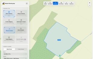
Browser-based waypoint mission planner for DJI Mini, Air, Mavic and Lito drones: mapping grids, obliques, corridors, orbits, facades and smart 3D capture, exported for DJI Fly.


Features
Highlights All activities
Mission Planning App News & Activities
Recent activities
- MissionPlanningApp added Mission Planning App
- Paul updated Mission Planning App
 MissionPlanningApp added Mission Planning App as alternative to DroneDeploy, FlightDronePlan and QGroundControl

Developed by
UnknownLicensing
Proprietary and Freemium product.Pricing
Subscription ranging between $3 and $10 per month + free version with limited functionality.Alternatives
3 alternatives listedBadge
Get an embeddable badge for Mission Planning AppSupported Languages


No comments or reviews, maybe you want to be first?