Mapline Alternatives
Mapline is described as 'Maximize the use of your Excel spreadsheet data. Make mapping the easiest. Transform Excel data into visual analysis. We lead in data simplification and presentation. We are committed to deliver the tools needed to outpace competition' and is an app in the office & productivity category. There are more than 100 alternatives to Mapline for a variety of platforms, including Web-based, Windows, Android, iPhone and iPad apps. The best Mapline alternative is OpenStreetMap, which is both free and Open Source. Other great apps like Mapline are Google Maps, Google Earth, QGIS and HERE WeGo.
Alternatives list


Spatial Feature Server by MapET is an ESRI Geoservices REST Implementation and works with all ESRI Rest API's. The source of published data is the spatial extension of the major RDBMS, such Oracle, Microsoft SQLServer, MySQL, PostgreSQL.


Spotzi is an easy-to-use online geomarketing platform you can try for FREE. Spotzi has a short learning curve, so you don't have to be a data scientist to work with Spotzi. Our main goal is to find your best-fit customers in just a few clicks.
Cost / License
- Freemium
- Proprietary
Application type
Platforms
- Mac
- Windows
- Linux
- Online
- Android
- iPhone
- Android Tablet
- Windows Phone
- iPad
 +1
+1


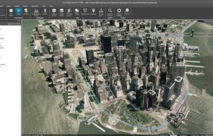
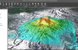
TerraExplorer is a powerful, easy to use tool to build, analyze, and navigate high resolution 3D world environments created by fusing aerial and satellite photography, terrain elevation data and other 2D and 3D information layers.onto a 3D map,.
Cost / License
- Freemium
- Proprietary
Platforms
- Windows
- Online
- Windows Mobile
- Android
- iPhone
- Android Tablet
- Windows Phone
- iPad


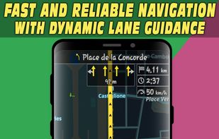
Android navigation app with high-quality offline HD maps, voice-guided turn-by-turn directions, speed and lane guidance, POI search by category, supports driving, biking and walking, automatic rerouting, itinerary planning, and multilingual interface for travelers.

 +5
+5

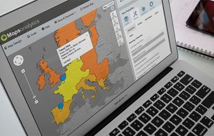
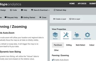
 12 CMaps Analytics alternatives
CMaps Analytics Location Intelligence Suite for Business Apps and Business Intelligence. CMaps Designer is a cloud-based geographic visualization and analysis designer. Without any server software or specialized skills, you can rapidly create embedded Location Intelligence...
Cost / License
- Paid
- Proprietary
Platforms
- Windows
- Online
- Microsoft SharePoint
- SAP HANA
- Google Maps


GeoCommons enables everyone to find, use and share geographic data and maps. Easily create rich interactive visualizations to solve problems without any experience using traditional mapping tools.
Cost / License
- Freemium
- Proprietary
Platforms
- Online


Cost / License
- Free
- Proprietary
Platforms
- Windows
- Linux


Azimap is a web GIS developed on open source principles and offers GI professionals with the tools to visualise, analyse and share their spatial data on the web.
Cost / License
- Freemium
- Proprietary
Application type
Platforms
- Linux
- Online
- Android
- iPhone
- Chrome OS
- Self-Hosted
- Software as a Service (SaaS)


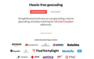
Geocodio is designed to make geocoding, reverse geocoding, mapping, and data matching easy, pain-free, and affordable. Unlike most geocoders, Geocodio lets you use the data without restrictions. And you can add many other pieces of data all at the same time, such as Census data...
Cost / License
- Paid
- Proprietary
Platforms
- Software as a Service (SaaS)


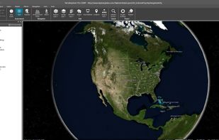
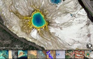
Earth View is a collection of the most beautiful and striking landscapes found in Google Earth.
Cost / License
- Free
- Proprietary
Platforms
- Windows
- Google Chrome

 +3
+3