HooMap Alternatives
HooMap is described as 'Browser-based tool designed to transform CSV and Excel coordinate data into interactive maps in seconds. Built for researchers, students, and data enthusiasts, it allows you to visualize spatial data directly in your workflow without the need for complex GIS software' and is a Map service in the travel & location category. There are more than 100 alternatives to HooMap for a variety of platforms, including Web-based, Windows, Mac, Linux and iPhone apps. The best HooMap alternative is OpenStreetMap, which is both free and Open Source. Other great apps like HooMap are Google Earth, Grafana, QGIS and HERE WeGo.
Alternatives list


 19 Relief Maps alternatives
Relief Maps is a GPS application focused on outdoor sports, the app is based on an beautiful and high-performance 3D map.
Cost / License
- Freemium
- Proprietary
Application types
Platforms
- Android
- iPhone
- Android Tablet
- iPad

 +4
+4


MapWindow is a fully free and open source geographic information system project. It includes an open source programming component, MapWinGIS ActiveX, and an extensible desktop application that supports plug-ins written in .NET (C# and VB.NET).


A business intelligence tool that includes ad hoc reporting, self-service data visualization and dashboards, predictive analytics, mobile apps, and more.
Cost / License
- Paid
- Proprietary
Application type
Platforms
- Windows
- Android
- iPhone
- Android Tablet
- iPad
 +3
+3

 40 Spotfire alternatives
The TIBCO Spotfire Enterprise Analytics platform offers a radically faster business intelligence experience and is far more adaptable to specific industry and business challenges than traditional alternatives.
Cost / License
- Paid
- Proprietary
Platforms
- Windows


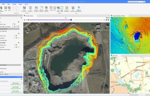
gvSIG is a Geographic Information System (GIS), that is, a desktop application designed for capturing, storing, handling, analyzing and deploying any kind of referenced geographic information in order to solve complex management and planning problems.


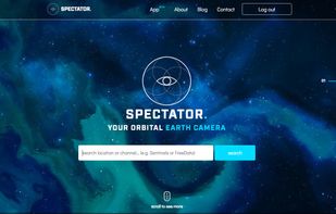
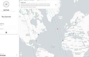
Spectator simplifies access to satellite imagery from NASA, ESA and other providers. It gives you access to images archives, but also tracks satellites in real-time to give you information about next image acquisition.


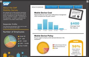
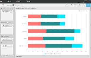
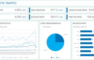
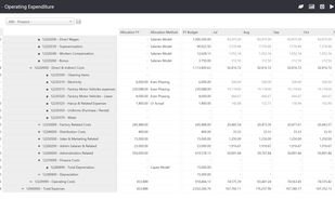
datapine enables people to explore, visualize and share data in one central analytics platform, that offers smart data connectors, a wealth of advanced BI 4.0 features and interactive dashboards.
Cost / License
- Paid
- Proprietary
Application type
Platforms
- Mac
- Windows
- Online
- Android
- iPhone
- Android Tablet
- iPad
- Software as a Service (SaaS)

 +1
+1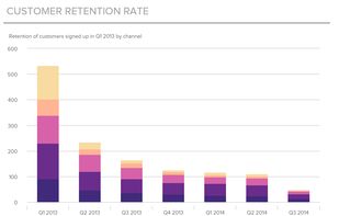


MapServer is an Open Source platform for publishing spatial data and interactive mapping applications to the web. Originally developed in the mid-1990’s at the University of Minnesota, MapServer is released under an MIT-style license, and runs on all major platforms (Windows...


MODLR is business modelling and planning software that provides everything needed to enable connected corporate modelling. Accessible from anywhere, simple to use, the platform empowers you to set your goals and execute better than ever.
Cost / License
- Freemium
- Proprietary
Application type
Platforms
- Online
- Self-Hosted
- Microsoft Office Excel
 +1
+1

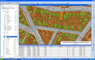
 27 MapInfo Professional alternatives
MapInfo Professional is a powerful, functionally rich desktop mapping application from Pitney Bowes MapInfo, designed to enable organisations to solve business problems that have a geographical element.


Esri Geoportal Server is a free, open source product that enables discovery and use of geospatial resources including datasets, rasters, and Web services.
Cost / License
- Free
- Open Source
Platforms
- Mac
- Windows
- Linux
- Online