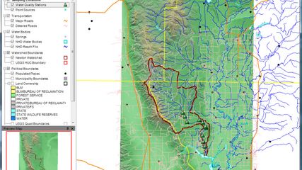
What is MapWindow GIS?
MapWindow is a fully free and open source geographic information system project. It includes an open source programming component, MapWinGIS ActiveX, and an extensible desktop application that supports plug-ins written in .NET (C# and VB.NET). The most recent effort, MapWindow 6, includes a fully C# programming library that is intended to serve as an alternative to ESRIs ArcObjects platform.
MapWindow GIS Desktop Screenshots and Videos

No screenshot
No features, maybe you want to suggest one?
Suggest and vote on featuresMapWindow GIS information
Supported Languages
- English
Comments and Reviews
Tags
- Mapping
- GIS
- shapefile
Recent user activities on MapWindow GIS

 Patrick Sapinski added MapWindow GIS as alternative(s) to Equator
 GISCloud added MapWindow GIS as alternative(s) to GIS Cloud
 nunya beezwaks added MapWindow GIS as alternative(s) to plus.codes


Can program this using .Net and is/has the ability to parallelize lots of GIS operations. You can also extend its functionality with open source code.
There are a whole lot of bloated, incoherent, unusable, expensive far beyond the point of obscenity, and/or generally broken GIS utilities out there. MapWindow is not one of them. MWGIS + Shape2Earth plugin made converting ArcGIS shapefiles into georeferenced polylines in KML a task much less horrifying than a creepy-long-haired-asian-girl movie... quite the opposite of ArcGIS Explorer which shall be consumed utterly in the infernal flames of Perdition (if there is any justice in the universe).