Road Sorties plans and navigates scenic and curvy driving routes—with multi-stop routing, stops along the way (EV charging, fuel, rest areas), turn-by-turn navigation on iOS, and GPX export.


Google Maps is described as 'Navigate efficiently with real-time traffic updates, turn-by-turn GPS, panoramic street views, and comprehensive route planning for multiple platforms' and is a leading GPS Navigation service in the travel & location category. There are more than 100 alternatives to Google Maps for a variety of platforms, including Web-based, Android, iPhone, iPad and Android Tablet apps. The best Google Maps alternative is OpenStreetMap, which is both free and Open Source. Other great apps like Google Maps are OsmAnd, CoMaps, Organic Maps and Waze.
Road Sorties plans and navigates scenic and curvy driving routes—with multi-stop routing, stops along the way (EV charging, fuel, rest areas), turn-by-turn navigation on iOS, and GPX export.


A complete Turn-By-Turn GPS Navigation solution with Australia and New Zealand's most comprehensive SpeedAlert including school zones - save your license!.


Geomapping automatically reads your articles, extracts every location mentioned, finds precise coordinates, and builds an interactive map linked to your text. Paste a single script tag to embed the map and keep readers engaged without extra coding.


GPS Navigation app is your go-to tool to find current location and choose the fastest route. Whether you're in a crowded area or stuck in traffic, GPS map direction guides you quickly. It includes traffic updates, weather forecast, & speedometer.


Offline-first spatial toolkit for Android and Wear OS with compass, AR measurement, target planning, local network location sharing, and GPS-denied tracking. Offers solar system fly-through, offline astronomy, and is privacy-focused with on-device computation.


The problem with sending a screenshot of a map is that it is just a flat image. If the other person doesn't recognise the street, they are stuck. Draw On A Map fixes this by sharing a real map so people can figure out where they are now.

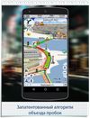
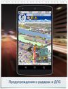
This is your fastest way around live traffic, speed cameras, and road hazards and right to wherever you are going. Boost your day-to-day navigation with your intelligent driving companion.


Fast and easy street viewing - just start typing an address and streetview or satelitte images start filling your screen.

Real time voice alerts based on "actual" speed limits. Unlike other apps, speed limits are automatically updated for your location.


OpenStreetMap based POI search tool (supports multiple criteria), POI download, search project reuse, etc. Can be used in market analysis and area research.