ArcGIS Alternatives
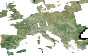
ArcGIS is described as 'Offers unique capabilities and flexible licensing for applying location-based analytics to your business practices' and is a GIS software in the travel & location category. There are more than 50 alternatives to ArcGIS for a variety of platforms, including Windows, Web-based, Linux, Mac and SaaS apps. The best ArcGIS alternative is QGIS, which is both free and Open Source. Other great apps like ArcGIS are R (programming language), GeoSpy, GRASS GIS and Global Mapper.
Alternatives list

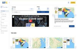
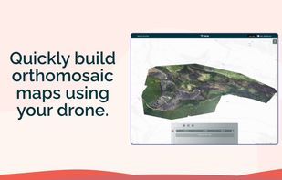
MAPOG is an AI-powered interactive mapping platform that lets users create map-based stories, add images, videos, links, and details to pins, manage tasks, collect field data, sort locations by live position, and share or embed maps.
 +9
+9


Fire AI is a software company that provides a modern, streamlined solution for wildfire intelligence. Our platform allows firefighters to create, edit, share, and store their maps in one place, making it easier to quickly understand the fire, map it with drones, and share...


 +2
+2

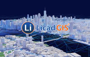
 11 LiCAD alternatives
With support for Lider CAD & GIS, CAD (Computer Aided Design) functions, mapping, cadastre, urban planning, construction, etc. to create projects, geographical analysis, query etc. by combining GIS (Geographic Information System) functions and CAD objects.
 +5
+5


SNAP is a common architecture for FOSS toolboxes developed by the European Space Agency (ESA) for the scientific processing, analysis, and exploitation of satellite data.

 13 KML viewer and converter alternatives
KML to KMZ, Geojson, Topojson, GPX, CSV, converter now available on the app store feel free to download because it's fully free. convert any compatible file format.

 +1
+1