
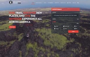
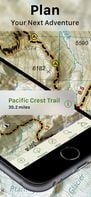
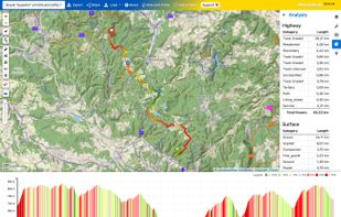
Find the best places for hiking, climbing, skiing, snowshoeing, kayak, trekking, camping, bike, mountain bike and lot more.
- Free • Proprietary
- Online
Best alternatives are  openclimbing.organd
 Komoot
8 alternativesopenclimbing.organdKomootFind the best places for hiking, climbing, skiing, snowshoeing, kayak, trekking, camping, bike, mountain bike and lot more.
openclimbing.organdKomoot
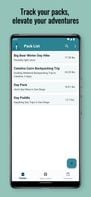
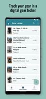
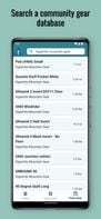
Pack smarter, not harder, with Don't Forget the Spoon. Our app simplifies trip planning with personalized gear lists, a community gear locker, pack weight statistics, and calorie tracking. Say goodbye to forgotten gear and hello to seamless planning for your next outdoor...
 PackTrek.ioand
 Lighterpack
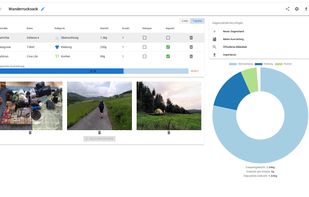
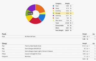
Create gear lists for travel & trekking, optimize your weight and share it with others.
 Don't Forget the Spoon
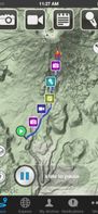
A ski, snowboard, backcountry and touring tool to discover mountain locations and inspiration for new adventures and to let you track and log your adventures with your phone's inbuilt GPS and camera.

 onX Backcountryand
 Slopes
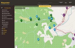
Waypointer is a service for POI (GPS coordinates) search and management. It will be useful for tourists and owners of GPS devices. With help of Waypointer you can find POIs on map filtered by categories (i.e. spring or camping sites), and prepare your next journey. Also you can e.
 OruxMapsand
 Garmin Connect
TrailDrop is a lightweight GPX open and sharing platform for outdoor enthusiasts, creators, and clubs. Upload your GPS track, generate a link, and share it instantly without requiring others to sign up.

Voyage Nation is a social media platform built on adventure. Share your adventures with the world. Use our GPS finder to locate voyages for you to go on near you!.
 TripAdvisorand
 Booking.com
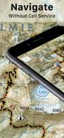
BY backpackers FOR backpackers, Topo Maps+ is fully functional with additional premium options for the serious backpacker. Downloaded, high resolution maps are still available for use even after your subscription expires!
 Don't Forget the Spoon
bikerouter.de is a web-based route planner for all kinds of bicycles (trekking, road bike, gravel bike, mountainbike, and many more) with specialized and adjustable routing profiles.
 Komoot
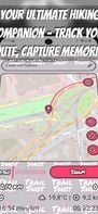
The perfect companion for hikers, outdoor photographers, and nature lovers — offering real-time GPS tracking, photo markers along your path, and key stats like distance, duration, and pace. With customizable map styles, GPX export, offline support, and battery-friendly design...


A peer-to-peer platform for guided outdoor adventures. Qualified tour operators and hobbyists are able to post an trip to the Onblay platform. Travelers can then see this listings and book online with confidence.

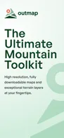
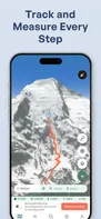
Explore the backcountry with the ultimate mountain toolkit. Outmap combines detailed 3D maps, offline access, intuitive library management, and advanced safety tools.
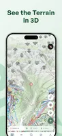
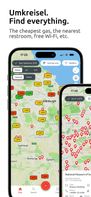
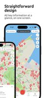
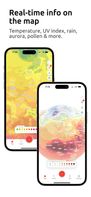
Customize your own map like never before: Combine background maps with real-time layers like gas prices, weather, traffic, light pollution, and 100+ location filters. Plan trips, find essentials, and explore smarter—all in one app.
Share your experience by blogging your hiking, traveling, outdoor fitness stories and GPX on a map. Ramblr is a geo located stories and blogging app for nature lovers with GPS or iPhone / Android.

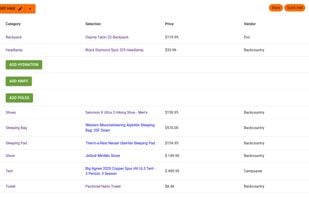
Backpack Planner is a web app to create list of hiking gear with a huge database of products. It also allows for the comparison of prices across several retailers with price history.
 PackTrek.io
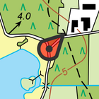
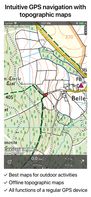
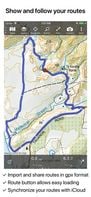
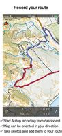
Topo GPS is an app that turns your smartphone in a full feature GPS device with topographic maps that are offline available. In Topo GPS you can easily create waypoints, enter, scan, and view coordinates, measure distances and angles, and record, plan and generate routes and...

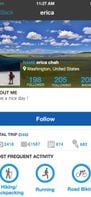
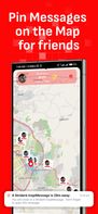
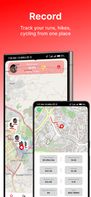
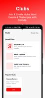
Striderk helps hikers, runners, and cyclists track their outdoor activities, connect with a like-minded community, and stay motivated on their fitness journey.

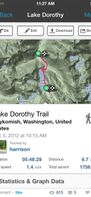
Website for trail guides based on location.


