TuriTop is a low-cost, multilingual booking system with customers of all sizes worldwide. It has support for tours, shows, parks, rental and accommodation.
Cost / License
- Paid
- Proprietary
Platforms
- Online
- PayPal
- Stripe
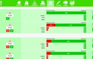
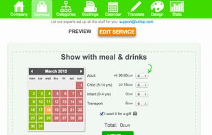
TuriTop is a low-cost, multilingual booking system with customers of all sizes worldwide. It has support for tours, shows, parks, rental and accommodation.

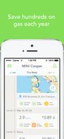
Automatic is a Smart Driving Assistant that can save you money on gas, remember where you parked, and even call for help in a crash.


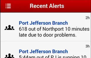
Our app (for iPhone / iPad and and Android) allows train / bus passengers to send/receive real-time "alerts" regarding the current commute.

Parking at the airport can be very expensive. Discount Park & Ride is a one-stop-shop for off-site, long-term and short-term airport and cruise port parking. Customers can use our database to find the parking facility that fits their needs and can shop by price and...


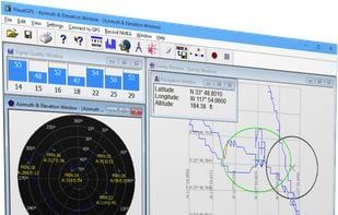
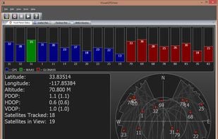
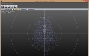
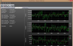
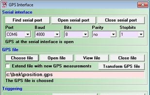
VisualGPSView is a new product that allows you to display graphically the output of your GPS receiver. VisualGPSView supports GPS and GLONASS NMEA 0183 sentences. Advanced feature included position plot, position scatter plot and averaging.
 GPS Status & Toolbox
VisualGPSView incorporates many advanced features found in professional programs. Its sole purpose is to display graphically specific NMEA 0183 sentences.
 GPS Status & Toolbox
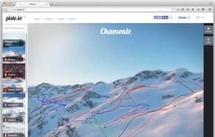
Piste.io is a web based 3D visualization of ski resorts, and the surrounding mountain landscapes. It allows a user to explore a resort, by rotating and panning the view, much like in other 3D globe products.


 MultiTimeInMenuBar
Schematic representation of the connectivity. Path might not be geographically accurate, and branching configuration is a best-guess.


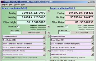
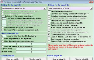
TRANSDAT performs Coordinate Transformations fast and with high accuracy. It supports thousands of world-wide Coordinate Systems, geodetic Reference Systems and Datum shifts, 2D/3D transformations, INSPIRE, NTv2, EPSG, GPS and more.
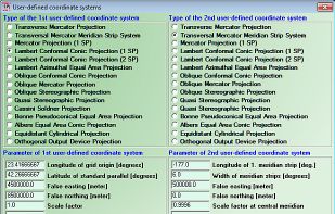
GeoCalc Software Developer Kit for Coordinate Conversion by Blue Marble Geographics
Modo is two-way carsharing. It's affordable, convenient and super easy. It's a Vancouver original.

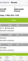
Rail Planner offers everything you need to help plan your rail journey in Europe. It provides offline timetable information for international European trains and connections, synchronising and simplifying cross-European travel.


 TransLinkand
 Rail Yatra
Browse, compare, and book worldwide fishing charters with filters for location, style, and budget. Read verified reviews and reserve directly on one easy platform.


 Navemos.com
Vamos is an easy to use event guide that helps you gaining access to the most interesting events in your city. You can find everything from Art, Food, Fashion to Club events, easily share them with your friends and follow your favorite venues.


Djubo is India's first hotel sales platform that integrates hotel bookings, channel management and booking engine all through a single seamless product.
 Mobile-Calendar
LandCAD is a CAD and GIS program for engineers, surveyors, and public administration for mapping and measurements.
 LibreCADand
 Autodesk AutoCAD
The Gmap Uploader is a service that allows you to upload any map or image you want into the Google Maps interface. From there, you can use the Google Maps API to put markers, info windows (bubbles), and polylines (routes) on your map. Visit the Gmap Uploader wiki for more info.

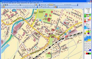
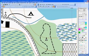
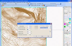
OCAD is a drawing program created for the needs of the cartographer. This focus in cartography makes it extremely easy and convenient to use (no plug-ins, no extra programs). OCAD has all the capabilities to create any kind of maps.
 OpenOrientering Mapper
Record your hikes, bike trips or jogs directly on your iPhone. Easily import tracks by simply searching on popular GPS websites such as everyTrail.commapmyrun.com and bikely.com to find hikes and jogs of other users and follow their tracks on your iPhone.
 CoPilotand
 EveryTrail
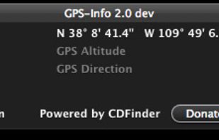
Display and use GPS coordinates embedded in photos directly in the Finder.
GPS-Info is an application that displays the GPS coordinate embedded in photos, and more. It allows you to show that location in web services, such as Flickr, Panoramio, Google Maps, SmugMug, WikiMapia or.
 ACDSee Photo Studio
 OrgBusiness Software
BlindSquare is an app for blind and visually impaired to help them understand their surroundings.


 Ariadne GPS