
Takeoff Field Tools icon

Takeoff Field Tools

Windows construction takeoff and estimating software for measuring plans and properly referenced photos, building reviewable estimates, exporting results, and reusing estimating knowledge.
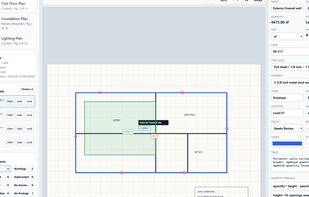
Measure plan PDFs with calibrated takeoff tools.

Cost / License

  • Pay once
  • Proprietary

Application type

Platforms

  • Windows
0likes
0comments
0articles

Features

  1.  Quantity Takeoffs

Takeoff Field Tools News & Activities

Highlights All activities

Recent activities

Takeoff Field Tools information

  • Developed by

    Takeoff Field Tools
  • Licensing

    Proprietary and Commercial product.
  • Pricing

    One time purchase (perpetual license) that costs $79.
  • Alternatives

    2 alternatives listed
  • Badge

    Get an embeddable badge for Takeoff Field Tools
  • Supported Languages

    • English

AlternativeTo Category

Office & Productivity

Popular alternatives

View all
Takeoff Field Tools was added to AlternativeTo by keenanfinkelstein on and this page was last updated .
No comments or reviews, maybe you want to be first?

What is Takeoff Field Tools?

Takeoff Field Tools is a local Windows application for measuring construction plans and properly calibrated photographs, organizing counts, lengths, areas, and volumes, and carrying those quantities into reviewable estimates. It exports proposal and workbook outputs and preserves cost items, formulas, assemblies, notes, and prior estimate logic so repeated work does not start from zero.

The license is $79 once with no subscription. Core project work and storage are local.

Takeoff Field Tools does not provide automatic AI or OCR takeoff, cloud collaboration, Mac, web, or mobile apps, live supplier pricing, CRM, scheduling, job management, accounting, or field verification. Measurements from photographs are dependable only when the image includes a known dimension on the same plane and the result is checked against field conditions.

Takeoff Field Tools Videos