Jawg Maps Alternatives
Jawg Maps is described as 'Provides SaaS Maps Services, such as Maps, Geocoding, Routing and Elevation. It is based on open data sources, like OpenStreetMap or OpenAdresses' and is a Map service in the online services category. There are more than 10 alternatives to Jawg Maps for a variety of platforms, including Web-based, Android, iPhone, Android Tablet and iPad apps. The best Jawg Maps alternative is OpenStreetMap, which is both free and Open Source. Other great apps like Jawg Maps are Google Maps, HERE WeGo, MAPS.ME and GMaps WV.
Alternatives list

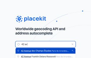
Our mission at PlaceKit is to become the go-to geocoding solution for developers. Existing solutions feel opaque as they're split across many indiscernible APIs, confusing pricing, and locking developers into their ecosystem.

 +2
+2


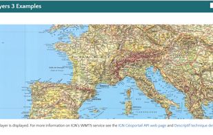
OpenMapTiles is a set of open-source tools for self-hosting of OpenStreetMap maps in more than 50 languages. It provides both raster as well as vector tiles, WMS and WMTS services for GIS programs, support for JavaScript viewers and mobile SDK.


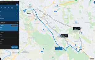
Web-based platform for trip planning offering live traffic info, multiple route options, device syncing, integration with mobile navigation, commute delay monitoring, map interactivity, vehicle type support, route optimization, experimental features, and secure account settings.


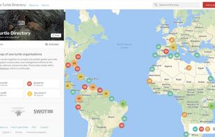
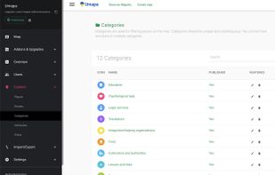
Mapotic is an innovative cloud platform that offers a wide range of map-based products and services to organizations globally, enabling them to effectively leverage the full potential of geolocation data.
Cost / License
- Freemium
- Proprietary
Application type
Platforms
- Online
- Android
- iPhone
- Android Tablet
- iPad
- Software as a Service (SaaS)


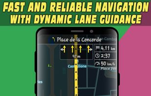
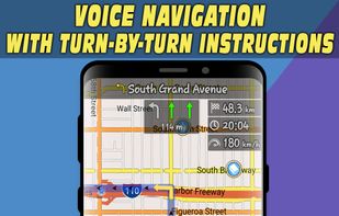
Android navigation app with high-quality offline HD maps, voice-guided turn-by-turn directions, speed and lane guidance, POI search by category, supports driving, biking and walking, automatic rerouting, itinerary planning, and multilingual interface for travelers.
 +5
+5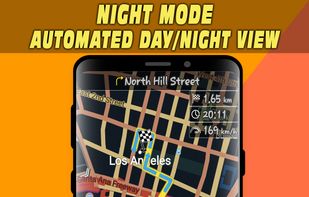


Universal Maps Downloader is a tool that help you to get small tile images from online maps:


