GMaps WV Alternatives
GMaps WV is described as 'Restricted WebView wrapper for Google Maps web version, blocking trackers, forcing HTTPS, clearing private data on close, with optional location permission' and is a GPS Navigation service in the travel & location category. There are more than 100 alternatives to GMaps WV for a variety of platforms, including Web-based, Android, iPhone, iPad and Android Tablet apps. The best GMaps WV alternative is CoMaps, which is both free and Open Source. Other great apps like GMaps WV are OpenStreetMap, Organic Maps, Google Maps and OsmAnd.
Alternatives list

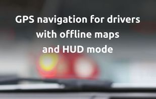
HUDWAY Go is a simple GPS navigation app for drivers. It keeps it very intuitive and non-distracting, displaying just the outline of the road you’re driving and your next manoeuvre.

 +2
+2


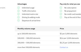
The APIs for computing distances, that accounts for traffic conditions, has different travel modes, forecasting features, and unlimited matrix size.

 +3
+3


Cost / License
- Free
- Open Source (GPL-2.0)
Platforms
- Online
- Self-Hosted
- Python
- Docker
- Docker Hub


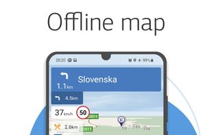
Navitel Navigator 11 is a precise offline GPS navigation, up-to-date online services, and detailed maps of 67 countries and territories of the world. 7 days free.

 +5
+5


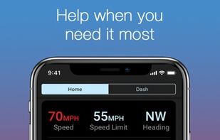
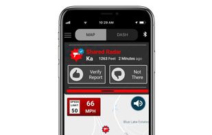
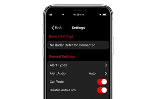
Drive Smarter® allows you to view a gallery timeline of your dash cam videos, set up advanced safety and security features, receive shared community alerts, and easily manage your device settings.
 +2
+2


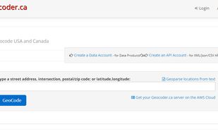
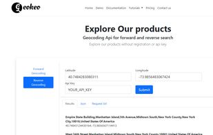
Geocoding service an alternative to google geocoding api and fast forward and reverse Geocoding. find Latitude and Longitude of freeform Addresses or reverse geocode latitude and longitude to elligible address.
Cost / License
- Freemium
- Proprietary
Platforms
- Online
- Software as a Service (SaaS)
 +1
+1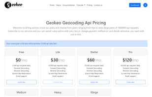


Anyplace is a first-of-a-kind GPS-less localization and navigation service working in indoor and outdoor space using ordinary smartphones. It has been developed by researchers and students at the Data Management Systems Laboratory (DMSL), Department of Computer Science and the...


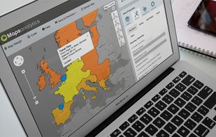
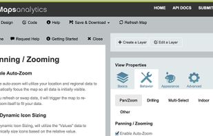
 12 CMaps Analytics alternatives
CMaps Analytics Location Intelligence Suite for Business Apps and Business Intelligence. CMaps Designer is a cloud-based geographic visualization and analysis designer. Without any server software or specialized skills, you can rapidly create embedded Location Intelligence...
Cost / License
- Paid
- Proprietary
Platforms
- Windows
- Online
- Microsoft SharePoint
- SAP HANA
- Google Maps


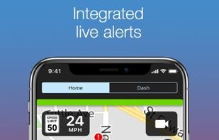
Share and receive real-time alerts from the entire network of users in the Cobra driving community. Instant red light and speed camera as well as live law enforcement detection notifications ensure you can drive smarter and safer.
Cost / License
- Free
- Proprietary
Application types
Platforms
- Android
- iPhone
- Android Tablet
- iPad

 +1
+1


Cost / License
- Paid
- Proprietary
Platforms
- Self-Hosted
- Software as a Service (SaaS)