2GIS Alternatives

2GIS is described as 'Provides 3D-maps of 180+ cities, contacts of 1.5 million companies, car routing and public transport routes and and more! 2GIS is a complete and up-to-date directory of organizations with detailed cities’ maps' and is a popular Map service in the travel & location category. There are more than 50 alternatives to 2GIS for a variety of platforms, including Web-based, Android, iPhone, iPad and Windows apps. The best 2GIS alternative is OpenStreetMap, which is both free and Open Source. Other great apps like 2GIS are Google Maps, Google Earth, Waze and HERE WeGo.

2GIS icon2GIS
  72
  • ...

2GIS provides 3D-maps of 180+ cities, contacts of 1.5 million companies, car routing and public transport routes and and...

More about 2GIS
2GIS alternatives page was last updated Mar 21, 2025
Copy a direct link to this comment to your clipboard
  1. OruxMaps icon
     24 likes
    Copy a direct link to this comment to your clipboard

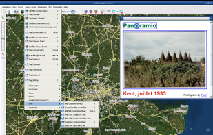
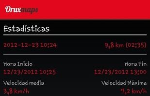
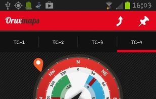
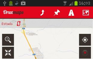
    OruxMaps is an online/offline map viewer and track logger for Android. You can use OruxMaps for your outdoor activities (running, trekking, mountain bike, paragliding, flying, nautic sports, etc.)

    Features:

    Online map viewer The tiles used online can be cached, and can be used.
    96 OruxMaps alternatives

    License model

    • FreeProprietary

    Country of Origin

    • ES flagSpain
    • European Union flagEU

    Platforms

    • Android

    OruxMaps Features

    1.  Points of Interest (POI)
    2.  Save your tracks
    3.  KML and GPX import/export
    4.  Apps with Offline Map

    OruxMaps VS 2GIS

     
  2. Copy a direct link to this comment to your clipboard

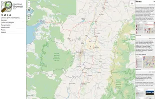
    An application to ‘browse’ the information in the displayed part of the map. Similar to common Wikis and also the main page of OpenStreetMap the website shows a narrow menu on the left side, most of the page is used for the display of...
    License model

    • FreeOpen Source

    Application type

    Platforms

    • Online

    Properties

    1.  Privacy focused

    Features

    1.  Ad-free
    2.  Public Transportation
    3.  Crowdsourced
    4.  Cycling
    5.  Points of Interest (POI)
    6.  Hiking Maps
    7.  Nearby Search
    8. Wikipedia icon  Wikipedia integration
    9.  Based on OpenStreetMap
    10. Wikidata icon  Wikidata integration
    11. OpenStreetMap icon  Openstreetmap integration
    12.  Location-based

    OpenStreetBrowser VS 2GIS

     
  3. Copy a direct link to this comment to your clipboard

    Find your way around the city and keep track of current traffic with your cell phone.

    License model

    • FreeProprietary

    Country of Origin

    • RU flagRussia

    Platforms

    • Android
    • iPhone
    • iPad

    Yandex.Navigator Features

    1.  Voice Search
    2.  Traffic Monitoring

    Yandex.Navigator VS 2GIS

     
  4. Copy a direct link to this comment to your clipboard

    Google Maps Go, the lighter version of the original Google Maps app. Designed to run smoothly on devices with limited memory and on unreliable networks without compromising speed to provide your location, real-time traffic updates, directions, and train, bus, and city transit...

    License model

    • FreeProprietary

    Application type

    Country of Origin

    • US flagUnited States

    Platforms

    • Android

    Properties

    1.  Lightweight

    Features

    1.  Multiple languages

    Google Maps Go VS 2GIS

     
  5. GMaps WV icon
     5 likes
    Copy a direct link to this comment to your clipboard

    Privacy-focused WebView tool for accessing the Google Maps web interface, enforcing HTTPS, blocking trackers, clearing private data on close, supporting toggleable location access, offering step-by-step directions but no real-time navigation, and not clearing cache automatically.

    License model

    • FreeOpen Source

    Country of Origin

    • International

    Platforms

    • Android
    • F-Droid

    Properties

    1.  Privacy focused

    Features

    1.  Points of Interest (POI)
    2.  Cycling
    3.  Hiking Maps
    4.  Turn-by-turn Navigation
    5.  Public Transportation
    6.  Ad-free
    7.  Web application wrapper
    8.  Ungoogled
    9. Google Maps icon  Google Maps integration

    GMaps WV VS 2GIS

     
  6. Mapcarta icon
     3 likes
    Copy a direct link to this comment to your clipboard

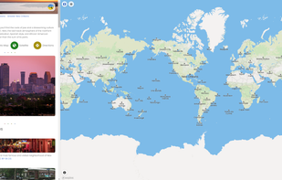
    Explore the world with Mapcarta. The open map that unites the world, with the collective knowledge of OpenStreetMap, Wikipedia, Wikidata and other open projects.
    18 Mapcarta alternatives

    License model

    • FreeProprietary

    Country of Origin

    • US flagUnited States

    Platforms

    • Online

    Top Mapcarta Features

    1.  Ad-free
    2.  Points of Interest (POI)
    3.  Crowdsourced
    4.  Geotagging
    5.  Turn-by-turn Navigation
    6.  Nearby Search
    7.  Based on OpenStreetMap
    8. Wikipedia icon  Wikipedia integration
    9. Wikidata icon  Wikidata integration
    10.  Real-time traffic
    11. OpenStreetMap icon  Openstreetmap integration

    Mapcarta VS 2GIS

     
  7. Karta GPS icon
     2 likes
    Copy a direct link to this comment to your clipboard

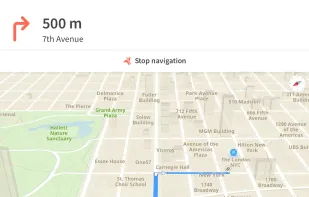
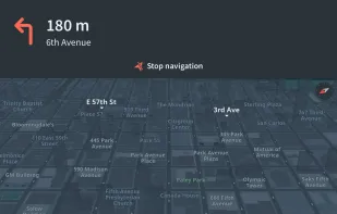
    Feature-packed offline navigation with turn-by-turn voice directions, enriched OSM maps, traffic-aware rerouting, lane assistance, restaurant details, parking finder, walking routes, contact navigation, arrival sharing, tourist guidance, and regular updates.
    License model

    • FreemiumProprietary

    Application type

    Country of Origin

    • PT flagPortugal
    • European Union flagEU

    Platforms

    • Android
    • iPhone
    • Android Tablet
    • iPad
    • Apple Car Play

    Karta GPS Features

    1.  Driving directions

    Karta GPS VS 2GIS

     
  8. KeplerJs icon
     4 likes
    Copy a direct link to this comment to your clipboard

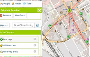
    KeplerJs is a open source geosocial solution that lets users share favorite places and join discussions in real-time. It can be seen as a platform where users can interact with other open data platforms searching across OpenStreetMap, Geonames among other sources.


    License model

    • FreeOpen Source

    Country of Origin

    • IT flagItaly
    • European Union flagEU

    Platforms

    • Online
    • Self-Hosted

    KeplerJs Features

    1.  GPS Location Tracking
    2.  Based on OpenStreetMap

    KeplerJs VS 2GIS

     
  9. Mappa Mini icon
     1 like
    Copy a direct link to this comment to your clipboard

    Quickly search for locations directly from your Mac’s menu bar and open them in Apple Maps, Google Maps, or OpenStreetMap.

    License model

    • FreeProprietary

    Application type

    Country of Origin

    • NL flagNetherlands
    • European Union flagEU

    Platforms

    • Mac

    Properties

    1.  Lightweight

    Features

    1.  Ad-free
    2.  Dark Mode
    3.  No registration required
    4.  Points of Interest (POI)
    5. OpenStreetMap icon  Openstreetmap integration
    6.  Based on OpenStreetMap
    7. Google Maps icon  Google Maps integration
    8. Waze icon  Waze integration
    9.  Sits in the MenuBar

    Mappa Mini VS 2GIS

     
  10. Copy a direct link to this comment to your clipboard

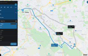
    Web-based platform for trip planning offering live traffic info, multiple route options, device syncing, integration with mobile navigation, commute delay monitoring, map interactivity, vehicle type support, route optimization, experimental features, and secure account settings.
    License model

    • FreeProprietary

    Country of Origin

    • NL flagNetherlands
    • European Union flagEU

    Platforms

    • Online

    Plan.TomTom.com Features

    1.  Points of Interest (POI)
    2.  Route Planning

    Plan.TomTom.com VS 2GIS

     
  11. Copy a direct link to this comment to your clipboard

    Android navigation app with high-quality offline HD maps, voice-guided turn-by-turn directions, speed and lane guidance, POI search by category, supports driving, biking and walking, automatic rerouting, itinerary planning, and multilingual interface for travelers.


    License model

    • FreemiumProprietary

    Country of Origin

    • RO flagRomania
    • European Union flagEU

    Platforms

    • Android

    Evolved GPS Navigator Offline Features

    1.  Route Planning
    2.  Voice Navigation
    3.  Portable
    4.  Apps with Offline Map
    5.  Route optimization

    Evolved GPS Navigator Offline VS 2GIS

     
  12. Copy a direct link to this comment to your clipboard

    This is your fastest way around live traffic, speed cameras, and road hazards and right to wherever you are going. Boost your day-to-day navigation with your intelligent driving companion.

    License model

    • FreeProprietary

    Country of Origin

    • NL flagNetherlands
    • European Union flagEU

    Platforms

    • Android
    • iPhone

    Properties

    1.  Privacy focused

    Features

    1.  Turn-by-turn Navigation
    2.  Nearby Search
    3.  Voice Navigation
    4.  Ad-free
    5.  Real-time traffic

    TomTom AmiGO VS 2GIS

     
You are at page 2 of 2GIS alternatives