

Every document tells a story. See how they connect. Visualize file relationships on Mac and Windows without moving files from their folders.
- Paid • Proprietary
- Mac
- Windows
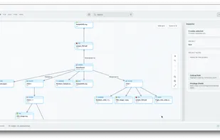
Every document tells a story. See how they connect. Visualize file relationships on Mac and Windows without moving files from their folders.

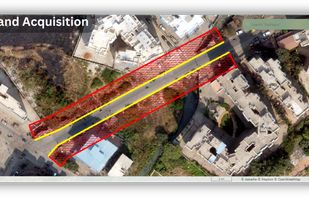
Aakashe is an instant drone imagery platform based in India. The subscription-based solution provides high-resolution aerial data to customers in infrastructure, urban planning, and real estate sectors.
 Google Earthand
 HERE WeGo
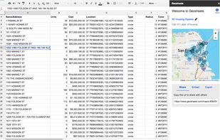
GeoSheets is a free add-on for Google Spreadsheets that makes it simple to do lightweight GIS tasks like geocoding, address normalization, distance calculations and creating customized and embeddable maps.
 QGISand
 Plus Codes
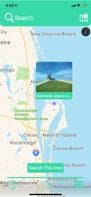
Picsplore is a brand new location based social network! We want to show you what’s new and exciting around you, it could be a band playing at a dive bar, a carnival, a house party, the possibilities are truly endless.


 Google Mapsand
 Pixelfed
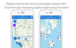
Create a post and it goes to the seven closest people to you with the app. They in turn can choose to kill the ripple or ripple it themselves, and it goes to the seven closest people to them. Ripple also visualizes the spread of every post around the globe on a map.

UrtheCast is developing the world's first near realtime HD Earth video stream, via two cameras mounted aboard the International Space Station (ISS).
Google Earthand Marble
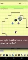
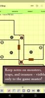
Dungeon Sketch is a lo-fi tactical combat map for tabletop roleplaying games such as Dungeons and Dragons. This is meant to replace the whiteboard or graph paper that sits in the middle of a gaming table.
 OpenStereoand
 InnStereo
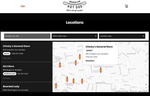
Fully customizable store locator for your website. Very easy to manage, upload or sync locations and the locator itself can be fully customized to your website theme, layout, fonts, colors and more...
 IzyMaps
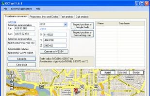
GCTool is a must have Geocaching toolkit. It is developed for assisting Geocachers in solving geometrical problems and common mystery puzzles. The toolkit provides accurate solutions for diverse geometrical problems and is able to analyse both text and numbers.
 GCTK Geocaching Tools
LittleSis (the opposite of Big Brother) is a free wiki database detailing the connections between powerful people and organizations.

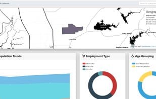
Corgilytics allows non-technical users to explore geographies using demographic, psychographic and other useful data sets.

SOLO Forest is the only field solution designed specifically for the forest industry. Hundreds of foresters use SOLO Forest to help solve issues encountered on a daily basis. No other software provides utilities that foresters need most as standard tools, such as buffering and...

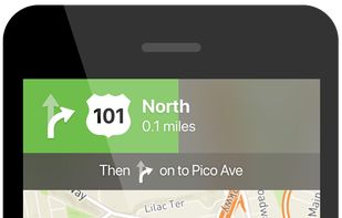
TallyGo provides a state-of-the-art mapping and navigation SDK that can be integrated into existing apps with virtually no development effort. Built for iOS, Android, and web.
 Google Mapsand
 OpenFreeMap
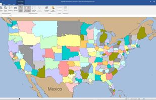
Free and commercial Sales Territory Mapping tool for Windows. Import your data into AlignMix and use the patent pending touch align technology to create sales or franchise territories.
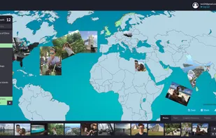
App for creating awesome travel maps. Customize your maps with photos, texts, graphics and more. Get awesome wall posters with your maps, or postcards - excellent custom made gifts idea!.
free wizard for creating and managing customized google maps of address lists, the addresses for the map come from your own google spreadsheet, no coding required, modify your address list and the map is automatically updated, you can privately be the only viewer of your maps or...
Adze gives you the tools to edit GPX documents like a pro: create, modify and delete tracks, plan routes, mark waypoints, and more.
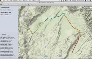
 GpsPruneand
 TrailRunner


