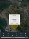
Mgrs & Utm Map is a GPS and coordinate system application designed to assist military personnel and outdoor enthusiasts with navigation, supporting various satellite systems and offering diverse map layers.
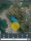

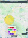
Mgrs & Utm Map is a GPS and coordinate system application designed to assist military personnel and outdoor enthusiasts with navigation, supporting various satellite systems and offering diverse map layers.


Land Nav Assistant is a navigation app designed for military personnel that accepts MGRS or Latitude / Longitude coordinates, providing visual navigation to each point and enabling users to analyze their pace count and directional tendencies.


Military-grade navigational app, created by a U.S. Army Field Artillery officer, designed to provide service members with a highly accurate mobile solution for tactical navigation, featuring features such as offline mapping, waypoint plotting, and a tactical drawing mode.