Apps tagged with 'Elevation Profile'

All apps in Apps tagged with 'Elevation Profile' category. Use the filters below to narrow down your search. 
Copy a direct link to this comment to your clipboard
  1. Magic Earth icon
     61 likes

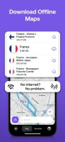
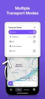
    Navigation app using OpenStreetMap data with offline maps for 233 countries, real-time traffic, transit info, multiple modes, privacy, and detailed routes.

    Cost / License

    • Freemium (Subscription)
    • Proprietary

    Application type

    Since

    • Since 2016 (updated Oct 2026)

    Platforms

    • Android
    • iPhone
    • iPad
    • Android Tablet
    • Apple Watch
    • Android Auto
    • Apple Car Play
    • HUAWEI AppGallery
    • NL flagNetherlands
    • European Union flagEU
    Magic Earth screenshot 2
    Magic Earth screenshot 3
    +8
    Magic Earth screenshot 4
    51 alternatives
    4.4
    Very Good14 ratings
  2. MapDraw icon
     2 likes

    Free browser tool to draw, view and edit GPX, KML, KMZ or GeoJSON with routing, elevation profiles, custom map styles, and Strava integration for planning routes.

    Cost / License

    Application type

    Since

    • Since 2025 (updated Oct 2026)

    GitHub

    • GitHub stars: 80

    Platforms

    • Online
    • CH flagSwitzerland
    MapDraw screenshot 1
    MapDraw screenshot 2
    8 alternatives
  3. Geisro icon
     1 like

    Online GIS map editor: draw and measure on the map, digitize PDF drawings and scanned maps, import OpenStreetMap data, GeoJSON in/out, elevation profiles.

    Cost / License

    • Freemium (Subscription)
    • Proprietary

    Application type

    Since

    • New

    Platforms

    • Online
    • Software as a Service (SaaS)
    Geisro screenshot 1
    Geisro screenshot 2
    Geisro screenshot 3
    +1
    Geisro screenshot 4
    26 alternatives