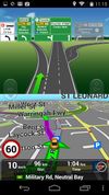
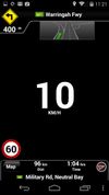
A complete Turn-By-Turn GPS Navigation solution with Australia and New Zealand's most comprehensive SpeedAlert including school zones - save your license!.
Cost / License
- Paid
- Proprietary
Application typeApplication types
Since
- Since 2025
Australia
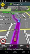


A complete Turn-By-Turn GPS Navigation solution with Australia and New Zealand's most comprehensive SpeedAlert including school zones - save your license!.


Explore the backcountry with the ultimate mountain toolkit. Outmap combines detailed 3D maps, offline access, intuitive library management, and advanced safety tools.


CityGuide is a next-generation offline GPS navigator that offers maps from various vendors, including OSM (OpenStreetMap), HERE (NOKIA) maps, CityGuide maps, and other high-quality maps from national producers.


The Cartograph app views Mapsforge offline vector maps, offline raster maps, and online/WMS maps. It supports tracking, route search, overlays, hillshading, reliefs, track drawing, and has many other features.


Customize your own map like never before: Combine background maps with real-time layers like gas prices, weather, traffic, light pollution, and 100+ location filters. Plan trips, find essentials, and explore smarter—all in one app.


Topo GPS is an app that turns your smartphone in a full feature GPS device with topographic maps that are offline available. In Topo GPS you can easily create waypoints, enter, scan, and view coordinates, measure distances and angles, and record, plan and generate routes and...


Offline ski and snowboard navigation that routes you across lifts and pistes by ability, with spoken turn cues and automatic run tracking.


UrtheCast is developing the world's first near realtime HD Earth video stream, via two cameras mounted aboard the International Space Station (ISS).
Open source mapping and GPS navigation using OpenStreetMap and Openrouteservice, offering online and offline access, multiple transport modes, and voice guidance.