Plan.TomTom.com Alternatives
Plan.TomTom.com is described as 'Web-based trip planner with real-time traffic data, route optimization options, device syncing, integration with mobile navigation, and commute monitoring tools' and is a GPS Navigation service in the travel & location category. There are more than 100 alternatives to Plan.TomTom.com, not only websites but also apps for a variety of platforms, including Android, iPhone, iPad and Android Tablet apps. The best Plan.TomTom.com alternative is OpenStreetMap, which is both free and Open Source. Other great sites and apps similar to Plan.TomTom.com are Google Maps, OsmAnd, Magic Earth and Waze.
Alternatives list

CityGuide is a next-generation offline GPS navigator that offers maps from various vendors, including OSM (OpenStreetMap), HERE (NOKIA) maps, CityGuide maps, and other high-quality maps from national producers.

 +3
+3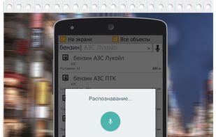


Cost / License
- Free
- Open Source (GPL-2.0)
Platforms
- Online
- Self-Hosted
- Python
- Docker
- Docker Hub


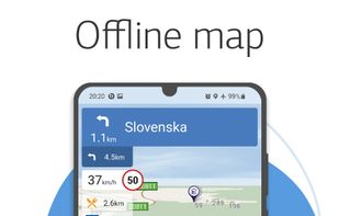
Offline Maps offers free GPS Navigation with Driving Directions and Real-Time Traffic Alerts.

 +2
+2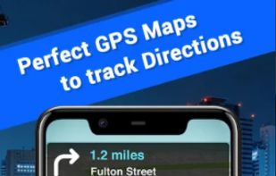


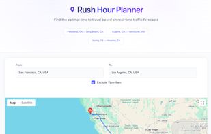
Free rush hour traffic estimator tool. Get accurate traffic forecasts, find optimal driving times, and plan your commute to avoid rush hour congestion. Our traffic estimator analyzes 24-hour patterns to tell you exactly when to leave for the fastest journey.


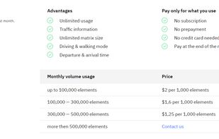
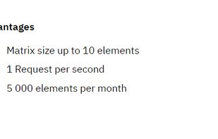
The APIs for computing distances, that accounts for traffic conditions, has different travel modes, forecasting features, and unlimited matrix size.

 +3
+3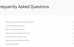


Picsplore is a brand new location based social network! We want to show you what’s new and exciting around you, it could be a band playing at a dive bar, a carnival, a house party, the possibilities are truly endless.


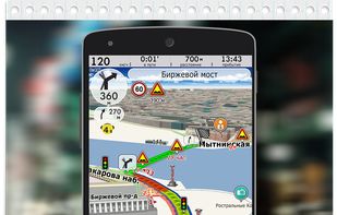
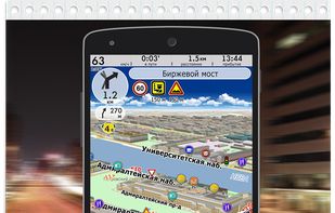
Navitel Navigator 11 is a precise offline GPS navigation, up-to-date online services, and detailed maps of 67 countries and territories of the world. 7 days free.

 +5
+5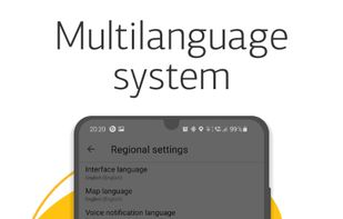


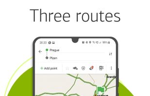
Provides precise turn-by-turn navigation with voice and visual guidance, live traffic updates, offline maps, multiple route options, point-of-interest search, global coverage, tailored modes for driving, walking, and cycling, plus integration with smart devices for seamless travel.

 +5
+5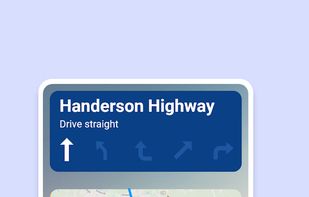


Cartogram is an indoor search engine that helps you find things indoors with over 10,000 indoor maps. Navigate indoors, search malls for products, get indoor directions, and share indoor location with others. Cartogram is an atlas for indoors.

 +1
+1


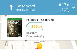
This is your fastest way around live traffic, speed cameras, and road hazards and right to wherever you are going. Boost your day-to-day navigation with your intelligent driving companion.

 +7
+7