Maplytics icon
Maplytics icon

Maplytics

 2 likes

Maplytics is a geospatial mapping app that seamlessly integrates Bing Maps with Microsoft Dynamics 365 to visualize Dynamics CRM/365 data on a map and improve business processes and engage the right customers at the right time.
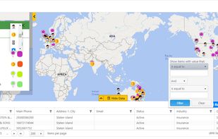
Geocode Dynamics 365 CRM Data

Cost / License

  • Subscription
  • Proprietary

Platforms

  • Mac
  • Windows
  • Online  [https://docs.maplytics.com/](https://docs.maplytics.com/)
  • Android
  • iPhone
2likes
0articles
Save

Features

  1.  Turn-by-turn Navigation
  2.  Route Planning
  3.  Nearby Search
  4.  Geotagging
  5.  Points of Interest (POI)
  6.  Geocoding
  7.  Automatic Scheduling
  8.  Location Mapping
  9.  Route optimization
Highlights All activities

Maplytics News & Activities

Recent activities

Maplytics information

  • Developed by

    IN flagInogic Tech
  • Licensing

    Proprietary and Commercial product.
  • Pricing

    Subscription.
  • Alternatives

    23 alternatives listed
  • Badge

    Get an embeddable badge for Maplytics
  • Supported Languages

    • English
    • Arabic
    • German
    • French
    • Spanish
    • Portuguese
    • Turkish
    • Hungarian
    • Dutch
Maplytics was added to AlternativeTo by Inogic Tech on and this page was last updated .

No comments or reviews, maybe you want to be first?

Official Links

What is Maplytics?

Maplytics is a Microsoft Preferred Solution and #1 geo-analytical mapping app that enable organizations to visualize and analyze Dynamics 365 CRM and Dataverse (Power Apps) data on a map, in real-time and on the move. It offers powerful features like Real-Time Tracking, Automated Appointment Planning, Optimized Route Planning, Radius Search, Truck Routing, Territory Management, Heat Maps, Census, Land Area Mapping, PCF Controls, Multi-Language Support, and much more!

Below are some Maplytics features:

  1. Radius Search: Perform proximity search on nearby locations with the shortest travel distance and line-of-sight distance.
  2. Optimized Routing: Create optimized routes for your reps to meet them with turn-by-turn navigation using Google Maps or Waze app.
  3. Shape File Integration: Overlay Dynamics data shapefiles, as well as the metadata, included over the geographical boundaries defined by the shape.
  4. Location Marketing: Launch marketing campaigns for regions to generate leads and prospects.
  5. Map Controls and Dashboards: View Dynamics 365 data right within the CRM without switching screens.
  6. Heat Maps: Visualize and analyze the complex density of data spread with Pie-Chart and Column-Charts.
  7. Territory Management: Manually or auto-create and analyze Sales territories and distribute them among your reps as well as align territories for even work distribution.
  8. Auto Scheduling: Create an automated schedule for multiple reps at once to meet appointments over a span of days with optimized routes.
  9. Real-Time Tracking: Track the location of Field Service Reps within Dynamics 365 CRM in real-time.
  10. Land Area Mapping: Visualize the land areas for agricultural, residential, commercial properties, etc. on the map. Available for: Microsoft Dynamics 365 CRM v8.2 and above, Power Apps/Dataverse and native Dynamics 365 App for Phones and Tablets.

Deployment: Online and On-Premises Languages: English, Spanish, German, French, Portuguese, Turkish and Arabic.

Maplytics Videos
