This program allows work with any maps service if you can describe getting picture by longitude/latitude(if you want you can write config file or simplepascal script to describe how obtain needle photos).


The best free alternative to Google Street View is Google Earth. It's not free, so if you're looking for a free alternative, you could try Google Earth or Mapillary. If that doesn't suit you, our users have ranked more than 25 alternatives to Google Street View and many of them is free so hopefully you can find a suitable replacement. Other interesting free alternatives to Google Street View are Apple Maps, Yandex Maps, Panoramax and Bing Maps.
This program allows work with any maps service if you can describe getting picture by longitude/latitude(if you want you can write config file or simplepascal script to describe how obtain needle photos).

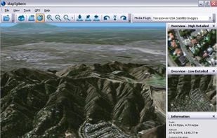
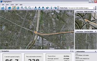
MapSphere is a manageable way to view and organize geographical data of different kind. This might be raster maps and satellite imagery from various sources, your own information received from GPS, tracks of your friends, whatever you want.

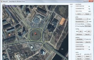
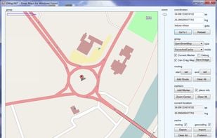
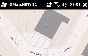
GMap.NET is great and Powerful, Free, cross platform, open source .NET control. Enable use routing, geocoding, directions and maps from Google, Yahoo!, Bing, OpenStreetMap, ArcGIS, Pergo, SigPac, Yandex, Mapy.cz, Maps.lt, iKarte.


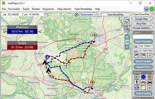
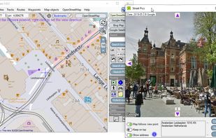
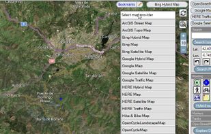
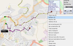
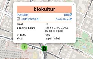
Justmapzz is an advanced map browser to view the world with 18 different maps, including satellite maps, Openstreetmap, Google maps, Bing and Here maps, traffic maps and hiking / biking maps. The Streetpics mode shows all the imaging of Google Streetview.

TransforMap works towards an online platform for you to visualize the myriads of alternatives to the dominant economic thinking on a single mapping system.

Free navigation and traffic app offering offline OpenStreetMap-based maps, live traffic updates, voice guidance, automatic rerouting, walking mode, driver analytics, HD maps, POI searches with Foursquare integration, in more than 150 countries worldwide.


OpenTrailView (OTV) is a platform to upload 360 degree panoramas of off-road routes such as footpaths and cycle paths. The aim is to create a similar piece of software to Google Street View but for footpaths, using open licencing, and using underlying OSM data to link panoramas...

Get FREE Driving Directions between any point (address, city, state, zip code, or GPS Coordinates) shown on Google Maps™ and follow the turn-by-turn directions that will be displayed below the map.

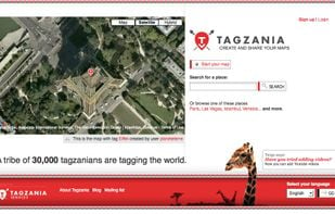
Tagzania is an application that helps you saving your places of the world. Using Tagzania you can save the place where you were first kissed, where you were born or where you work. You decide what to save


Maximize the use of your Excel spreadsheet data. Make mapping the easiest. Transform Excel data into visual analysis. We lead in data simplification and presentation. We are committed to deliver the tools needed to outpace competition.
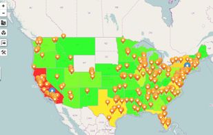

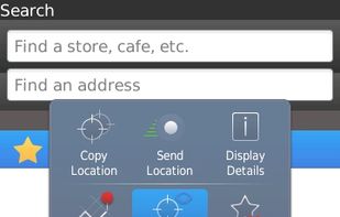
Chart your own course with built-in GPS (Global Positioning System) featured in selected BlackBerry smartphones.

Modest Maps is a small, extensible, and free library for designers and developers who want to use interactive maps in their own projects. It provides a core set of features in a tight, clean package with plenty of hooks for additional functionality.