





FieldSignal
Like
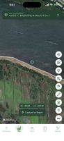
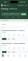
Offline-first field data collection app for renewable energy and environmental work: GPS-tagged notes, photos, checklists, offline maps and AI-generated reports.


Cost / License
- Freemium (Subscription)
- Proprietary
Application type
Since
- New
Updated
- Updated Oct 2026

Features
Highlights All activities
FieldSignal News & Activities
Recent activities
- info_fieldsignal added FieldSignal
 info_fieldsignal added FieldSignal as alternative to Fulcrum Platform, QField, Mergin Maps, SafetyCulture and 1 more

Developed by
Fieldsignal LLCLicensing
Proprietary and Freemium product.Pricing
Subscription ranging between $19 and $25 per month + free version with limited functionality.Alternatives
5 alternatives listedBadge
Get an embeddable badge for FieldSignalSupported Languages


No comments or reviews, maybe you want to be first?