ArxSilex MapTools Converter icon

ArxSilex MapTools Converter

ArxSilex MapTools Converter is a free, open-source desktop application for Windows and Linux that creates custom extracts from local map, POI and elevation data. Select one or more source files, define an area with rectangles, circles, polygons or imported GPX and MapTools...

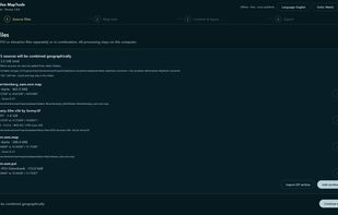
Start screen of MapTools Converter 1.8.6 with supported map, POI and elevation source formats.

Cost / License

Platforms

  • Windows  Portable Windows x64 package; not yet Authenticode-signed, so Windows may show a SmartScreen warning.
  • Linux  Portable Linux x64 package.
Five local Mapsforge map, POI and GeoTIFF elevation sources ready to be combined geographically.
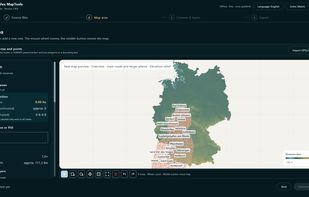
Map preview combining maps, POIs and elevation data before selecting an export area.
+5
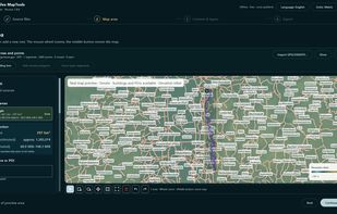
GPX track imported as a reference and converted into a bounding-box export area with size estimates.
Alternatives
0likes
0alternatives
0articles

Features

Properties

  1.  Privacy focused

Features

  1.  Nearby Search
  2.  No Tracking
  3.  No registration required
  4.  Works Offline
  5.  Dark Mode
  6.  Ad-free
  7.  Points of Interest (POI)
  8.  Based on OpenStreetMap
  9.  Apps with Offline Map

ArxSilex MapTools Converter News & Activities

Highlights All activities

Recent activities

ArxSilex MapTools Converter information

AlternativeTo Category

Travel & Location
ArxSilex MapTools Converter was added to AlternativeTo by Peter Stich on and this page was last updated .
No comments or reviews, maybe you want to be first?

Official Links

What is ArxSilex MapTools Converter?

ArxSilex MapTools Converter is a free, open-source desktop application for Windows and Linux that creates custom extracts from local map, POI and elevation data. Select one or more source files, define an area with rectangles, circles, polygons or imported GPX and MapTools references, preview the selection and export only the data you need.

It reads OSM PBF, Mapsforge .map and .poi, GeoTIFF, ASC, HGT and DTED sources. Exports include Mapsforge .map v4/v5, merged .poi v3/v4, clipped OSM PBF, GeoTIFF, ASC, HGT and DTED, or a verified MapTools package. Processing runs locally; no account, cloud upload, Java or Gradle installation is required for the portable packages. The application is GPL-3.0-only and available as portable Windows x64 and Linux x64 downloads.