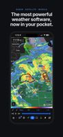
Aguacero puts weather radar, satellite, forecast models and soundings on one map and one timeline. It's built for storm chasers, forecasters, broadcasters and anyone who wants to read the weather for themselves.
RADAR
• NEXRAD and TDWR sites, plus MRMS national mosaics
• Reflectivity, velocity and more at every tilt
• 3D storm volumes and radar cross sections
• NWS warnings and watches drawn on the map
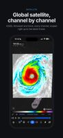
SATELLITE
• GOES East and West, Himawari and EUMETSAT
• Every channel, looped right up to the latest frame
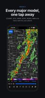
FORECAST MODELS
• ECMWF, GFS, HRRR, GDPS, RGEM, NBM and more
• Global, regional, high-resolution, ensemble, hurricane and climate models
• Contours, wind barbs and data points over any field
• Compare models at the same valid time
CHARTS AT ANY POINT
• Full model soundings with Skew-T, hodograph and severe parameters
• Meteograms with ready-made layouts for surface, winter, severe and aviation, or build your own
• Model cross sections
MORE
• Tropical cyclone tracks, SPC outlooks and surface observations
• Custom color tables with your own breakpoints, data ranges and opacity
• Replay past events in archive mode
• Export map images and animations
• Layouts and map styles that sync with the AguaceroWx web and desktop apps
Free to download. A free account saves your layouts. Some data and tools need a paid plan.
Always follow official warnings from your national weather service.










 AguaceroWx L.L.C.


No comments or reviews, maybe you want to be first?