



Organic Maps adds satellite imagery, public transport routing, alternate routes, and more
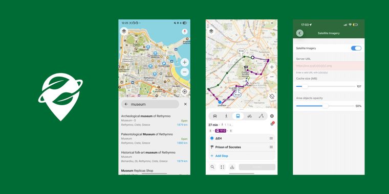
Organic Maps has released a substantial update to this privacy-focused offline maps & GPS app, introducing the ability to display satellite imagery using a custom raster tile server URL via the app's settings. The development team also mentions ongoing work on their own satellite imagery server.
Alongside satellite imagery support, users now gain public transport routing options, including subway, light rail, bus, and tram navigation. This update makes it possible to view several alternate route options, showing both the fastest and shortest paths for greater trip planning flexibility. Building on these improvements, walking and cycling routes will now warn users of steps, gates, and lift gates encountered along the way.
Android users benefit from an updated search and route planning interface, aimed at creating a smoother experience, while iOS users see accessibility enhancements such as support for Dynamic Type, large fonts, and easier selection between overlapping tracks or routes. For those marking places, any color can now be used when adding new bookmarks.
Additionally, the release expands coordinate support to British National Grid, Irish Grid, and Irish Transverse Mercator formats, and applies improved visual patterns for land types like beaches, rocks, orchards, vineyards, protected areas, and wetlands. Finally, GeoJSON track handling now preserves elevation and timestamps during import and export.





Comments
Alternate routes and more public transport is great, it was lacking compared to other proprietary apps, and public transports are often pretty up to date and detailed on OpenStreetMap.
Aerial imagery is also nice (since map data are overlaid on it), even if it requires a persistent internet connection (and some easy setup), so let's hope that to be able to download a whole zone even with limited zoom levels will be possible.