Apps with 'Satellite imagery' feature

All apps in Apps with 'Satellite imagery' feature category. Use the filters below to narrow down your search. 
Copy a direct link to this comment to your clipboard
  1. Google Maps icon
     1195 likes

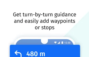
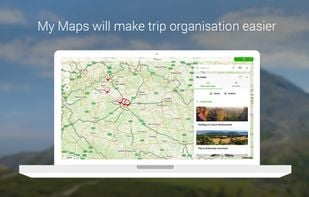
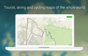
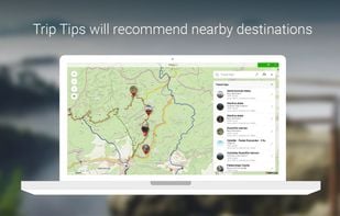
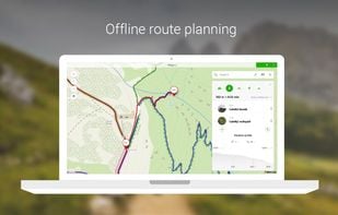
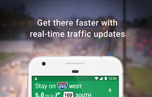
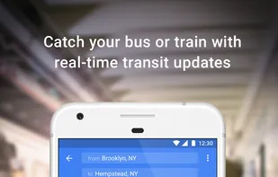
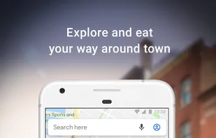
    Navigate efficiently with real-time traffic updates, turn-by-turn GPS, panoramic street views, and comprehensive route planning for multiple platforms.

    Cost / License

    • Freemium
    • Proprietary

    Platforms

    • Online
    • Android
    • iPhone
    • Blackberry
    • Chrome OS
    • Android Tablet
    • iPad
    • Apple Watch
    • Android Auto
    • Android Wear
    • KaiOS
    • Apple Car Play
    Google Maps screenshot 1
    Google Maps screenshot 1
    Google Maps screenshot 2
    +7
    Google Maps screenshot 3
    177 alternatives
    3.9
    Good22 reviews
  2. HERE WeGo icon
     135 likes

    Explore the world in glorious 3D with HERE Maps. Discover new places, collect your favourite places, plan the perfect journey, and sync it all with your mobile phones.

    Cost / License

    • Free
    • Proprietary

    Platforms

    • Online
    • Android
    • iPhone
    • Android Tablet
    • HUAWEI AppGallery
    • iPad
    • Samsung Galaxy Store
    HERE WeGo screenshot 1
    HERE WeGo screenshot 1
    HERE WeGo screenshot 2
    +5
    HERE WeGo screenshot 3
    100 alternatives
  3. Mapy.com icon
     22 likes

    Global offline tourist maps feature hiking and bike trails, route planning, synced trip organization, panoramic images, public transit info, and local amenities.

    Cost / License

    • Free
    • Proprietary

    Platforms

    • Windows
    • Online
    • Android
    • iPhone
    • Android Tablet
    • iPad
    • Android Auto
    • Apple Watch
    • Apple Car Play
    • Android Wear
    Mapy.com screenshot 1
    Mapy.com screenshot 1
    Mapy.com screenshot 2
    +4
    Mapy.com screenshot 3
    44 alternatives
  4. Positional icon
     6 likes

    An elegant and colorful location information app for Android with Compass, Clock, Level, Sun, Moon, Trail Marker and many other features.

    Cost / License

    Platforms

    • Android
    Positional screenshot 1
    Positional screenshot 1
    Positional screenshot 2
    +5
    Positional screenshot 3
    11 alternatives
  5. Sfera Technologies is a high-resolution satellite imagery provider that delivers optical, radar, thermal, and hyperspectral imagery through a cloud-based tasking platform. It helps geospatial developers, enterprises, and public-sector organizations monitor climate change, manage...

    Cost / License

    • Paid
    • Proprietary

    Platforms

    • Online
    Tasking platform for satellite images
    2 alternatives
  6. Daily earth data and analytics for broad area management.

    Easily extract insights from Earth observation data and build your own applications on top of Planet Insights Platform — without having to build or manage your own infrastructure.

    • Explore earth observation data
    • Impor.

    Cost / License

    • Paid
    • Proprietary

    Platforms

    • Online
    • Software as a Service (SaaS)
    Sentinel Hub screenshot 1
    11 alternatives