Weather Belt icon
Weather Belt icon

Weather Belt

Map-first emergency weather and situational awareness app for iOS with Apple-approved critical alerts (DND bypass), live feeds, NEXRAD radar, scanner audio, intelligent alerts, geofencing, 12 tools.

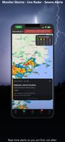
Live radar - multiple layers including power outage map.

Cost / License

  • Pay once
  • Proprietary

Application type

Platforms

  • iPhone
  • iPad
0likes
0comments
0articles

Features

Properties

  1.  Privacy focused

Features

  1.  No registration required
  2.  Works Offline
  3.  Ad-free
  4.  Local-weather

Weather Belt News & Activities

Highlights All activities

Recent activities

Weather Belt information

  • Developed by

    US flagJoseph Evitts
  • Licensing

    Proprietary and Commercial product.
  • Pricing

    One time purchase (perpetual license) that costs $10.
  • Alternatives

    2 alternatives listed
  • Supported Languages

    • English

AlternativeTo Category

Online Services
Weather Belt was added to AlternativeTo by Joe Evitts on and this page was last updated .
No comments or reviews, maybe you want to be first?

What is Weather Belt?

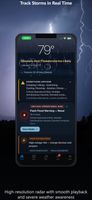
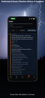
Smarter Alerts, Not Just More of Them Weather Belt now scores every alert by real severity, actual proximity, and your personal Risk Profile—ensuring critical threats rise to the top instead of being buried by distant advisories. Tap the (i) icon on any Home alert to see exactly why it's surfacing.

Honest Watch vs. Warning Language We audited all hazard types (Tornado, Flood, Hurricane, Wildfire, etc.) to ensure Watch-tier alerts never display Warning-tier urgency. The terminology now strictly matches the active threat level.

Offline Emergency Region Packs Download map tiles for your area in advance. When cell towers go down or connectivity drops during a real disaster, your map layout stays fully functional.

Targeted Flood Risk Guidance The Flood Risk banner now distinguishes between local immediate hazards and regional threats 40 miles away in a separate watershed.

Key Fixes & Refinements • Fixed: Active Tornado/Severe Warnings now visibly override "Clear" sky condition labels. • Clearer source disclosure labels for modeled data vs. live ground-station measurements. • Replaced precise confidence percentages with clear HIGH/MEDIUM/LOW threat language. • Corrected Northern Hemisphere moon shading and astronomical geometry on the Home hero card. • Improved action guidance across 9 distinct hazards to separate "prepare" from "act."

As always: One-time purchase. No subscriptions, no ads, no accounts, and zero telemetry. Built local-first to be ready when it matters most.

Official Links