

NavIT
Offline open source navigation offers real-time vector map rendering, GPS-based route calculation, 3D and bird-view display modes, touchscreen support, multi-language voice guidance, plugin extendability, Points of Interest integration, and strong privacy protection.
Cost / License
- Free
- Open Source
Application type
Alerts
- Discontinued
Platforms
- Windows
- Windows Mobile
- Android
- Symbian S60
- Android Tablet
The apps are no longer updated since 2021

Features
- Points of Interest (POI)
- Text to Speech
- Works Offline
- Multiple languages
- GPS Navigation
- Apps with Offline Map
- Based on OpenStreetMap
Tags
- 3d-maps
- map-viewer
NavIT News & Activities
Recent activities
- Danilo_Venom updated NavIT
 POX added NavIT as alternative to Mappa Mini

NavIT information
Developed by
Navit-project.orgLicensing
Open Source and Free product.Written in
Alternatives
45 alternatives listedSupported Languages
- English

AlternativeTo Category
Travel & LocationGitHub repository
- 623 Stars
- 177 Forks
- 193 Open Issues
- Updated


What is NavIT?
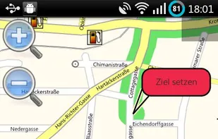
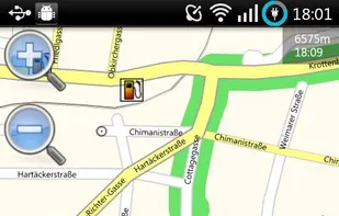
Navit is an open source car navigation software for Linux, Windows systems and portable devices. It will display your position on a map (in bird-view mode or as a 3D "visualization") from GPS sensor data, and can provide precise route calculation, touch screen functionality and supports Points of Interest (POI), which can be extended via an easy to use plugin system. Unlike other navigation systems, Navit maps are dynamically generated in real time from vector data. Navit is completely offline and works without an internet connection. Navit respects your privacy and does not track your position.
Features:
- Navigate to target from
 Google Maps
 - works offline
- spoken directions in many languages
- uptodate OSM maps