GeoImgr is a web-application to check the GPS geo-coordinates in the EXIF data of an JPG-image, show the location on the map and save new GPS geo-coordinates into the image.
Cost / License
- Free
- Proprietary
Platforms
- Online


GeoTag for macOS is described as 'GeoTag is a freeware tool for Mac for showing and changing geo data of image files (e.g. images taken by digital cameras)' and is an app in the travel & location category. There are more than 10 alternatives to GeoTag for macOS for a variety of platforms, including Windows, Mac, Web-based, iPhone and iPad apps. The best GeoTag for macOS alternative is Geosetter, which is free. Other great apps like GeoTag for macOS are GeoPhoto, Geotag, Photo Route and MeeSoft PhotoLocator.
GeoImgr is a web-application to check the GPS geo-coordinates in the EXIF data of an JPG-image, show the location on the map and save new GPS geo-coordinates into the image.


GPSPhotoLinker adds GPS position and location data to your photos. The latitude and longitude recorded by your GPS unit are linked and saved to your photos. GPSPhotoLinker automatically enters the city, state and country into the metadata.

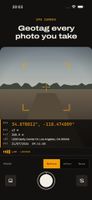
Free GPS photo stamp tool that renders location data directly onto your photos — not just a coordinate readout in a sidebar.


Add GPS capabilities to your camera for the fraction of the cost of a dedicated GPS logger.


Whether your photos are geotagged using PhotoLinker or automatically geotagged using your camera, PhotoLinker lets you interact with and explore your photos on a number of different high quality maps.