Open Source Citymapper AlternativesGPS Navigation & Map Services like Citymapper

The best open source alternative to Citymapper is CoMaps. If that doesn't suit you, our users have ranked more than 50 alternatives to Citymapper and 16 is open source so hopefully you can find a suitable replacement. Other interesting open source alternatives to Citymapper are Organic Maps, OsmAnd, Transportr and OsmAPP.

Copy a direct link to this comment to your clipboard
Citymapper alternatives page was last updated

Alternatives list

  1. CoMaps icon
     131 likes

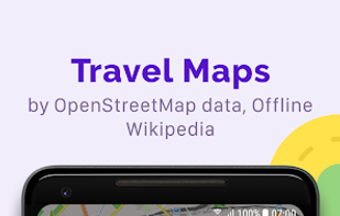
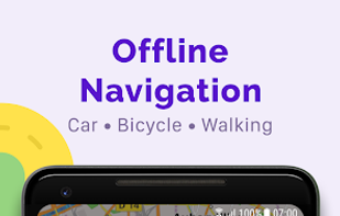
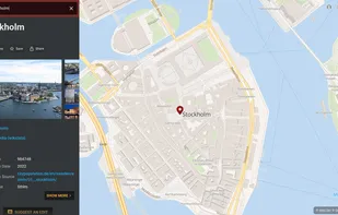
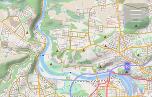
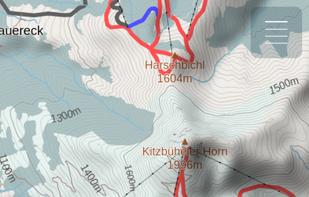
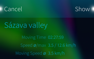
    Community-led offline navigation offering privacy by design, ad-free experience, open-source code, transparent decision-making, donation funding, and inclusive collaboration for drivers, cyclists, hikers, and travelers. Prioritizes transparency and community ownership.

    55 CoMaps alternatives

    Cost / License

    Application types

    Platforms

    • Android
    • iPhone
    • Android Tablet
    • iPad
    • Android Auto
    • F-Droid
    • Apple Car Play
    • Flathub
    • Flatpak
    • Linux
     
  2. Organic Maps icon
     199 likes

    Experience a privacy-oriented GPS solution with Organic Maps, featuring turn-by-turn navigation, offline maps, and a commitment to community development. Enjoy zero data collection, no location tracking, and comprehensive OpenStreetMap data for diverse travel modes.

    51 Organic Maps alternatives

    Cost / License

    • Free
    • Open Source

    Application types

    Platforms

    • Linux
    • Android
    • iPhone
    • Android Tablet
    • HUAWEI AppGallery
    • iPad
    • OpenStreetMap
    • Flathub
    • F-Droid
     
  3. OsmAnd icon
     301 likes

    Navigation app offering offline and online OSM-based maps, turn-by-turn voice direction, driving, cycling, and walking modes, POI search, GPX track management, map overlays, monthly map updates by country or region, speed and safety features, and location sharing.

    103 OsmAnd alternatives

    Cost / License

    • Freemium
    • Open Source

    Application types

    Platforms

    • Android
    • iPhone
    • Android Tablet
    • iPad
    • Android Auto
    • F-Droid
    • Apple Car Play
     
  4. Transportr icon
     30 likes

    Transportr is the public transport companion that respects your privacy and your freedom. Transportr is a non-profit app developed by people around the world to make using public transport as easy as possible wherever you are.

    51 Transportr alternatives

    Cost / License

    Platforms

    • Android
    • F-Droid
     
  5. OsmAPP icon
     11 likes

    Combines a user-friendly map interface, clickable points of interest, OpenStreetMap editing, public transport info, 3D tilting vector maps, multilingual options, mobile PWA features, advanced search powered by Photon, opening hours editor, and airport details.

    Cost / License

    Application types

    Platforms

    • Online
     
  6. GMaps WV icon
     12 likes

    Privacy-focused WebView tool for accessing the Google Maps web interface, enforcing HTTPS, blocking trackers, clearing private data on close, supporting toggleable location access, offering step-by-step directions but no real-time navigation, and not clearing cache automatically.

    Cost / License

    Application types

    Platforms

    • Android
    • F-Droid
     
  7. OSM Scout icon
     8 likes

    Goal of this project is to bring offline maps and navigation to Sailfish OS with native look and feel. OSM Scout for Sailfish OS is based on OSM Scout library.

    Cost / License

    • Free
    • Open Source

    Application type

    Platforms

    • Sailfish OS
     
  8. Öffi icon
     11 likes

    Öffi is an Android app that tells you where and when trains and buses go, including delays and replacement bus services for more and more transport authorities in Europe and worldwide.

    Cost / License

    • Free
    • Open Source

    Application type

    Platforms

    • Android
    • Android Tablet
    • F-Droid
     
  9. osmin icon
     7 likes

    Provides GPS navigation for on-road and off-road journeys on Android and Linux, utilizing a forked libosmscout backend, with GPX reading and writing, compass, trip tracker, road routing, POI database, offline mapping, data import/export, and suitable for outdoor activities.

    Cost / License

    Application type

    Platforms

    • Android
     
  10. KTrip icon
     7 likes

    Public transport navigator that finds journeys between specified locations, and shows departures and real-time delay information.

    Cost / License

    • Free
    • Open Source

    Platforms

    • Linux
    • Android
    • Android Tablet
    • KDE
    • Linux Mobile
    • Flathub
    • F-Droid
    • Plasma Mobile
     
  11. Free online editor for GPX, KML & Strava routes. Create, view, and edit tracks. Features routing & elevation profiles. Privacy-first, no signup.

    Cost / License

    Application type

    Platforms

    • Online
     
  12. maps.earth icon
     2 likes

    The Headway Project was born out of a frustration with the need to send current and future location data to a corporation in order to figure out how we’re getting from A to B. Offline-only maps apps can be frustrating to use, and sometimes suffer from performance problems, poor...

    Cost / License

    Application type

    Platforms

    • Online
    • Self-Hosted
     
12 of 16 Citymapper alternatives