AirCorp Photogrammetry Alternatives

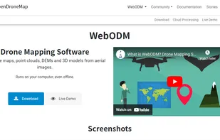
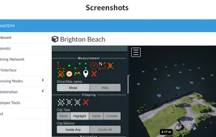
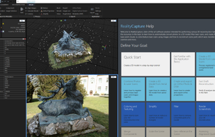
AirCorp Photogrammetry is described as 'Hosting service, provided by iBrain Developers, for Drone data, in formats including JPEG/PNG (Photogrammetry), 3D Object (Mesh) data & Point-Cloud-Data in LAS/LAZ formats. It provides both free & subscription plans' and is an app in the web browsers category. There are more than 10 alternatives to AirCorp Photogrammetry for a variety of platforms, including Web-based, Windows, Linux, Mac and iPhone apps. The best AirCorp Photogrammetry alternative is Agisoft Metashape. It's not free, so if you're looking for a free alternative, you could try WebODM or MicMac. Other great apps like AirCorp Photogrammetry are RealityCapture, Pixpro, 3DSOM and Petro Outlet.

Copy a direct link to this comment to your clipboard
AirCorp Photogrammetry alternatives page was last updated

Alternatives list

  1. Agisoft Metashape is a stand-alone software product that performs photogrammetric processing of digital images and generates 3D spatial data to be used in GIS applications, cultural heritage documentation, and visual effects production as well as for indirect measurements of...

    30 Agisoft Metashape alternatives

    Cost / License

    • Paid
    • Proprietary

    Application type

    Platforms

    • Mac
    • Windows
    • Linux
     
  2. WebODM icon
     4 likes

    WebODM. Drone Mapping Software. Generate maps, point clouds, DEMs and 3D models from aerial images. Runs on your computer, even offline. No monthly fees.

    29 WebODM alternatives

    Cost / License

    Application type

    Platforms

    • Mac
    • Windows
    • Linux
     
  3. RealityCapture icon
     14 likes

    RealityCapture is a state-of-the-art all-in-one photogrammetry software solution which automatically extracts beautiful and accurate 3D models from a set of ordinary images and / or laser scans.

    21 RealityCapture alternatives

    Cost / License

    • Paid
    • Proprietary

    Application type

    Platforms

    • Windows
     
  4. MicMac icon
     1 like

    MicMac is a free open-source (Cecill-B licence) photogrammetric suite that can be used in a variety of 3D reconstruction scenarios. In aims mainly at professionnal or academic users but constant efforts are made to make it more accessible to the general public.

    Cost / License

    • Free
    • Open Source

    Application type

    Platforms

    • Mac
    • Windows
    • Linux
     
  5. Pixpro icon
     9 likes

    Pixpro is a photogrammetric software targeted at solving surveying challenges and facilitating multiple on-site and off-site work stages.

    Cost / License

    • Paid
    • Proprietary

    Application type

    Platforms

    • Windows
    • Online
     
  6. 3DSOM icon
     1 like

    3DSOM Pro is a professional solution for automated 3D modeling of real world objects.

    Cost / License

    • Paid
    • Proprietary

    Application type

    Platforms

    • Windows
     
  7. Petro Outlet icon
     1 like

    Petro Outlet is a modern fully featured back office application for the convenience industry with two modules. One for independent stations and franchises. The other for brand names and distributors.The application can be accessed on a computer or on-the-go via a Smartphone.

    Cost / License

    • Freemium
    • Proprietary

    Platforms

    • Online
     
  8. FlytBase icon
     1 like

    FlytBase platform allows easy deployment of intelligent drones, connected with cloud-based business applications. FlytBase provides drone software which is compatible with all major drones (DJI, 3DR, APM, PX4) and hardware platforms.

    Cost / License

    • Paid
    • Proprietary

    Platforms

    • Online
     
  9. Sputnik Web icon
     1 like

    Sputnik Web is a service which opens up new opportunities in the field of online cartography. Create 3D models, publish and share.

    Cost / License

    • Freemium
    • Proprietary

    Platforms

    • Online
     
  10. Skycatch icon
     Like

    Commercial drone data solutions for modern businesses. Skycatch saves your job site millions with automated aerial mapping + analytics.

    Cost / License

    • Paid
    • Proprietary

    Application type

    Platforms

    • Mac
    • Windows
    • Linux
    • Online
    • iPhone
    • iPad
     
  11. FlytNow icon
     Like

    Live stream HD videos from drones in real-time; control drones & their payloads remotely, over 4G/5G at ultra low latency. Ideal for commercial drone operators, system integrators and enterprises.

    Cost / License

    • Freemium
    • Proprietary

    Platforms

    • Online
    • Software as a Service (SaaS)
     
12 of 15 AirCorp Photogrammetry alternatives