AAT icon
AAT icon

AAT

Android Activity Tracker is a GPS-tracking application for tracking sportive activities, with emphasis on cycling.
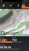
AAT screenshot 1
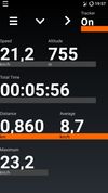
AAT screenshot 2
+5
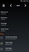
AAT screenshot 3

Cost / License

Application type

Platforms

  • Android
  • Android Tablet
  • F-Droid
  • Linux
  • Flathub
  • Flatpak
2likes
0articles
Save

Features

Features

Highlights All activities

AAT News & Activities

Recent News

No news, maybe you know any news worth sharing?

Share a News Tip

Recent activities

  • OpenTrailPaper icon
    Paul added AAT as alternative to OpenTrailPaper
  • Paul added AAT as alternative to Remap
  • µlogger icon
    K0RR added AAT as alternative to µlogger
  • Kuta icon
    erikkuta added AAT as alternative to Kuta
  • Colota icon
    Paul added AAT as alternative to Colota
  • RideLink icon
    Dalieba added AAT as alternative to RideLink
  • JustFit icon
    Benjamin Brooks added AAT as alternative to JustFit and FitMe
  • Furtive icon
    ethicnology added AAT as alternative to Furtive

AAT information

AlternativeTo Categories

Sport & Health, Travel & Location

GitHub repository

  •  176 Stars
  •  46 Forks
  •  19 Open Issues
  •   Updated  
View on GitHub
AAT was added to AlternativeTo by Paul on and this page was last updated . AAT is sometimes referred to as Another Activity Tracker. 

No comments or reviews, maybe you want to be first?

Official Links

Install from the command line

  • flatpak install flathub ch.bailu.aat

Be careful what you paste into a terminal. Check what a command installs before running it.

What is AAT?

Android Activity Tracker is a GPS-tracking application for tracking sportive activities, with emphasis on cycling. It uses MapsForge to display map tiles and off-line maps from the OpenStreetMap project.
Features

  • Display live tracking on different cockpit and map views
  • Offline as well as tile based map
  • Tile based overlays for displaying cycle and hiking routes (Waymarked Trails)
  • Integration of Overpass and Nominatim
  • Simple GPX editor for quick route planing
  • GPS independent altitude information and hill shading