MapServer is an Open Source platform for publishing spatial data and interactive mapping applications to the web. Originally developed in the mid-1990’s at the University of Minnesota, MapServer is released under an MIT-style license, and runs on all major platforms (Windows...


The reference implementation of the Open Geospatial Consortiums WFS and WMS services, GeoServer is a full featured open source software server written in Java that allows users to query, visualize, combine, edit and publish spatial data over the web.
Web Services
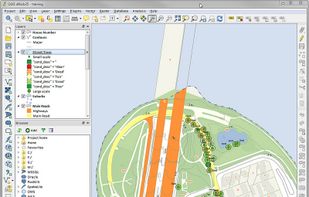
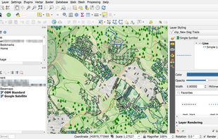
Desktop GIS

A fully featured, user friendly, open source Geographic Information System (GIS) with similar power to ArcGIS and MapInfo.
Cost / License
- Free
- Open Source
Application types
Platforms
- Mac
- Windows
- Linux
- Android
- BSD
 +9
+9

GRASS GIS (Geographic Resources Analysis Support System) is an open source, free software (FOSS) Geographical Information System (GIS) with raster, topological, vector, image processing, and visualization functionality.


gvSIG is a Geographic Information System (GIS), that is, a desktop application designed for capturing, storing, handling, analyzing and deploying any kind of referenced geographic information in order to solve complex management and planning problems.


uDig is a GIS software program produced by a community led by Canadian-based consulting company Refractions Research. It is based on the Eclipse platform and features full layered open source GIS. It is written in Java and released under GNU Lesser General Public License.

OpenJUMP is an open source Geographic Information System (GIS) written in the Java programming language. It is developed and maintained by a group of volunteers from around the globe.

SAGA - System for Automated Geoscientific Analyses - is a Geographic Information System (GIS) software with immense capabilities for geodata processing and analysis. SAGA is programmed in the object oriented C++ language and supports the implementation of new functions with a...

Browser Facing GIS


Cost / License
- Free
- Open Source
Platforms
- Mac
- Windows
- Linux
- Online
- Android
- Self-Hosted
- JSON
- (Planet) Duniter
- JavaScript
- Gulp.js
- Ionic Framework
 +2
+2

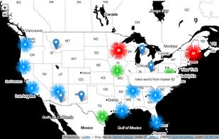
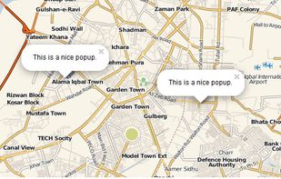
Leaflet is a modern open-source JavaScript library for mobile-friendly interactive maps. It is developed by Vladimir Agafonkin with a team of dedicated contributors. Weighing just about 28 KB of JS code, it has all the features most developers ever need for online maps.


No comments so far, maybe you want to be first?
Gu